Property Record
6305 Monona Dr, Monona, WI 53716


NEARBY LISTINGS FOR SALE OR LEASE
Property Detail
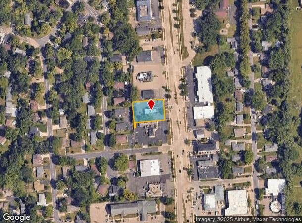
6305 Monona Dr
Madison, WI
Neal H Stoddard Enterprises
0710-204-6223-8
NEAL H STODDARD ENTERPRISES LOT 3 & LOT 4 SUBJ TO LTD ESMT IN DOC #4533626
Commercialnec
Dane
X
Wisconsin
55025C0437H
3,4,d
2024
0.49 AC
2024
Southeast Madison
010400
Milwaukee/Madison
DEMOGRAPHICS near 6305 Monona Dr
1 Mile
3 Mile
5 Mile
2024 Total Population
7,242
40,917
169,073
2029 Population
7,528
42,376
174,533
Pop Growth 2024-2029
+ 3.95%
+ 3.57%
+ 3.23%
Average Age
42
41
36
2024 Total Households
3,505
18,154
75,095
HH Growth 2024-2029
+ 4.05%
+ 3.70%
+ 3.48%
Median Household Inc
$65,584
$78,010
$62,916
Avg Household Size
2.00
2.20
2.00
2024 Avg HH Vehicles
2.00
2.00
1.00
Median Home Value
$284,582
$288,206
$303,195
Median Year Built
1970
1971
1975
Nearby Places
Map Layers
Map Styles
 Street
 Aerial
- Restaurants
- Banks
- Shops
- Fitness
- Groceries
PUBLIC TRANSPORTATION
AIRPORT
Dane County Regional/Truax Field
DRIVE
WALK
Distance
Dane County Regional/Truax Field
16 min
9.1 mi
Nearby Properties
Address
Land Use
TOTAL SIZE
Lot Size
Zoning
Address
Land Use
TOTAL SIZE
Lot Size
Zoning
168,685 SF
14.05 AC
IL
Address
Land Use
TOTAL SIZE
Lot Size
Zoning
13,440 SF
10.98 AC
IL
Address
Land Use
TOTAL SIZE
Lot Size
Zoning
2.03 AC
Address
Land Use
TOTAL SIZE
Lot Size
Zoning
13.40 AC
Address
Land Use
TOTAL SIZE
Lot Size
Zoning
3.59 AC
Address
Land Use
TOTAL SIZE
Lot Size
Zoning
12,450 SF
9.40 AC
SE
Address
Land Use
TOTAL SIZE
Lot Size
Zoning
2.38 AC
Address
Land Use
TOTAL SIZE
Lot Size
Zoning
4,992 SF
4.09 AC
SE
Address
Land Use
TOTAL SIZE
Lot Size
Zoning
19.81 AC
Address
Land Use
TOTAL SIZE
Lot Size
Zoning
149,897 SF
17.72 AC
IL
Address
Land Use
TOTAL SIZE
Lot Size
Zoning
5.53 AC
Address
Land Use
TOTAL SIZE
Lot Size
Zoning
3.49 AC
Address
Land Use
TOTAL SIZE
Lot Size
Zoning
6,868 SF
18.35 AC
IL
Address
Land Use
TOTAL SIZE
Lot Size
Zoning
202,800 SF
13.05 AC
IL
Address
Land Use
TOTAL SIZE
Lot Size
Zoning
94,290 SF
21.31 AC
SR-V2
Address
Land Use
TOTAL SIZE
Lot Size
Zoning
95,909 SF
1 AC
TE
Address
Land Use
TOTAL SIZE
Lot Size
Zoning
86,831 SF
2.73 AC
SE
Address
Land Use
TOTAL SIZE
Lot Size
Zoning
117,606 SF
1.85 AC
TR-U2
Address
Land Use
TOTAL SIZE
Lot Size
Zoning
16.40 AC
IL
Address
Land Use
TOTAL SIZE
Lot Size
Zoning
137,806 SF
1.80 AC
SE
Address
Land Use
TOTAL SIZE
Lot Size
Zoning
280,000 SF
15.01 AC
IL
Address
Land Use
TOTAL SIZE
Lot Size
Zoning
10.45 AC
IL
Address
Land Use
TOTAL SIZE
Lot Size
Zoning
49,562 SF
4.42 AC
SE
Address
Land Use
TOTAL SIZE
Lot Size
Zoning
6,492 SF
1.35 AC
SE
Address
Land Use
TOTAL SIZE
Lot Size
Zoning
100,161 SF
27.20 AC
SE
Address
Land Use
TOTAL SIZE
Lot Size
Zoning
100,161 SF
27.20 AC
SE
Address
Land Use
TOTAL SIZE
Lot Size
Zoning
73,170 SF
8.71 AC
SR-V2
Address
Land Use
TOTAL SIZE
Lot Size
Zoning
9,030 SF
6.59 AC
SR-V2
Address
Land Use
TOTAL SIZE
Lot Size
Zoning
42,967 SF
5.25 AC
SR-V2
Address
Land Use
TOTAL SIZE
Lot Size
Zoning
1.99 AC
The World's #1 Commercial Real Estate Marketplace
Connect with us
© 2025 CoStar Group
The information above has been obtained from sources believed reliable. While we do not doubt its accuracy we have not verified it and make no guarantee, warranty or representation about it. It is your responsibility to independently confirm its accuracy and completeness. Any projections, opinions, assumptions, or estimates used are for example only and do not represent the current or future performance of the property. The value of this transaction to you depends on tax and other factors which should be evaluated by your tax, financial, and legal advisors. You and your advisors should conduct a careful, independent investigation of the property to determine to your satisfaction the suitability of the property for your needs.