Property Record
6307 84Th St Se, Caledonia, MI 49316

NEARBY LISTINGS FOR SALE OR LEASE
-
-
View all Caledonia listings for sale on LoopNet.com
Property Detail
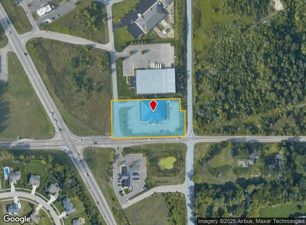
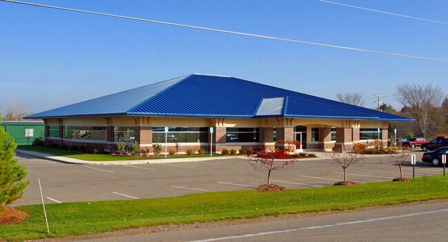
6307 84Th St Se
41-23-17-400-076
412317400076 PART OF SE 1/4 COM AT SE COR OF SEC TH S 88D 24M 20S W ALONG S SEC LINE 451.75 FT TH N 1D 35M 40S W 223.52 FT TH
Officebuilding
Kent
X
Michigan
26005C0150G
2.59 AC
2024
SE Kent County/Caledonia
2025
West Michigan
014811
Grand Rapids-Wyoming, MI
12,668 SF
DEMOGRAPHICS near 6307 84Th St Se
1 Mile
3 Mile
5 Mile
2024 Total Population
2,907
13,177
29,419
2029 Population
2,969
13,391
29,960
Pop Growth 2024-2029
+ 2.13%
+ 1.62%
+ 1.84%
Average Age
39
38
38
2024 Total Households
1,076
4,339
10,116
HH Growth 2024-2029
+ 2.14%
+ 1.80%
+ 1.86%
Median Household Inc
$82,672
$96,560
$99,247
Avg Household Size
2.70
2.80
2.80
2024 Avg HH Vehicles
2.00
2.00
2.00
Median Home Value
$286,987
$309,734
$304,675
Median Year Built
2002
1998
1997
Nearby Places
Map Layers
Map Styles
 Street
 Aerial
- Restaurants
- Banks
- Shops
- Fitness
- Groceries
PUBLIC TRANSPORTATION
AIRPORT
Gerald R Ford International
DRIVE
WALK
Distance
Gerald R Ford International
12 min
4.9 mi
SALE & LEASE HISTORY
LISTING DATE
SALE/LEASE

Nov 20, 2023
For Sale
May 24, 2021
For Lease
May 21, 2021
For Sale
Mar 31, 2020
For Lease
Jun 07, 2019
For Lease
Jan 09, 2022
For Lease
Jan 09, 2022
For Sale
Aug 17, 2020
For Lease
Aug 02, 2022
For Lease
Aug 01, 2022
For Sale
Nearby Properties
Address
Land Use
TOTAL SIZE
Lot Size
Zoning
Address
Land Use
TOTAL SIZE
Lot Size
Zoning
855,000 SF
PUD LSP-LG
Address
Land Use
TOTAL SIZE
Lot Size
Zoning
438,644 SF
117.24 AC
PUD
Address
Land Use
TOTAL SIZE
Lot Size
Zoning
223,592 SF
26.33 AC
PUD LSP-LG
Address
Land Use
TOTAL SIZE
Lot Size
Zoning
210,096 SF
75.30 AC
PUD
Address
Land Use
TOTAL SIZE
Lot Size
Zoning
146.43 AC
Address
Land Use
TOTAL SIZE
Lot Size
Zoning
165,589 SF
Address
Land Use
TOTAL SIZE
Lot Size
Zoning
245,000 SF
17.43 AC
I1
Address
Land Use
TOTAL SIZE
Lot Size
Zoning
34,238 SF
6.43 AC
I1
Address
Land Use
TOTAL SIZE
Lot Size
Zoning
184,500 SF
9.11 AC
I1
Address
Land Use
TOTAL SIZE
Lot Size
Zoning
41,667 SF
7.46 AC
PUD
Address
Land Use
TOTAL SIZE
Lot Size
Zoning
87.08 AC
PUD LSP-LG
Address
Land Use
TOTAL SIZE
Lot Size
Zoning
185,500 SF
Address
Land Use
TOTAL SIZE
Lot Size
Zoning
9.71 AC
R3
Address
Land Use
TOTAL SIZE
Lot Size
Zoning
131,200 SF
13.21 AC
I1
Address
Land Use
TOTAL SIZE
Lot Size
Zoning
104.89 AC
Address
Land Use
TOTAL SIZE
Lot Size
Zoning
78,260 SF
Address
Land Use
TOTAL SIZE
Lot Size
Zoning
5,744 SF
112.32 AC
MHC
Address
Land Use
TOTAL SIZE
Lot Size
Zoning
79,896 SF
7.17 AC
RR
Address
Land Use
TOTAL SIZE
Lot Size
Zoning
81,000 SF
11 AC
RR
Address
Land Use
TOTAL SIZE
Lot Size
Zoning
8.80 AC
R3
Address
Land Use
TOTAL SIZE
Lot Size
Zoning
65,016 SF
7.08 AC
RR
Address
Land Use
TOTAL SIZE
Lot Size
Zoning
5.52 AC
Address
Land Use
TOTAL SIZE
Lot Size
Zoning
100,751 SF
8.45 AC
I1
Address
Land Use
TOTAL SIZE
Lot Size
Zoning
8,274 SF
54 AC
HC
Address
Land Use
TOTAL SIZE
Lot Size
Zoning
69,360 SF
Address
Land Use
TOTAL SIZE
Lot Size
Zoning
108,900 SF
6.31 AC
I1
Address
Land Use
TOTAL SIZE
Lot Size
Zoning
100.10 AC
PUD
Address
Land Use
TOTAL SIZE
Lot Size
Zoning
14.14 AC
I1
Address
Land Use
TOTAL SIZE
Lot Size
Zoning
216.05 AC
Address
Land Use
TOTAL SIZE
Lot Size
Zoning
12.05 AC
The World's #1 Commercial Real Estate Marketplace
Connect with us
© 2026 CoStar Group
The information above has been obtained from sources believed reliable. While we do not doubt its accuracy we have not verified it and make no guarantee, warranty or representation about it. It is your responsibility to independently confirm its accuracy and completeness. Any projections, opinions, assumptions, or estimates used are for example only and do not represent the current or future performance of the property. The value of this transaction to you depends on tax and other factors which should be evaluated by your tax, financial, and legal advisors. You and your advisors should conduct a careful, independent investigation of the property to determine to your satisfaction the suitability of the property for your needs.