Property Record
6307 Debarr Rd, Anchorage, AK 99504
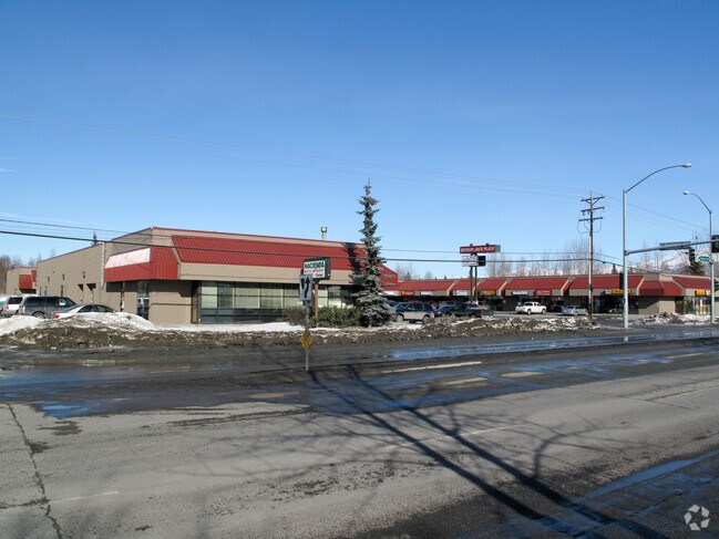

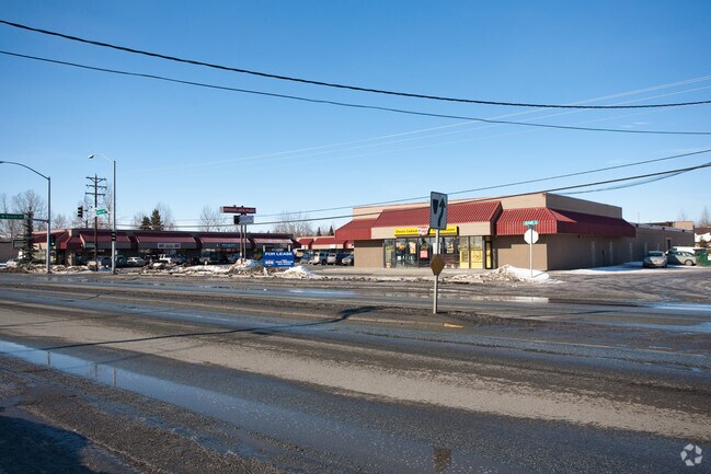

Property Detail
6307 Debarr Rd
00614102000
ADAMSVILLE TR C
Regionalshoppingcenterormallwithanchorstore
ANCHORAGE
B1A
Alaska
B and X Area of moderate flood hazard, usually the area between the limits of the 100-year and 500-year floods.
2.33 AC
2024
Boniface/Muldoon-45
2025
Anchorage
000701
Anchorage, AK
35,094 SF
NEARBY LISTINGS FOR SALE OR LEASE
DEMOGRAPHICS near 6307 Debarr Rd
1 mile
3 mile
5 mile
2025 Total Population
18,083
81,543
143,205
2030 Population
18,124
82,144
144,062
Pop Growth 2025-2030
+ 0.23%
+ 0.74%
+ 0.60%
Average Age
37
36
37
2025 Total Households
6,552
29,158
53,717
HH Growth 2025-2030
+ 0.18%
+ 0.70%
+ 0.58%
Median Household Inc
$82,538
$76,707
$78,345
Avg Household Size
2.60
2.60
2.40
2025 Avg HH Vehicles
2.00
2.00
2.00
Median Home Value
$324,601
$317,233
$334,935
Median Year Built
1981
1979
1979
Nearby Places
Map Layers
Map Styles
 Street
 Aerial
Transit
 Traffic
 Biking
Places
Listings with unknown addresses are not visible on the map
- Restaurants
- Banks
- Shops
- Fitness
- Groceries
PUBLIC TRANSPORTATION
AIRPORT
Merrill Field
Drive
Walk
Distance
Merrill Field
8 min
3.3 mi
Ted Stevens Anchorage International
Drive
Walk
Distance
Ted Stevens Anchorage International
18 min
10.2 mi
Freight Ports
Port of Anchorage
Drive
Walk
Distance
Port of Anchorage
15 min
7.3 mi
SALE & LEASE HISTORY
LISTING DATE
SALE/LEASE

Sep 25, 2016
For Lease
Nearby Properties
Address
Land Use
TOTAL SIZE
Lot Size
Zoning
Address
Land Use
TOTAL SIZE
Lot Size
Zoning
658,690 SF
70.86 AC
PLI
Address
Land Use
TOTAL SIZE
Lot Size
Zoning
22,362 SF
71.05 AC
PLI
Address
Land Use
TOTAL SIZE
Lot Size
Zoning
380,635 SF
10.82 AC
B3
Address
Land Use
TOTAL SIZE
Lot Size
Zoning
14,009 SF
24.86 AC
PLI
Address
Land Use
TOTAL SIZE
Lot Size
Zoning
160,830 SF
41.64 AC
PLI
Address
Land Use
TOTAL SIZE
Lot Size
Zoning
33,906 SF
40 AC
PLI
Address
Land Use
TOTAL SIZE
Lot Size
Zoning
179,543 SF
26.03 AC
PLI
Address
Land Use
TOTAL SIZE
Lot Size
Zoning
41,034 SF
6.28 AC
B3
Address
Land Use
TOTAL SIZE
Lot Size
Zoning
120,000 SF
9.09 AC
PLI
Address
Land Use
TOTAL SIZE
Lot Size
Zoning
171,604 SF
30.51 AC
PLI
Address
Land Use
TOTAL SIZE
Lot Size
Zoning
104,412 SF
2.79 AC
B3SL
Address
Land Use
TOTAL SIZE
Lot Size
Zoning
133,758 SF
2.36 AC
ROSL
Address
Land Use
TOTAL SIZE
Lot Size
Zoning
64,695 SF
13.66 AC
PLI
Address
Land Use
TOTAL SIZE
Lot Size
Zoning
294,060 SF
69.74 AC
PLI
Address
Land Use
TOTAL SIZE
Lot Size
Zoning
320,366 SF
36.42 AC
PLI
Address
Land Use
TOTAL SIZE
Lot Size
Zoning
24,120 SF
4.68 AC
B3
Address
Land Use
TOTAL SIZE
Lot Size
Zoning
173,845 SF
19.98 AC
R2A
Address
Land Use
TOTAL SIZE
Lot Size
Zoning
204,769 SF
13.08 AC
R4SL
Address
Land Use
TOTAL SIZE
Lot Size
Zoning
49,217 SF
4.76 AC
B3
Address
Land Use
TOTAL SIZE
Lot Size
Zoning
69,627 SF
25.74 AC
PLI
Address
Land Use
TOTAL SIZE
Lot Size
Zoning
1,800 SF
26.71 AC
PLI
Address
Land Use
TOTAL SIZE
Lot Size
Zoning
17,045 SF
14.66 AC
PLI
Address
Land Use
TOTAL SIZE
Lot Size
Zoning
8,189 SF
26.11 AC
R3
Address
Land Use
TOTAL SIZE
Lot Size
Zoning
43,325 SF
28.68 AC
PLI
Address
Land Use
TOTAL SIZE
Lot Size
Zoning
48.70 AC
PLI
Address
Land Use
TOTAL SIZE
Lot Size
Zoning
190,766 SF
16.45 AC
I1
Address
Land Use
TOTAL SIZE
Lot Size
Zoning
11,457 SF
2.81 AC
ROSL
Address
Land Use
TOTAL SIZE
Lot Size
Zoning
62,020 SF
12.42 AC
I1SL
Address
Land Use
TOTAL SIZE
Lot Size
Zoning
159,834 SF
0.98 AC
ROSL
Address
Land Use
TOTAL SIZE
Lot Size
Zoning
170,534 SF
11.13 AC
B3SL
The World's #1 Commercial Real Estate Marketplace
Connect with us
© 2026 CoStar Group
The information above has been obtained from sources believed reliable. While we do not doubt its accuracy we have not verified it and make no guarantee, warranty or representation about it. It is your responsibility to independently confirm its accuracy and completeness. Any projections, opinions, assumptions, or estimates used are for example only and do not represent the current or future performance of the property. The value of this transaction to you depends on tax and other factors which should be evaluated by your tax, financial, and legal advisors. You and your advisors should conduct a careful, independent investigation of the property to determine to your satisfaction the suitability of the property for your needs.