Property Record
6308 W 12Th St, Sioux Falls, SD 57107
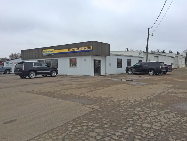


Property Detail
6308 W 12Th St
76581
LOT 46 TRACT 8 & W160 E640 TR 9 & W150 E790 TR 9 & W280 E480 TR 9 WEBSTER GROV E SUB TRACT 9 IN CITY OF SIOUX FALLS
Autorepair
Minnehaha
I1;LIGHT I
South Dakota
B and X Area of moderate flood hazard, usually the area between the limits of the 100-year and 500-year floods.
46
2024
6.16 AC
2024
Sioux Falls
001001
Other Market Areas
15,300 SF
Sioux Falls, SD-MN
NEARBY LISTINGS FOR SALE OR LEASE
-
-
View all Sioux Falls listings for lease on LoopNet.com
DEMOGRAPHICS near 6308 W 12Th St
1 mile
3 mile
5 mile
2025 Total Population
10,226
61,417
125,391
2030 Population
10,755
64,612
132,870
Pop Growth 2025-2030
+ 5.17%
+ 5.20%
+ 5.96%
Average Age
38
37
38
2025 Total Households
3,918
25,690
52,714
HH Growth 2025-2030
+ 5.62%
+ 5.68%
+ 6.43%
Median Household Inc
$71,978
$69,325
$68,062
Avg Household Size
2.50
2.30
2.30
2025 Avg HH Vehicles
2.00
2.00
2.00
Median Home Value
$232,089
$278,896
$274,059
Median Year Built
1994
1995
1991
Nearby Places
Map Layers
Map Styles
 Street
 Aerial
Transit
 Traffic
 Biking
Places
Listings with unknown addresses are not visible on the map
- Restaurants
- Banks
- Shops
- Fitness
- Groceries
PUBLIC TRANSPORTATION
AIRPORT
Joe Foss Field
Drive
Walk
Distance
Joe Foss Field
23 min
7.2 mi
SALE & LEASE HISTORY
LISTING DATE
SALE/LEASE

Apr 12, 2017
For Lease
Nearby Properties
Address
Land Use
TOTAL SIZE
Lot Size
Zoning
Address
Land Use
TOTAL SIZE
Lot Size
Zoning
639,393 SF
53.46 AC
FP;FP
Address
Land Use
TOTAL SIZE
Lot Size
Zoning
9.41 AC
Address
Land Use
TOTAL SIZE
Lot Size
Zoning
32,169 SF
9.91 AC
Address
Land Use
TOTAL SIZE
Lot Size
Zoning
55,998 SF
5.42 AC
FP;FP
Address
Land Use
TOTAL SIZE
Lot Size
Zoning
15.89 AC
Address
Land Use
TOTAL SIZE
Lot Size
Zoning
77,853 SF
10.42 AC
Address
Land Use
TOTAL SIZE
Lot Size
Zoning
36,986 SF
8.49 AC
FP;FP
Address
Land Use
TOTAL SIZE
Lot Size
Zoning
100,053 SF
8.50 AC
FP;FP
Address
Land Use
TOTAL SIZE
Lot Size
Zoning
75,786 SF
7.14 AC
Address
Land Use
TOTAL SIZE
Lot Size
Zoning
1.66 AC
FP;FP
Address
Land Use
TOTAL SIZE
Lot Size
Zoning
23,832 SF
216 AC
Address
Land Use
TOTAL SIZE
Lot Size
Zoning
137,651 SF
22.28 AC
Address
Land Use
TOTAL SIZE
Lot Size
Zoning
Address
Land Use
TOTAL SIZE
Lot Size
Zoning
47,142 SF
6.09 AC
Address
Land Use
TOTAL SIZE
Lot Size
Zoning
167,162 SF
17.11 AC
Address
Land Use
TOTAL SIZE
Lot Size
Zoning
168,359 SF
9.65 AC
NO;SPECIAL
Address
Land Use
TOTAL SIZE
Lot Size
Zoning
26,601 SF
5.31 AC
Address
Land Use
TOTAL SIZE
Lot Size
Zoning
72,601 SF
15.33 AC
Address
Land Use
TOTAL SIZE
Lot Size
Zoning
21,060 SF
6.70 AC
FP;FP
Address
Land Use
TOTAL SIZE
Lot Size
Zoning
8,768 SF
5.48 AC
Address
Land Use
TOTAL SIZE
Lot Size
Zoning
5,649 SF
9.13 AC
Address
Land Use
TOTAL SIZE
Lot Size
Zoning
60,929 SF
13.18 AC
Address
Land Use
TOTAL SIZE
Lot Size
Zoning
185,662 SF
18.09 AC
Address
Land Use
TOTAL SIZE
Lot Size
Zoning
72,820 SF
12.43 AC
Address
Land Use
TOTAL SIZE
Lot Size
Zoning
214,855 SF
14.65 AC
FP;FP
Address
Land Use
TOTAL SIZE
Lot Size
Zoning
1,796 SF
7.57 AC
Address
Land Use
TOTAL SIZE
Lot Size
Zoning
67,645 SF
6.68 AC
Address
Land Use
TOTAL SIZE
Lot Size
Zoning
Address
Land Use
TOTAL SIZE
Lot Size
Zoning
42,810 SF
11.57 AC
Address
Land Use
TOTAL SIZE
Lot Size
Zoning
72,342 SF
6.09 AC
FP;FP
The World's #1 Commercial Real Estate Marketplace
Connect with us
© 2026 CoStar Group
The information above has been obtained from sources believed reliable. While we do not doubt its accuracy we have not verified it and make no guarantee, warranty or representation about it. It is your responsibility to independently confirm its accuracy and completeness. Any projections, opinions, assumptions, or estimates used are for example only and do not represent the current or future performance of the property. The value of this transaction to you depends on tax and other factors which should be evaluated by your tax, financial, and legal advisors. You and your advisors should conduct a careful, independent investigation of the property to determine to your satisfaction the suitability of the property for your needs.