Property Record
631 Lowther Rd, Lewisberry, PA 17339

Current Lease Availabilities
NEARBY LISTINGS FOR SALE OR LEASE
Property Detail
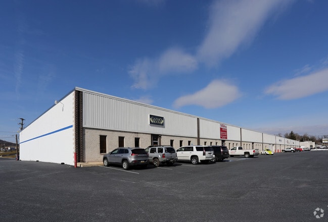
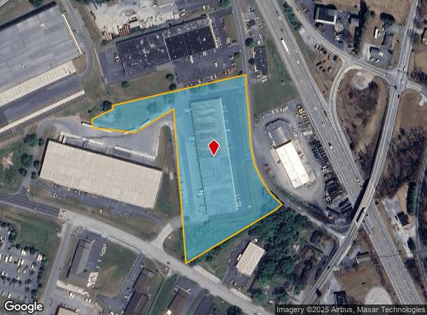
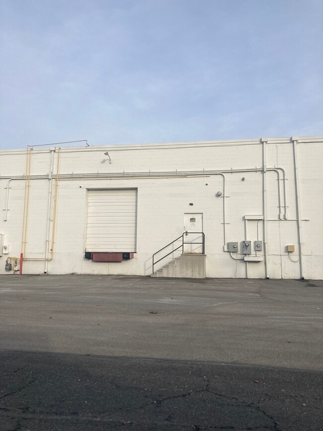
631 Lowther Rd
27-000-QG-0127.B0-00000
Fairview Industrial Park
Warehouse
LOT 1; RR-126
X
York
42133C0065F
Pennsylvania
2025
6.13 AC
2025
York County
020221
Philadelphia
60,732 SF
York-Hanover, PA
DEMOGRAPHICS near 631 Lowther Rd
1 Mile
3 Mile
5 Mile
2024 Total Population
2,848
16,211
57,771
2029 Population
2,941
16,658
59,669
Pop Growth 2024-2029
+ 3.27%
+ 2.76%
+ 3.29%
Average Age
42
42
41
2024 Total Households
1,120
6,392
23,115
HH Growth 2024-2029
+ 3.30%
+ 2.78%
+ 3.43%
Median Household Inc
$96,747
$92,373
$78,796
Avg Household Size
2.50
2.50
2.40
2024 Avg HH Vehicles
2.00
2.00
2.00
Median Home Value
$264,875
$234,252
$201,312
Median Year Built
1996
1982
1975
Nearby Places
- Restaurants
- Banks
- Shops
- Fitness
- Groceries
PUBLIC TRANSPORTATION
COMMUTER RAIL
DRIVE
WALK
Distance
15 min
8.8 mi
AIRPORT
Harrisburg International
DRIVE
WALK
Distance
Harrisburg International
22 min
12.1 mi
Freight Ports
Port Newark Container Terminal
DRIVE
WALK
Distance
Port Newark Container Terminal
123 min
80.4 mi
Nearby Properties
Address
Land Use
TOTAL SIZE
Lot Size
Zoning
Address
Land Use
TOTAL SIZE
Lot Size
Zoning
133.33 AC
AG
Address
Land Use
TOTAL SIZE
Lot Size
Zoning
797,500 SF
88.70 AC
LI
Address
Land Use
TOTAL SIZE
Lot Size
Zoning
705,000 SF
54.01 AC
IND
Address
Land Use
TOTAL SIZE
Lot Size
Zoning
9,840 SF
37.87 AC
AG
Address
Land Use
TOTAL SIZE
Lot Size
Zoning
187,759 SF
85.13 AC
ID
Address
Land Use
TOTAL SIZE
Lot Size
Zoning
274,224 SF
19.90 AC
LI
Address
Land Use
TOTAL SIZE
Lot Size
Zoning
23,632 SF
13.16 AC
LI
Address
Land Use
TOTAL SIZE
Lot Size
Zoning
139,688 SF
44.61 AC
RM
Address
Land Use
TOTAL SIZE
Lot Size
Zoning
150,915 SF
28.04 AC
RCO
Address
Land Use
TOTAL SIZE
Lot Size
Zoning
187,848 SF
21.91 AC
RCO
Address
Land Use
TOTAL SIZE
Lot Size
Zoning
994 SF
12.48 AC
LI
Address
Land Use
TOTAL SIZE
Lot Size
Zoning
43,200 SF
8.13 AC
RCO
Address
Land Use
TOTAL SIZE
Lot Size
Zoning
85,500 SF
5.93 AC
LI
Address
Land Use
TOTAL SIZE
Lot Size
Zoning
10,300 SF
11.61 AC
AG
Address
Land Use
TOTAL SIZE
Lot Size
Zoning
70,976 SF
4.29 AC
LI
Address
Land Use
TOTAL SIZE
Lot Size
Zoning
6.35 AC
Address
Land Use
TOTAL SIZE
Lot Size
Zoning
77 AC
CN
Address
Land Use
TOTAL SIZE
Lot Size
Zoning
70,000 SF
5.12 AC
LI
Address
Land Use
TOTAL SIZE
Lot Size
Zoning
67,443 SF
49.20 AC
CC
Address
Land Use
TOTAL SIZE
Lot Size
Zoning
13,854 SF
87.99 AC
RS
Address
Land Use
TOTAL SIZE
Lot Size
Zoning
11.73 AC
Address
Land Use
TOTAL SIZE
Lot Size
Zoning
25,600 SF
4.06 AC
MU
Address
Land Use
TOTAL SIZE
Lot Size
Zoning
1,266 SF
15.55 AC
Address
Land Use
TOTAL SIZE
Lot Size
Zoning
29,400 SF
8.75 AC
LI
Address
Land Use
TOTAL SIZE
Lot Size
Zoning
20.73 AC
RM
Address
Land Use
TOTAL SIZE
Lot Size
Zoning
14,808 SF
1.90 AC
RCO
Address
Land Use
TOTAL SIZE
Lot Size
Zoning
16,432 SF
17.22 AC
AG
Address
Land Use
TOTAL SIZE
Lot Size
Zoning
11,664 SF
4.58 AC
V
Address
Land Use
TOTAL SIZE
Lot Size
Zoning
2 AC
RCO
The World's #1 Commercial Real Estate Marketplace
Connect with us
© 2025 CoStar Group
The information above has been obtained from sources believed reliable. While we do not doubt its accuracy we have not verified it and make no guarantee, warranty or representation about it. It is your responsibility to independently confirm its accuracy and completeness. Any projections, opinions, assumptions, or estimates used are for example only and do not represent the current or future performance of the property. The value of this transaction to you depends on tax and other factors which should be evaluated by your tax, financial, and legal advisors. You and your advisors should conduct a careful, independent investigation of the property to determine to your satisfaction the suitability of the property for your needs.