Property Record
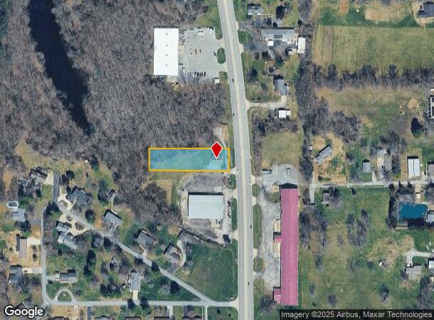
631 N Pershing St, Energy, IL 62933

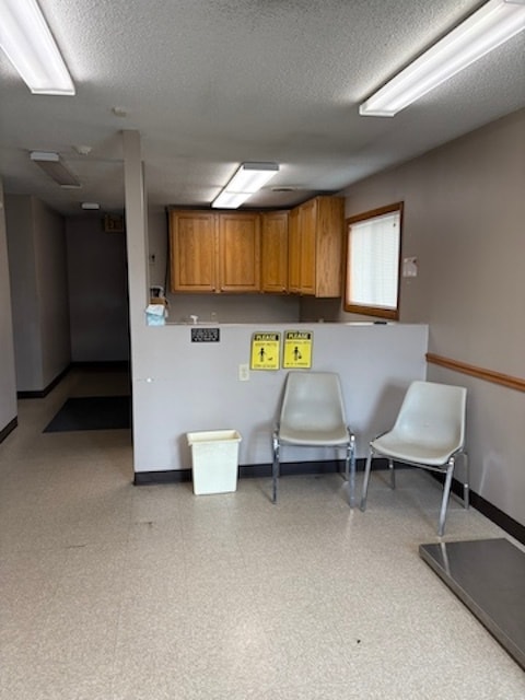
This Property Is For Sale
NEARBY LISTINGS FOR SALE OR LEASE
Property Detail
631 N Pershing St
Carbondale-Marion, IL
POPES HIGHLAND W40 OF LOT 6 BLK 4
02-31-251-005
Williamson
Commercialnec
Illinois
AE
6
17055C0300D
0.82 AC
2024
Marion/I-64 & South
2025
Other Market Areas
020300
DEMOGRAPHICS near 631 N Pershing St
1 Mile
3 Mile
5 Mile
2024 Total Population
2,675
15,961
26,604
2029 Population
2,627
15,851
26,380
Pop Growth 2024-2029
(1.79%)
(0.69%)
(0.84%)
Average Age
43
41
41
2024 Total Households
1,169
6,852
11,383
HH Growth 2024-2029
(1.80%)
(0.73%)
(0.87%)
Median Household Inc
$60,710
$49,577
$55,466
Avg Household Size
2.30
2.30
2.30
2024 Avg HH Vehicles
2.00
2.00
2.00
Median Home Value
$168,081
$125,614
$143,679
Median Year Built
1978
1976
1982
Nearby Places
Map Layers
Map Styles
 Street
 Aerial
- Restaurants
- Banks
- Shops
- Fitness
- Groceries
Nearby Properties
Address
Land Use
TOTAL SIZE
Lot Size
Zoning
Address
Land Use
TOTAL SIZE
Lot Size
Zoning
38.14 AC
Address
Land Use
TOTAL SIZE
Lot Size
Zoning
26.41 AC
Address
Land Use
TOTAL SIZE
Lot Size
Zoning
50.79 AC
Address
Land Use
TOTAL SIZE
Lot Size
Zoning
3.78 AC
Address
Land Use
TOTAL SIZE
Lot Size
Zoning
6.75 AC
Address
Land Use
TOTAL SIZE
Lot Size
Zoning
4.66 AC
Address
Land Use
TOTAL SIZE
Lot Size
Zoning
66,000 SF
9.37 AC
Address
Land Use
TOTAL SIZE
Lot Size
Zoning
1.12 AC
Address
Land Use
TOTAL SIZE
Lot Size
Zoning
Address
Land Use
TOTAL SIZE
Lot Size
Zoning
3.39 AC
Address
Land Use
TOTAL SIZE
Lot Size
Zoning
Address
Land Use
TOTAL SIZE
Lot Size
Zoning
1.21 AC
Address
Land Use
TOTAL SIZE
Lot Size
Zoning
Address
Land Use
TOTAL SIZE
Lot Size
Zoning
1.59 AC
Address
Land Use
TOTAL SIZE
Lot Size
Zoning
5.50 AC
Address
Land Use
TOTAL SIZE
Lot Size
Zoning
Address
Land Use
TOTAL SIZE
Lot Size
Zoning
Address
Land Use
TOTAL SIZE
Lot Size
Zoning
2.05 AC
Address
Land Use
TOTAL SIZE
Lot Size
Zoning
1.87 AC
Address
Land Use
TOTAL SIZE
Lot Size
Zoning
0.57 AC
Address
Land Use
TOTAL SIZE
Lot Size
Zoning
3.20 AC
Address
Land Use
TOTAL SIZE
Lot Size
Zoning
0.61 AC
Address
Land Use
TOTAL SIZE
Lot Size
Zoning
Address
Land Use
TOTAL SIZE
Lot Size
Zoning
4.68 AC
Address
Land Use
TOTAL SIZE
Lot Size
Zoning
4.83 AC
Address
Land Use
TOTAL SIZE
Lot Size
Zoning
2.31 AC
Address
Land Use
TOTAL SIZE
Lot Size
Zoning
37.16 AC
Address
Land Use
TOTAL SIZE
Lot Size
Zoning
0.47 AC
Address
Land Use
TOTAL SIZE
Lot Size
Zoning
1.05 AC
Address
Land Use
TOTAL SIZE
Lot Size
Zoning
0.90 AC
The World's #1 Commercial Real Estate Marketplace
Connect with us
© 2025 CoStar Group
The information above has been obtained from sources believed reliable. While we do not doubt its accuracy we have not verified it and make no guarantee, warranty or representation about it. It is your responsibility to independently confirm its accuracy and completeness. Any projections, opinions, assumptions, or estimates used are for example only and do not represent the current or future performance of the property. The value of this transaction to you depends on tax and other factors which should be evaluated by your tax, financial, and legal advisors. You and your advisors should conduct a careful, independent investigation of the property to determine to your satisfaction the suitability of the property for your needs.