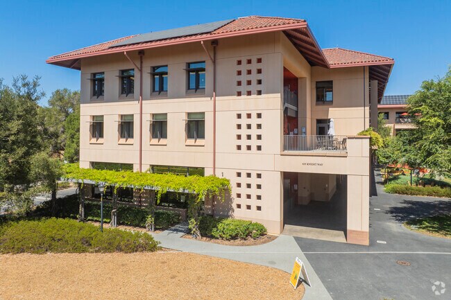
Property Record
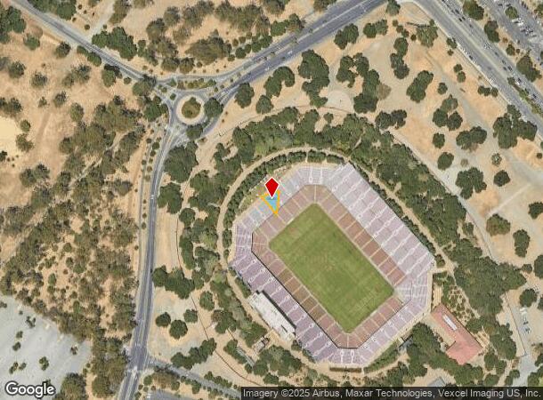
631 Olmsted Rd, Stanford, CA 94305

NEARBY LISTINGS FOR SALE OR LEASE
Property Detail
631 Olmsted Rd
142-04-024
Santa Clara
University
California
D
0.40 AC
06081C0320E
Downtown Palo Alto
2024
South Bay/San Jose
2025
San Jose-Sunnyvale-Santa Clara, CA
513000
DEMOGRAPHICS near 631 Olmsted Rd
1 Mile
3 Mile
5 Mile
2024 Total Population
22,290
136,075
284,112
2029 Population
21,754
131,513
274,427
Pop Growth 2024-2029
(2.40%)
(3.35%)
(3.41%)
Average Age
31
39
40
2024 Total Households
6,522
47,166
99,721
HH Growth 2024-2029
(1.47%)
(3.37%)
(3.37%)
Median Household Inc
$76,450
$173,143
$157,517
Avg Household Size
2.00
2.50
2.60
2024 Avg HH Vehicles
1.00
2.00
2.00
Median Home Value
$1,139,984
$1,140,952
$1,134,121
Median Year Built
1987
1965
1967
Nearby Places
Map Layers
Map Styles
 Street
 Aerial
- Restaurants
- Banks
- Shops
- Fitness
- Groceries
PUBLIC TRANSPORTATION
COMMUTER RAIL
Palo Alto (Caltrain - Caltrain (Caltrain), Express - Caltrain (Caltrain), Limited - Caltrain (Caltrain), Local Weekday - Caltrain (Caltrain), Local Weekend - Caltrain (Caltrain))
DRIVE
WALK
Distance
Palo Alto (Caltrain - Caltrain (Caltrain), Express - Caltrain (Caltrain), Limited - Caltrain (Caltrain), Local Weekday - Caltrain (Caltrain), Local Weekend - Caltrain (Caltrain))
3 min
15 min
0.8 mi
California Avenue Caltrain Station Southbound (Limited - Caltrain (Caltrain), Local Weekday - Caltrain (Caltrain), Local Weekend - Caltrain (Caltrain))
DRIVE
WALK
Distance
California Avenue Caltrain Station Southbound (Limited - Caltrain (Caltrain), Local Weekday - Caltrain (Caltrain), Local Weekend - Caltrain (Caltrain))
4 min
1.5 mi
AIRPORT
Norman Y Mineta San Jose International
DRIVE
WALK
Distance
Norman Y Mineta San Jose International
24 min
15.2 mi
San Francisco International
DRIVE
WALK
Distance
San Francisco International
32 min
21.5 mi
Metro Oakland International
DRIVE
WALK
Distance
Metro Oakland International
44 min
29.6 mi
Freight Ports
Port of Redwood City
DRIVE
WALK
Distance
Port of Redwood City
16 min
6.9 mi
Nearby Properties
Address
Land Use
TOTAL SIZE
Lot Size
Zoning
Address
Land Use
TOTAL SIZE
Lot Size
Zoning
1,395,540 SF
51.72 AC
C3
Address
Land Use
TOTAL SIZE
Lot Size
Zoning
Address
Land Use
TOTAL SIZE
Lot Size
Zoning
78,277 SF
16.31 AC
RP
Address
Land Use
TOTAL SIZE
Lot Size
Zoning
265,341 SF
13.53 AC
RP
Address
Land Use
TOTAL SIZE
Lot Size
Zoning
918,926 SF
17.54 AC
PC442
Address
Land Use
TOTAL SIZE
Lot Size
Zoning
675,100 SF
52.78 AC
RP5
Address
Land Use
TOTAL SIZE
Lot Size
Zoning
Address
Land Use
TOTAL SIZE
Lot Size
Zoning
458,842 SF
26.64 AC
RP5
Address
Land Use
TOTAL SIZE
Lot Size
Zoning
118,168 SF
10.92 AC
EA0C1C
Address
Land Use
TOTAL SIZE
Lot Size
Zoning
521,754 SF
46.72 AC
RP
Address
Land Use
TOTAL SIZE
Lot Size
Zoning
212,924 SF
1.83 AC
Address
Land Use
TOTAL SIZE
Lot Size
Zoning
164,853 SF
3.89 AC
Address
Land Use
TOTAL SIZE
Lot Size
Zoning
110,384 SF
10.17 AC
RP
Address
Land Use
TOTAL SIZE
Lot Size
Zoning
169,391 SF
13.30 AC
EAC01C
Address
Land Use
TOTAL SIZE
Lot Size
Zoning
145,617 SF
8.24 AC
EA00C1
Address
Land Use
TOTAL SIZE
Lot Size
Zoning
328,024 SF
10.64 AC
Address
Land Use
TOTAL SIZE
Lot Size
Zoning
61.20 AC
R10000
Address
Land Use
TOTAL SIZE
Lot Size
Zoning
516,963 SF
36.46 AC
RP
Address
Land Use
TOTAL SIZE
Lot Size
Zoning
143,429 SF
2.12 AC
Address
Land Use
TOTAL SIZE
Lot Size
Zoning
149,700 SF
2.28 AC
Address
Land Use
TOTAL SIZE
Lot Size
Zoning
113,964 SF
6.28 AC
RP
Address
Land Use
TOTAL SIZE
Lot Size
Zoning
184,142 SF
10.29 AC
RP
Address
Land Use
TOTAL SIZE
Lot Size
Zoning
16.43 AC
Address
Land Use
TOTAL SIZE
Lot Size
Zoning
190,000 SF
3.37 AC
Address
Land Use
TOTAL SIZE
Lot Size
Zoning
129,678 SF
7.17 AC
LMS
Address
Land Use
TOTAL SIZE
Lot Size
Zoning
35,926 SF
6.50 AC
RP5
Address
Land Use
TOTAL SIZE
Lot Size
Zoning
161,432 SF
13.72 AC
RP
Address
Land Use
TOTAL SIZE
Lot Size
Zoning
224,852 SF
9.86 AC
GMB
Address
Land Use
TOTAL SIZE
Lot Size
Zoning
207,857 SF
16.34 AC
RP-5D
Address
Land Use
TOTAL SIZE
Lot Size
Zoning
97,203 SF
5.91 AC
RP
The World's #1 Commercial Real Estate Marketplace
Connect with us
© 2025 CoStar Group
The information above has been obtained from sources believed reliable. While we do not doubt its accuracy we have not verified it and make no guarantee, warranty or representation about it. It is your responsibility to independently confirm its accuracy and completeness. Any projections, opinions, assumptions, or estimates used are for example only and do not represent the current or future performance of the property. The value of this transaction to you depends on tax and other factors which should be evaluated by your tax, financial, and legal advisors. You and your advisors should conduct a careful, independent investigation of the property to determine to your satisfaction the suitability of the property for your needs.