Property Record
631 Pennsylvania Ave, Ottumwa, IA 52501
NEARBY LISTINGS FOR SALE OR LEASE
-
-
View all Ottumwa listings for lease on LoopNet.com
Property Detail
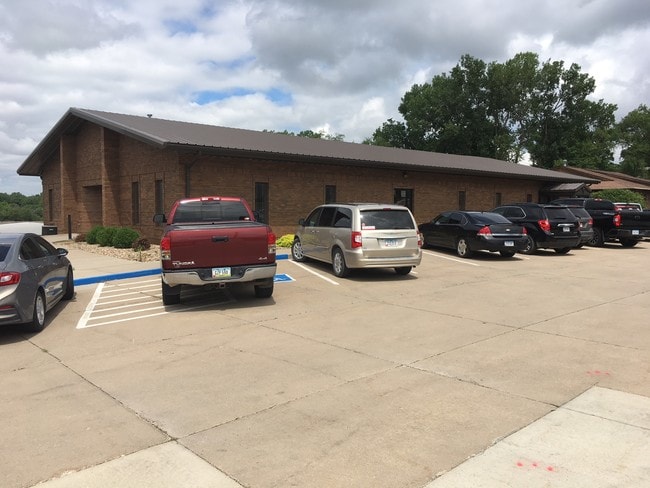
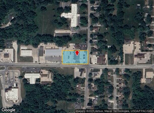
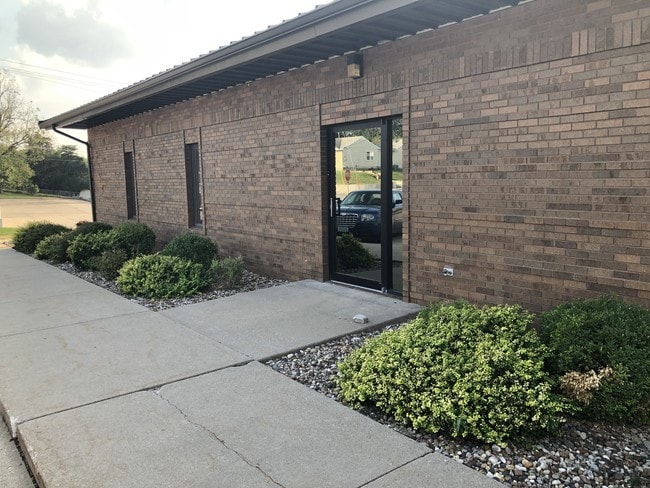
631 Pennsylvania Ave
Ottumwa, IA
S 1/2 FOLL: PT NWNE S 1/2 FOLL: PT NWNE BG NWCOR INTER NELM BG NWCOR INTER NELM & PENN AVE BEING 72 & PENN AVE BEING 72 1.6 E
007411580194000
Wapello
Apartment
Iowa
2025
1.03 AC
2025
Iowa Southeast Area
960200
Other Market Areas
5,000 SF
DEMOGRAPHICS near 631 Pennsylvania Ave
1 Mile
3 Mile
5 Mile
2024 Total Population
6,552
24,440
28,270
2029 Population
6,472
24,030
27,774
Pop Growth 2024-2029
(1.22%)
(1.68%)
(1.75%)
Average Age
38
39
39
2024 Total Households
2,600
9,695
11,218
HH Growth 2024-2029
(1.27%)
(1.75%)
(1.82%)
Median Household Inc
$55,836
$49,509
$50,357
Avg Household Size
2.40
2.40
2.40
2024 Avg HH Vehicles
2.00
2.00
2.00
Median Home Value
$116,900
$85,380
$93,006
Median Year Built
1949
1952
1954
Nearby Places
Map Layers
Map Styles
 Street
 Aerial
- Restaurants
- Banks
- Shops
- Fitness
- Groceries
PUBLIC TRANSPORTATION
COMMUTER RAIL
Ottumwa Amtrak Station (California Zephyr - Amtrak)
DRIVE
WALK
Distance
Ottumwa Amtrak Station (California Zephyr - Amtrak)
3 min
1.5 mi
Freight Ports
Port Milwaukee
DRIVE
WALK
Distance
Port Milwaukee
404 min
349.8 mi
SALE & LEASE HISTORY
LISTING DATE
SALE/LEASE

Jul 16, 2018
For Lease
Nearby Properties
Address
Land Use
TOTAL SIZE
Lot Size
Zoning
Address
Land Use
TOTAL SIZE
Lot Size
Zoning
1,680 SF
17.26 AC
Address
Land Use
TOTAL SIZE
Lot Size
Zoning
97,103 SF
0.35 AC
Address
Land Use
TOTAL SIZE
Lot Size
Zoning
527,878 SF
28.50 AC
Address
Land Use
TOTAL SIZE
Lot Size
Zoning
1.01 AC
Address
Land Use
TOTAL SIZE
Lot Size
Zoning
34,134 SF
9.89 AC
Address
Land Use
TOTAL SIZE
Lot Size
Zoning
32,796 SF
5.10 AC
Address
Land Use
TOTAL SIZE
Lot Size
Zoning
161,539 SF
5.43 AC
Address
Land Use
TOTAL SIZE
Lot Size
Zoning
87,967 SF
4.28 AC
Address
Land Use
TOTAL SIZE
Lot Size
Zoning
41,660 SF
0.55 AC
Address
Land Use
TOTAL SIZE
Lot Size
Zoning
53,552 SF
1.92 AC
Address
Land Use
TOTAL SIZE
Lot Size
Zoning
24,094 SF
4 AC
Address
Land Use
TOTAL SIZE
Lot Size
Zoning
47,341 SF
2.33 AC
Address
Land Use
TOTAL SIZE
Lot Size
Zoning
51,520 SF
8.37 AC
Address
Land Use
TOTAL SIZE
Lot Size
Zoning
217,810 SF
7.80 AC
Address
Land Use
TOTAL SIZE
Lot Size
Zoning
12,620 SF
4.87 AC
Address
Land Use
TOTAL SIZE
Lot Size
Zoning
55,481 SF
8.65 AC
Address
Land Use
TOTAL SIZE
Lot Size
Zoning
86,534 SF
8.77 AC
Address
Land Use
TOTAL SIZE
Lot Size
Zoning
7,995 SF
0.14 AC
Address
Land Use
TOTAL SIZE
Lot Size
Zoning
36,586 SF
0.15 AC
Address
Land Use
TOTAL SIZE
Lot Size
Zoning
3,440 SF
3.95 AC
Address
Land Use
TOTAL SIZE
Lot Size
Zoning
49,084 SF
3.87 AC
Address
Land Use
TOTAL SIZE
Lot Size
Zoning
28,476 SF
30.05 AC
Address
Land Use
TOTAL SIZE
Lot Size
Zoning
40,939 SF
5.72 AC
Address
Land Use
TOTAL SIZE
Lot Size
Zoning
18,457 SF
0.57 AC
Address
Land Use
TOTAL SIZE
Lot Size
Zoning
33,060 SF
3.83 AC
Address
Land Use
TOTAL SIZE
Lot Size
Zoning
23,858 SF
3.53 AC
Address
Land Use
TOTAL SIZE
Lot Size
Zoning
65,762 SF
7.96 AC
Address
Land Use
TOTAL SIZE
Lot Size
Zoning
29,226 SF
0.14 AC
Address
Land Use
TOTAL SIZE
Lot Size
Zoning
7,044 SF
2.39 AC
Address
Land Use
TOTAL SIZE
Lot Size
Zoning
14,593 SF
2.51 AC
The World's #1 Commercial Real Estate Marketplace
Connect with us
© 2025 CoStar Group
The information above has been obtained from sources believed reliable. While we do not doubt its accuracy we have not verified it and make no guarantee, warranty or representation about it. It is your responsibility to independently confirm its accuracy and completeness. Any projections, opinions, assumptions, or estimates used are for example only and do not represent the current or future performance of the property. The value of this transaction to you depends on tax and other factors which should be evaluated by your tax, financial, and legal advisors. You and your advisors should conduct a careful, independent investigation of the property to determine to your satisfaction the suitability of the property for your needs.