Property Record
6310 Pangola Rd, Fort Myers, FL 33905
NEARBY LISTINGS FOR SALE OR LEASE
Property Detail
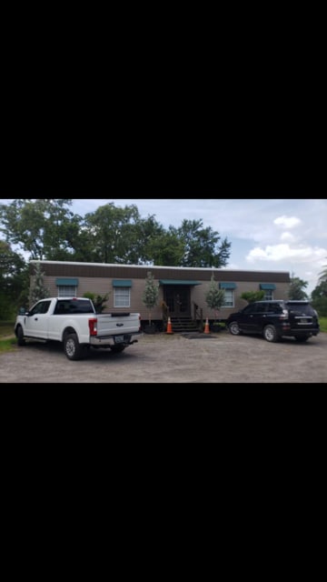
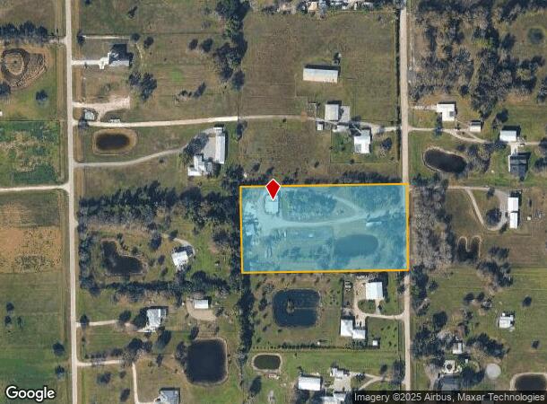
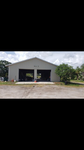
6310 Pangola Rd
Cape Coral-Fort Myers, FL
Orange River Blvd Ext So
18-44-26-04-00020.0000
ORANGE RVR RANCHETTES UNR OR 760 PG 281 LOT 20
Residentialacreage
Lee
X
Florida
12071C0295G
20
2024
5.04 AC
2025
City of Ft Myers
040123
Southwest Florida
2,400 SF
DEMOGRAPHICS near 6310 Pangola Rd
1 Mile
3 Mile
5 Mile
2024 Total Population
405
19,286
103,762
2029 Population
467
22,707
123,390
Pop Growth 2024-2029
+ 15.31%
+ 17.74%
+ 18.92%
Average Age
39
40
40
2024 Total Households
159
6,806
36,845
HH Growth 2024-2029
+ 15.09%
+ 17.47%
+ 19.00%
Median Household Inc
$77,631
$74,999
$63,989
Avg Household Size
2.50
2.70
2.60
2024 Avg HH Vehicles
2.00
2.00
2.00
Median Home Value
$287,499
$250,714
$259,870
Median Year Built
2001
2002
2003
Nearby Places
Map Layers
Map Styles
 Street
 Aerial
- Restaurants
- Banks
- Shops
- Fitness
- Groceries
PUBLIC TRANSPORTATION
AIRPORT
Southwest Florida International
DRIVE
WALK
Distance
Southwest Florida International
25 min
10.5 mi
Punta Gorda
DRIVE
WALK
Distance
Punta Gorda
42 min
26.7 mi
Freight Ports
Port Manatee
DRIVE
WALK
Distance
Port Manatee
121 min
98.4 mi
SALE & LEASE HISTORY
LISTING DATE
SALE/LEASE

Sep 11, 2020
For Sale
Nearby Properties
Address
Land Use
TOTAL SIZE
Lot Size
Zoning
Address
Land Use
TOTAL SIZE
Lot Size
Zoning
77.79 AC
PUD
Address
Land Use
TOTAL SIZE
Lot Size
Zoning
24.69 AC
C-1
Address
Land Use
TOTAL SIZE
Lot Size
Zoning
111.70 AC
C1
Address
Land Use
TOTAL SIZE
Lot Size
Zoning
580,121 SF
61.83 AC
IL
Address
Land Use
TOTAL SIZE
Lot Size
Zoning
324,346 SF
20 AC
C1
Address
Land Use
TOTAL SIZE
Lot Size
Zoning
17.50 AC
C1
Address
Land Use
TOTAL SIZE
Lot Size
Zoning
320,566 SF
500.70 AC
AG-2
Address
Land Use
TOTAL SIZE
Lot Size
Zoning
333,614 SF
294.30 AC
AG-2
Address
Land Use
TOTAL SIZE
Lot Size
Zoning
67.46 AC
C1
Address
Land Use
TOTAL SIZE
Lot Size
Zoning
154,653 SF
11.77 AC
SDA
Address
Land Use
TOTAL SIZE
Lot Size
Zoning
230,967 SF
8.31 AC
SDA
Address
Land Use
TOTAL SIZE
Lot Size
Zoning
68.11 AC
PUD
Address
Land Use
TOTAL SIZE
Lot Size
Zoning
291,613 SF
40.32 AC
RPD
Address
Land Use
TOTAL SIZE
Lot Size
Zoning
127,637 SF
6.50 AC
SDA
Address
Land Use
TOTAL SIZE
Lot Size
Zoning
5.88 AC
CG
Address
Land Use
TOTAL SIZE
Lot Size
Zoning
29.75 AC
CI
Address
Land Use
TOTAL SIZE
Lot Size
Zoning
85,812 SF
15.76 AC
PUD
Address
Land Use
TOTAL SIZE
Lot Size
Zoning
103,801 SF
2.63 AC
SDA
Address
Land Use
TOTAL SIZE
Lot Size
Zoning
87,353 SF
3.70 AC
SDA
Address
Land Use
TOTAL SIZE
Lot Size
Zoning
2.10 AC
C1
Address
Land Use
TOTAL SIZE
Lot Size
Zoning
2.11 AC
SDA
Address
Land Use
TOTAL SIZE
Lot Size
Zoning
142,693 SF
5.97 AC
C-2
Address
Land Use
TOTAL SIZE
Lot Size
Zoning
40,975 SF
5 AC
CPD
Address
Land Use
TOTAL SIZE
Lot Size
Zoning
104,006 SF
9.22 AC
IH
Address
Land Use
TOTAL SIZE
Lot Size
Zoning
108,797 SF
7.39 AC
IL
Address
Land Use
TOTAL SIZE
Lot Size
Zoning
35,974 SF
3.16 AC
IL
Address
Land Use
TOTAL SIZE
Lot Size
Zoning
70,622 SF
2.17 AC
CPD
Address
Land Use
TOTAL SIZE
Lot Size
Zoning
76,999 SF
34.31 AC
C-2
Address
Land Use
TOTAL SIZE
Lot Size
Zoning
46,846 SF
19.56 AC
IL
Address
Land Use
TOTAL SIZE
Lot Size
Zoning
35,087 SF
3.34 AC
MU
The World's #1 Commercial Real Estate Marketplace
Connect with us
© 2025 CoStar Group
The information above has been obtained from sources believed reliable. While we do not doubt its accuracy we have not verified it and make no guarantee, warranty or representation about it. It is your responsibility to independently confirm its accuracy and completeness. Any projections, opinions, assumptions, or estimates used are for example only and do not represent the current or future performance of the property. The value of this transaction to you depends on tax and other factors which should be evaluated by your tax, financial, and legal advisors. You and your advisors should conduct a careful, independent investigation of the property to determine to your satisfaction the suitability of the property for your needs.