Property Record
6310 Thomas Dr, Panama City, FL 32408


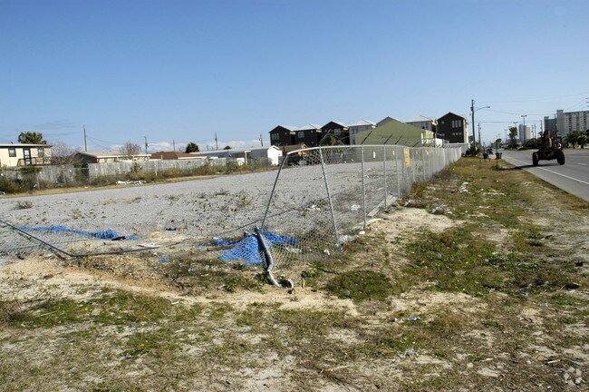
Property Detail
6310 Thomas Dr
Panama City-Panama City Beach, FL
HOLIDAY BEACH UNIT #4 LOTS 1,2,3 BLK M ** AND ** 8 4S 15W -5.15- BEG AT PT OF INT. OF NELY R/W L. OF THOM. DR. & N BDRY LI OF CRESCENT BEACH UNIT 1, TH SELY 142.51, NELY 120, NWLY 13.24 WLY 176.38 TO P.O.B. ORB 963 P 1304 ORB 3663 P 1582
30715-000-000
BAY
Commercialacreage
Florida
BC03
1,2,3
B and X Area of moderate flood hazard, usually the area between the limits of the 100-year and 500-year floods.
0.75 AC
2024
Panama City
2025
Other Market Areas
002604
NEARBY LISTINGS FOR SALE OR LEASE
DEMOGRAPHICS near 6310 Thomas Dr
1 mile
3 mile
5 mile
2025 Total Population
8,603
29,937
53,513
2030 Population
10,140
34,873
61,997
Pop Growth 2025-2030
+ 17.87%
+ 16.49%
+ 15.85%
Average Age
46
45
43
2025 Total Households
4,147
13,638
23,921
HH Growth 2025-2030
+ 18.40%
+ 17.22%
+ 16.59%
Median Household Inc
$83,824
$75,386
$70,868
Avg Household Size
2.10
2.10
2.20
2025 Avg HH Vehicles
2.00
2.00
2.00
Median Home Value
$370,778
$387,036
$374,884
Median Year Built
1988
1995
1995
Nearby Places
Map Layers
Map Styles
 Street
 Aerial
Transit
 Traffic
 Biking
Places
Listings with unknown addresses are not visible on the map
- Restaurants
- Banks
- Shops
- Fitness
- Groceries
PUBLIC TRANSPORTATION
AIRPORT
Northwest Florida Beaches International
Drive
Walk
Distance
Northwest Florida Beaches International
36 min
21.5 mi
Freight Ports
Port of Panama City
Drive
Walk
Distance
Port of Panama City
13 min
6.5 mi
Nearby Properties
Address
Land Use
TOTAL SIZE
Lot Size
Zoning
Address
Land Use
TOTAL SIZE
Lot Size
Zoning
96 AC
BC14
Address
Land Use
TOTAL SIZE
Lot Size
Zoning
68 AC
BC14
Address
Land Use
TOTAL SIZE
Lot Size
Zoning
176.88 AC
BC14
Address
Land Use
TOTAL SIZE
Lot Size
Zoning
287 AC
BC10
Address
Land Use
TOTAL SIZE
Lot Size
Zoning
335,150 SF
17.17 AC
BC05
Address
Land Use
TOTAL SIZE
Lot Size
Zoning
285,798 SF
16.50 AC
BC19
Address
Land Use
TOTAL SIZE
Lot Size
Zoning
503,491 SF
79.46 AC
PC12
Address
Land Use
TOTAL SIZE
Lot Size
Zoning
40,690 SF
24.86 AC
BC19
Address
Land Use
TOTAL SIZE
Lot Size
Zoning
38,884 SF
149 AC
BC10
Address
Land Use
TOTAL SIZE
Lot Size
Zoning
254,904 SF
20.60 AC
BC05
Address
Land Use
TOTAL SIZE
Lot Size
Zoning
210,652 SF
19.47 AC
BC19
Address
Land Use
TOTAL SIZE
Lot Size
Zoning
132,433 SF
6.43 AC
PCB21
Address
Land Use
TOTAL SIZE
Lot Size
Zoning
84.50 AC
BC10
Address
Land Use
TOTAL SIZE
Lot Size
Zoning
206,450 SF
12.52 AC
BC05
Address
Land Use
TOTAL SIZE
Lot Size
Zoning
56,045 SF
2.82 AC
BC05
Address
Land Use
TOTAL SIZE
Lot Size
Zoning
43,287 SF
7.73 AC
BC04
Address
Land Use
TOTAL SIZE
Lot Size
Zoning
22,462 SF
1.99 AC
BC05
Address
Land Use
TOTAL SIZE
Lot Size
Zoning
216,844 SF
25.60 AC
PCB22
Address
Land Use
TOTAL SIZE
Lot Size
Zoning
112,780 SF
20.85 AC
BC14
Address
Land Use
TOTAL SIZE
Lot Size
Zoning
143,993 SF
7.27 AC
BC05
Address
Land Use
TOTAL SIZE
Lot Size
Zoning
50,377 SF
1.88 AC
BC05
Address
Land Use
TOTAL SIZE
Lot Size
Zoning
50,354 SF
2.44 AC
BC05
Address
Land Use
TOTAL SIZE
Lot Size
Zoning
55 AC
BC14
Address
Land Use
TOTAL SIZE
Lot Size
Zoning
18,427 SF
2.90 AC
PCB21
Address
Land Use
TOTAL SIZE
Lot Size
Zoning
54 AC
BC10
Address
Land Use
TOTAL SIZE
Lot Size
Zoning
49,004 SF
6.85 AC
PCB21
Address
Land Use
TOTAL SIZE
Lot Size
Zoning
58,752 SF
4.62 AC
PCB21
Address
Land Use
TOTAL SIZE
Lot Size
Zoning
104,254 SF
2.20 AC
BC05
Address
Land Use
TOTAL SIZE
Lot Size
Zoning
49.47 AC
BC14
Address
Land Use
TOTAL SIZE
Lot Size
Zoning
100,607 SF
12.14 AC
BC05
The World's #1 Commercial Real Estate Marketplace
Connect with us
© 2026 CoStar Group
The information above has been obtained from sources believed reliable. While we do not doubt its accuracy we have not verified it and make no guarantee, warranty or representation about it. It is your responsibility to independently confirm its accuracy and completeness. Any projections, opinions, assumptions, or estimates used are for example only and do not represent the current or future performance of the property. The value of this transaction to you depends on tax and other factors which should be evaluated by your tax, financial, and legal advisors. You and your advisors should conduct a careful, independent investigation of the property to determine to your satisfaction the suitability of the property for your needs.