Property Record
6311 Woodland Ave, Kansas City, MO 64131
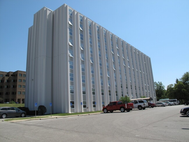
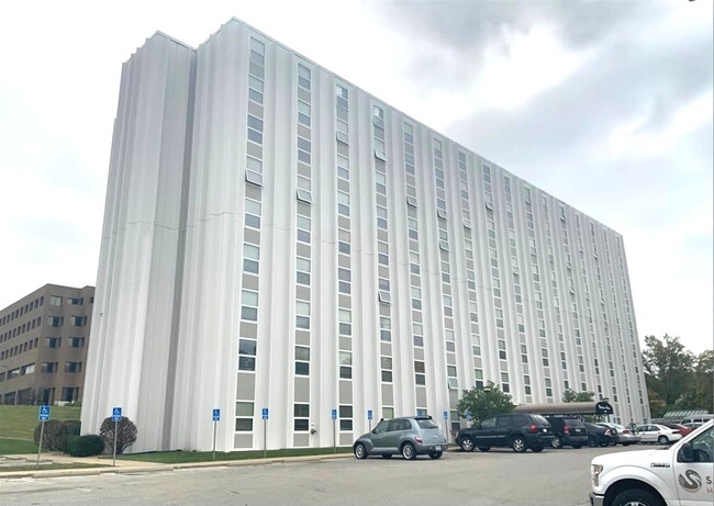
This Property Is For Sale
NEARBY LISTINGS FOR SALE OR LEASE
Property Detail
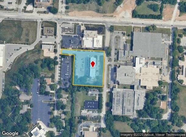
6311 Woodland Ave
Kansas City, MO-KS
Elm Ridge
47-140-01-44-00-0-00-000
ELM RIDGE S 52 OF LOT 3, ALL LO TS 4,5&6 & S 52 OF TH PT O F LOT 22 LY E OF TH E LI WOODLAND AVE RET/RN/PPF/99
Governmentalpublicusegeneral
Jackson
X
Missouri
29095C0264G
3,22
2024
2.58 AC
2025
Blenheim Square-Research Hospital
008700
Kansas City
19,240 SF
DEMOGRAPHICS near 6311 Woodland Ave
1 Mile
3 Mile
5 Mile
2024 Total Population
12,747
95,797
243,404
2029 Population
12,899
96,692
247,409
Pop Growth 2024-2029
+ 1.19%
+ 0.93%
+ 1.65%
Average Age
40
39
39
2024 Total Households
5,487
42,815
111,474
HH Growth 2024-2029
+ 1.02%
+ 0.83%
+ 1.57%
Median Household Inc
$49,238
$65,726
$63,238
Avg Household Size
2.20
2.10
2.10
2024 Avg HH Vehicles
1.00
2.00
2.00
Median Home Value
$146,646
$253,849
$256,543
Median Year Built
1949
1949
1955
Nearby Places
- Restaurants
- Banks
- Shops
- Fitness
- Groceries
PUBLIC TRANSPORTATION
COMMUTER RAIL
Kansas City (Lincoln Service Missouri River Runner - Amtrak, Missouri River Runner - Amtrak, Southwest Chief - Amtrak)
DRIVE
WALK
Distance
Kansas City (Lincoln Service Missouri River Runner - Amtrak, Missouri River Runner - Amtrak, Southwest Chief - Amtrak)
13 min
7.2 mi
AIRPORT
Kansas City International
DRIVE
WALK
Distance
Kansas City International
38 min
27.4 mi
Freight Ports
Tulsa Port Of Catoosa
DRIVE
WALK
Distance
Tulsa Port Of Catoosa
265 min
235.1 mi
Nearby Properties
Address
Land Use
TOTAL SIZE
Lot Size
Zoning
Address
Land Use
TOTAL SIZE
Lot Size
Zoning
105,247 SF
0.72 AC
Address
Land Use
TOTAL SIZE
Lot Size
Zoning
543,241 SF
8.39 AC
Address
Land Use
TOTAL SIZE
Lot Size
Zoning
626,244 SF
16.41 AC
Address
Land Use
TOTAL SIZE
Lot Size
Zoning
129,265 SF
1.17 AC
Address
Land Use
TOTAL SIZE
Lot Size
Zoning
109,563 SF
0.98 AC
Address
Land Use
TOTAL SIZE
Lot Size
Zoning
149,157 SF
0.02 AC
URD
Address
Land Use
TOTAL SIZE
Lot Size
Zoning
251,409 SF
3.39 AC
Address
Land Use
TOTAL SIZE
Lot Size
Zoning
379,472 SF
Address
Land Use
TOTAL SIZE
Lot Size
Zoning
369,624 SF
7.50 AC
Address
Land Use
TOTAL SIZE
Lot Size
Zoning
64,964 SF
0.85 AC
Address
Land Use
TOTAL SIZE
Lot Size
Zoning
193,643 SF
20.63 AC
Address
Land Use
TOTAL SIZE
Lot Size
Zoning
70,449 SF
0.66 AC
Address
Land Use
TOTAL SIZE
Lot Size
Zoning
174,983 SF
10.43 AC
Address
Land Use
TOTAL SIZE
Lot Size
Zoning
153,946 SF
5.91 AC
Address
Land Use
TOTAL SIZE
Lot Size
Zoning
50,684 SF
0.07 AC
Address
Land Use
TOTAL SIZE
Lot Size
Zoning
785,016 SF
23.73 AC
Address
Land Use
TOTAL SIZE
Lot Size
Zoning
136,963 SF
2.05 AC
Address
Land Use
TOTAL SIZE
Lot Size
Zoning
213,914 SF
3.60 AC
Address
Land Use
TOTAL SIZE
Lot Size
Zoning
481,764 SF
26.50 AC
Address
Land Use
TOTAL SIZE
Lot Size
Zoning
205,182 SF
3.09 AC
Address
Land Use
TOTAL SIZE
Lot Size
Zoning
273,418 SF
1.97 AC
Address
Land Use
TOTAL SIZE
Lot Size
Zoning
82,299 SF
1.07 AC
Address
Land Use
TOTAL SIZE
Lot Size
Zoning
151,831 SF
12.93 AC
Address
Land Use
TOTAL SIZE
Lot Size
Zoning
90,456 SF
0.81 AC
Address
Land Use
TOTAL SIZE
Lot Size
Zoning
59,590 SF
2.19 AC
Address
Land Use
TOTAL SIZE
Lot Size
Zoning
176,703 SF
1.43 AC
Address
Land Use
TOTAL SIZE
Lot Size
Zoning
57,972 SF
0.67 AC
Address
Land Use
TOTAL SIZE
Lot Size
Zoning
245,012 SF
4.66 AC
Address
Land Use
TOTAL SIZE
Lot Size
Zoning
252,936 SF
2.34 AC
Address
Land Use
TOTAL SIZE
Lot Size
Zoning
136,963 SF
0.66 AC
The World's #1 Commercial Real Estate Marketplace
Connect with us
© 2025 CoStar Group
The information above has been obtained from sources believed reliable. While we do not doubt its accuracy we have not verified it and make no guarantee, warranty or representation about it. It is your responsibility to independently confirm its accuracy and completeness. Any projections, opinions, assumptions, or estimates used are for example only and do not represent the current or future performance of the property. The value of this transaction to you depends on tax and other factors which should be evaluated by your tax, financial, and legal advisors. You and your advisors should conduct a careful, independent investigation of the property to determine to your satisfaction the suitability of the property for your needs.