Property Record
6312 S Halsted St, Chicago, IL 60621

Current Lease Availabilities
NEARBY LISTINGS FOR SALE OR LEASE
Property Detail
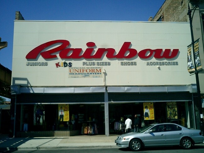
6312 S Halsted St
Chicago-Naperville-Elgin, IL-IN
Green Add To Chicago
20-20-207-017-0000
LUCY M (GREEN) ADD TO (CHICAGO) IN SEC 20-38-14
Storebuilding
Cook
X
Illinois
17031C0520J
39-41
2023
0.15 AC
2025
South Chicago
680900
Chicago
14,054 SF
DEMOGRAPHICS near 6312 S Halsted St
1 Mile
3 Mile
5 Mile
2024 Total Population
24,223
291,290
717,504
2029 Population
23,481
277,983
684,385
Pop Growth 2024-2029
(3.06%)
(4.57%)
(4.62%)
Average Age
38
37
39
2024 Total Households
9,542
108,726
273,304
HH Growth 2024-2029
(3.29%)
(4.69%)
(4.64%)
Median Household Inc
$21,242
$34,043
$43,518
Avg Household Size
2.40
2.50
2.50
2024 Avg HH Vehicles
1.00
1.00
1.00
Median Home Value
$118,050
$178,942
$212,419
Median Year Built
1949
1948
1949
Nearby Places
Map Layers
Map Styles
 Street
 Aerial
- Restaurants
- Banks
- Shops
- Fitness
- Groceries
PUBLIC TRANSPORTATION
TRANSIT/SUBWAY
Halsted Station (Green Line) (Green Line - Chicago Transit Authority "L" Trains (The "L"))
DRIVE
WALK
Distance
Halsted Station (Green Line) (Green Line - Chicago Transit Authority "L" Trains (The "L"))
1 min
2 min
0.1 mi
63rd Street Station (Red Line - Chicago Transit Authority "L" Trains (The "L"))
DRIVE
WALK
Distance
63rd Street Station (Red Line - Chicago Transit Authority "L" Trains (The "L"))
8 min
15 min
0.8 mi
Ashland & 63rd Street Station (Green Line - Chicago Transit Authority "L" Trains (The "L"))
DRIVE
WALK
Distance
Ashland & 63rd Street Station (Green Line - Chicago Transit Authority "L" Trains (The "L"))
4 min
20 min
1.1 mi
COMMUTER RAIL
Gresham Station (Rock Island District Line - Northeast Illinois Regional Commuter Railroad (Metra))
DRIVE
WALK
Distance
Gresham Station (Rock Island District Line - Northeast Illinois Regional Commuter Railroad (Metra))
6 min
3.0 mi
63rd Street Station (South Shore Line - Northern Indiana Commuter Transportation District (South Shore Line))
DRIVE
WALK
Distance
63rd Street Station (South Shore Line - Northern Indiana Commuter Transportation District (South Shore Line))
8 min
3.3 mi
AIRPORT
Chicago Midway International
DRIVE
WALK
Distance
Chicago Midway International
13 min
6.2 mi
Chicago O'Hare International
DRIVE
WALK
Distance
Chicago O'Hare International
64 min
28.7 mi
Nearby Properties
Address
Land Use
TOTAL SIZE
Lot Size
Zoning
Address
Land Use
TOTAL SIZE
Lot Size
Zoning
10.73 AC
PD 1243
Address
Land Use
TOTAL SIZE
Lot Size
Zoning
134,800 SF
2.53 AC
PD 1273
Address
Land Use
TOTAL SIZE
Lot Size
Zoning
0.91 AC
PD 1177
Address
Land Use
TOTAL SIZE
Lot Size
Zoning
87,830 SF
0.76 AC
B1-1
Address
Land Use
TOTAL SIZE
Lot Size
Zoning
260,481 SF
12.93 AC
PD 463
Address
Land Use
TOTAL SIZE
Lot Size
Zoning
7,200 SF
0.22 AC
B3-3
Address
Land Use
TOTAL SIZE
Lot Size
Zoning
PD 43
Address
Land Use
TOTAL SIZE
Lot Size
Zoning
Address
Land Use
TOTAL SIZE
Lot Size
Zoning
0.29 AC
PD 1548
Address
Land Use
TOTAL SIZE
Lot Size
Zoning
4,900 SF
0.29 AC
PD 1548
Address
Land Use
TOTAL SIZE
Lot Size
Zoning
151,303 SF
0.88 AC
PD 568
Address
Land Use
TOTAL SIZE
Lot Size
Zoning
1.65 AC
B2-3
Address
Land Use
TOTAL SIZE
Lot Size
Zoning
PD 43
Address
Land Use
TOTAL SIZE
Lot Size
Zoning
78,000 SF
0.62 AC
RM-5
Address
Land Use
TOTAL SIZE
Lot Size
Zoning
36,365 SF
Address
Land Use
TOTAL SIZE
Lot Size
Zoning
7.47 AC
RT-4
Address
Land Use
TOTAL SIZE
Lot Size
Zoning
352,529 SF
12.77 AC
PMD 8
Address
Land Use
TOTAL SIZE
Lot Size
Zoning
283,228 SF
14.47 AC
PMD 8
Address
Land Use
TOTAL SIZE
Lot Size
Zoning
13,700 SF
0.33 AC
B3-2
Address
Land Use
TOTAL SIZE
Lot Size
Zoning
168,120 SF
8.06 AC
PMD 8
Address
Land Use
TOTAL SIZE
Lot Size
Zoning
258,000 SF
13.22 AC
PMD 8
Address
Land Use
TOTAL SIZE
Lot Size
Zoning
141,165 SF
7.82 AC
PD 966
Address
Land Use
TOTAL SIZE
Lot Size
Zoning
0.18 AC
PD 43
Address
Land Use
TOTAL SIZE
Lot Size
Zoning
65,186 SF
10.47 AC
PD 566
Address
Land Use
TOTAL SIZE
Lot Size
Zoning
184,487 SF
0.66 AC
RM-5,RS-3
Address
Land Use
TOTAL SIZE
Lot Size
Zoning
111,198 SF
10.60 AC
PD 566
Address
Land Use
TOTAL SIZE
Lot Size
Zoning
743,663 SF
7.14 AC
RT-4
Address
Land Use
TOTAL SIZE
Lot Size
Zoning
2.51 AC
RT-4,PD 12
Address
Land Use
TOTAL SIZE
Lot Size
Zoning
Address
Land Use
TOTAL SIZE
Lot Size
Zoning
15,600 SF
0.18 AC
C2-1
The World's #1 Commercial Real Estate Marketplace
Connect with us
© 2026 CoStar Group
The information above has been obtained from sources believed reliable. While we do not doubt its accuracy we have not verified it and make no guarantee, warranty or representation about it. It is your responsibility to independently confirm its accuracy and completeness. Any projections, opinions, assumptions, or estimates used are for example only and do not represent the current or future performance of the property. The value of this transaction to you depends on tax and other factors which should be evaluated by your tax, financial, and legal advisors. You and your advisors should conduct a careful, independent investigation of the property to determine to your satisfaction the suitability of the property for your needs.