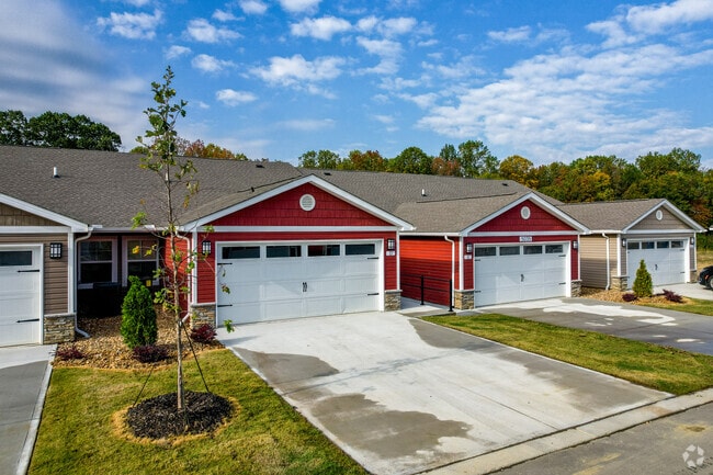
Property Record
6317 Ridge Rd, Charlotte, NC 28269


NEARBY LISTINGS FOR SALE OR LEASE
Property Detail
6317 Ridge Rd
Charlotte-Concord-Gastonia, NC-SC
Redwood Charlotte Ridge Road Nc P1 Llc
029-721-18
L1 M67-362
Multifamilydwelling
Mecklenburg
AE
North Carolina
3710457900K
1
2024
21.05 AC
2025
Highland Creek
005511
Charlotte
134,908 SF
DEMOGRAPHICS near 6317 Ridge Rd
1 Mile
3 Mile
5 Mile
2024 Total Population
8,154
66,238
155,047
2029 Population
8,716
71,077
167,064
Pop Growth 2024-2029
+ 6.89%
+ 7.31%
+ 7.75%
Average Age
35
36
35
2024 Total Households
3,144
25,432
59,971
HH Growth 2024-2029
+ 7.12%
+ 6.92%
+ 7.32%
Median Household Inc
$77,375
$88,906
$79,854
Avg Household Size
2.60
2.60
2.50
2024 Avg HH Vehicles
2.00
2.00
2.00
Median Home Value
$273,248
$314,556
$298,165
Median Year Built
2003
2003
2002
Nearby Places
Map Layers
Map Styles
 Street
 Aerial
- Restaurants
- Banks
- Shops
- Fitness
- Groceries
PUBLIC TRANSPORTATION
AIRPORT
Concord-Padgett Regional
DRIVE
WALK
Distance
Concord-Padgett Regional
8 min
3.6 mi
Charlotte/Douglas International
DRIVE
WALK
Distance
Charlotte/Douglas International
34 min
22.1 mi
Freight Ports
North Charleston Terminal
DRIVE
WALK
Distance
North Charleston Terminal
247 min
218.0 mi
Nearby Properties
Address
Land Use
TOTAL SIZE
Lot Size
Zoning
Address
Land Use
TOTAL SIZE
Lot Size
Zoning
701,530 SF
143.45 AC
C-2
Address
Land Use
TOTAL SIZE
Lot Size
Zoning
381,490 SF
29.24 AC
C-2
Address
Land Use
TOTAL SIZE
Lot Size
Zoning
1,474,585 SF
30.93 AC
Address
Land Use
TOTAL SIZE
Lot Size
Zoning
1,532,477 SF
92.30 AC
RE1
Address
Land Use
TOTAL SIZE
Lot Size
Zoning
389,720 SF
33.83 AC
R12MFCD
Address
Land Use
TOTAL SIZE
Lot Size
Zoning
471,271 SF
24.30 AC
MUDD-O
Address
Land Use
TOTAL SIZE
Lot Size
Zoning
374,697 SF
12.46 AC
Address
Land Use
TOTAL SIZE
Lot Size
Zoning
324,349 SF
4.69 AC
C-2
Address
Land Use
TOTAL SIZE
Lot Size
Zoning
14,742 SF
587.28 AC
I-1
Address
Land Use
TOTAL SIZE
Lot Size
Zoning
375,242 SF
25.64 AC
CC
Address
Land Use
TOTAL SIZE
Lot Size
Zoning
26,733 SF
48.78 AC
C-2
Address
Land Use
TOTAL SIZE
Lot Size
Zoning
346,666 SF
26.53 AC
R17MFCD
Address
Land Use
TOTAL SIZE
Lot Size
Zoning
30,586 SF
54.10 AC
C-2
Address
Land Use
TOTAL SIZE
Lot Size
Zoning
316,033 SF
30.04 AC
R3
Address
Land Use
TOTAL SIZE
Lot Size
Zoning
347,856 SF
21.16 AC
R17MFCD
Address
Land Use
TOTAL SIZE
Lot Size
Zoning
57,268 SF
25.88 AC
C-2
Address
Land Use
TOTAL SIZE
Lot Size
Zoning
497,811 SF
49.75 AC
RE2
Address
Land Use
TOTAL SIZE
Lot Size
Zoning
31,248 SF
21.72 AC
C-2
Address
Land Use
TOTAL SIZE
Lot Size
Zoning
310,576 SF
11.22 AC
Address
Land Use
TOTAL SIZE
Lot Size
Zoning
357,469 SF
49.75 AC
Address
Land Use
TOTAL SIZE
Lot Size
Zoning
15.72 AC
Address
Land Use
TOTAL SIZE
Lot Size
Zoning
317,085 SF
29.66 AC
R17MFCD
Address
Land Use
TOTAL SIZE
Lot Size
Zoning
276,620 SF
19.76 AC
R3
Address
Land Use
TOTAL SIZE
Lot Size
Zoning
252,523 SF
7.75 AC
R3
Address
Land Use
TOTAL SIZE
Lot Size
Zoning
62,780 SF
21.89 AC
Address
Land Use
TOTAL SIZE
Lot Size
Zoning
262,196 SF
21.30 AC
Address
Land Use
TOTAL SIZE
Lot Size
Zoning
330,181 SF
11.22 AC
O1CD
Address
Land Use
TOTAL SIZE
Lot Size
Zoning
261,156 SF
12.65 AC
RE1
Address
Land Use
TOTAL SIZE
Lot Size
Zoning
312,297 SF
18.28 AC
RE-3(O)
Address
Land Use
TOTAL SIZE
Lot Size
Zoning
289,262 SF
14.50 AC
CC
The World's #1 Commercial Real Estate Marketplace
Connect with us
© 2026 CoStar Group
The information above has been obtained from sources believed reliable. While we do not doubt its accuracy we have not verified it and make no guarantee, warranty or representation about it. It is your responsibility to independently confirm its accuracy and completeness. Any projections, opinions, assumptions, or estimates used are for example only and do not represent the current or future performance of the property. The value of this transaction to you depends on tax and other factors which should be evaluated by your tax, financial, and legal advisors. You and your advisors should conduct a careful, independent investigation of the property to determine to your satisfaction the suitability of the property for your needs.