Property Record
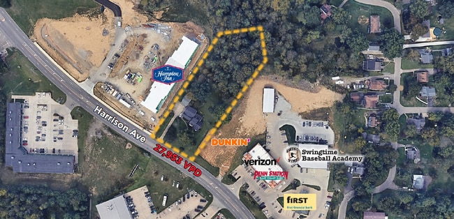
6320 Harrison Ave, Cincinnati, OH 45247

Property Detail
6320 Harrison Ave
550-0221-0017
HARRISON PK 2.22 AC PT LOT 5 BENJ GRIFFITHS SUB
Residentialacreage
Hamilton
A
Ohio
B and X Area of moderate flood hazard, usually the area between the limits of the 100-year and 500-year floods.
5
2025
2.22 AC
2025
Forest Park/West
020604
Cincinnati/Dayton
2,750 SF
Cincinnati, OH-KY-IN
NEARBY LISTINGS FOR SALE OR LEASE
DEMOGRAPHICS near 6320 Harrison Ave
1 mile
3 mile
5 mile
2025 Total Population
6,019
49,755
144,486
2030 Population
6,012
49,644
144,818
Pop Growth 2025-2030
(0.12%)
(0.22%)
+ 0.23%
Average Age
44
42
41
2025 Total Households
2,764
20,172
59,069
HH Growth 2025-2030
(0.04%)
(0.23%)
+ 0.20%
Median Household Inc
$69,844
$86,111
$70,331
Avg Household Size
2.10
2.40
2.40
2025 Avg HH Vehicles
2.00
2.00
2.00
Median Home Value
$239,974
$252,521
$231,842
Median Year Built
1982
1974
1967
Nearby Places
Map Layers
Map Styles
 Street
 Aerial
Layers
 Traffic
 Biking
Places
Listings with unknown addresses are not visible on the map
- Restaurants
- Banks
- Shops
- Fitness
- Groceries
PUBLIC TRANSPORTATION
AIRPORT
Cincinnati/Northern Kentucky International
Drive
Walk
Distance
Cincinnati/Northern Kentucky International
42 min
26.2 mi
Nearby Properties
Address
Land Use
TOTAL SIZE
Lot Size
Zoning
Address
Land Use
TOTAL SIZE
Lot Size
Zoning
5.38 AC
OO
Address
Land Use
TOTAL SIZE
Lot Size
Zoning
9.52 AC
B
Address
Land Use
TOTAL SIZE
Lot Size
Zoning
12.23 AC
Address
Land Use
TOTAL SIZE
Lot Size
Zoning
474 SF
9.59 AC
A
Address
Land Use
TOTAL SIZE
Lot Size
Zoning
1,671 SF
21.48 AC
CCUP
Address
Land Use
TOTAL SIZE
Lot Size
Zoning
2,678 SF
8.76 AC
Address
Land Use
TOTAL SIZE
Lot Size
Zoning
6,620 SF
16.91 AC
Address
Land Use
TOTAL SIZE
Lot Size
Zoning
14.43 AC
Address
Land Use
TOTAL SIZE
Lot Size
Zoning
Address
Land Use
TOTAL SIZE
Lot Size
Zoning
4.68 AC
E
Address
Land Use
TOTAL SIZE
Lot Size
Zoning
29,084 SF
30.10 AC
DD
Address
Land Use
TOTAL SIZE
Lot Size
Zoning
20.34 AC
Address
Land Use
TOTAL SIZE
Lot Size
Zoning
360 SF
7.79 AC
F
Address
Land Use
TOTAL SIZE
Lot Size
Zoning
18.30 AC
EE
Address
Land Use
TOTAL SIZE
Lot Size
Zoning
4.28 AC
OO
Address
Land Use
TOTAL SIZE
Lot Size
Zoning
60,751 SF
9.57 AC
C
Address
Land Use
TOTAL SIZE
Lot Size
Zoning
4.33 AC
Address
Land Use
TOTAL SIZE
Lot Size
Zoning
8,580 SF
19.31 AC
DD
Address
Land Use
TOTAL SIZE
Lot Size
Zoning
Address
Land Use
TOTAL SIZE
Lot Size
Zoning
6.91 AC
B
Address
Land Use
TOTAL SIZE
Lot Size
Zoning
3.04 AC
OO
Address
Land Use
TOTAL SIZE
Lot Size
Zoning
35,496 SF
13.86 AC
A
Address
Land Use
TOTAL SIZE
Lot Size
Zoning
8.69 AC
EE
Address
Land Use
TOTAL SIZE
Lot Size
Zoning
31.99 AC
B
Address
Land Use
TOTAL SIZE
Lot Size
Zoning
58,082 SF
16.25 AC
B
Address
Land Use
TOTAL SIZE
Lot Size
Zoning
2.76 AC
EE
Address
Land Use
TOTAL SIZE
Lot Size
Zoning
1,820 SF
5.75 AC
OO
Address
Land Use
TOTAL SIZE
Lot Size
Zoning
Address
Land Use
TOTAL SIZE
Lot Size
Zoning
Address
Land Use
TOTAL SIZE
Lot Size
Zoning
37,169 SF
12.82 AC
A
The World's #1 Commercial Real Estate Marketplace
Connect with us
© 2026 CoStar Group
The information above has been obtained from sources believed reliable. While we do not doubt its accuracy we have not verified it and make no guarantee, warranty or representation about it. It is your responsibility to independently confirm its accuracy and completeness. Any projections, opinions, assumptions, or estimates used are for example only and do not represent the current or future performance of the property. The value of this transaction to you depends on tax and other factors which should be evaluated by your tax, financial, and legal advisors. You and your advisors should conduct a careful, independent investigation of the property to determine to your satisfaction the suitability of the property for your needs.