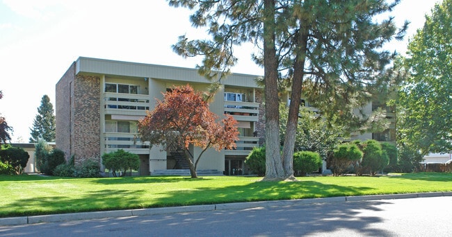
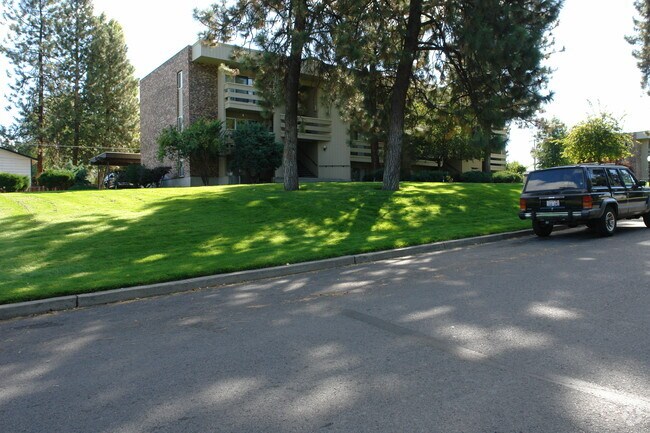
Property Record
6320 N Calispel St, Spokane, WA 99208

Property Detail
6320 N Calispel St
36304.3018
NORTH 12 FT OF LOT 27
Apartment
Spokane
HDR
Washington
B and X Area of moderate flood hazard, usually the area between the limits of the 100-year and 500-year floods.
27,40
2026
1.18 AC
2026
Town and Country
011000
Spokane
6,736 SF
Spokane-Spokane Valley, WA
NEARBY LISTINGS FOR SALE OR LEASE
DEMOGRAPHICS near 6320 N Calispel St
1 mile
3 mile
5 mile
2025 Total Population
16,704
119,372
207,795
2030 Population
16,828
120,982
211,269
Pop Growth 2025-2030
+ 0.74%
+ 1.35%
+ 1.67%
Average Age
40
39
39
2025 Total Households
7,359
47,565
84,464
HH Growth 2025-2030
+ 0.76%
+ 1.35%
+ 1.83%
Median Household Inc
$59,132
$67,864
$64,518
Avg Household Size
2.20
2.40
2.30
2025 Avg HH Vehicles
2.00
2.00
2.00
Median Home Value
$315,673
$341,895
$363,253
Median Year Built
1966
1958
1967
Nearby Places
Map Layers
Map Styles
 Street
 Aerial
Layers
 Traffic
 Biking
Places
Listings with unknown addresses are not visible on the map
- Restaurants
- Banks
- Shops
- Fitness
- Groceries
PUBLIC TRANSPORTATION
COMMUTER RAIL
Spokane (Empire Builder - Amtrak)
Drive
Walk
Distance
Spokane (Empire Builder - Amtrak)
12 min
4.4 mi
AIRPORT
Spokane International
Drive
Walk
Distance
Spokane International
22 min
10.8 mi
Freight Ports
Port of Everett
Drive
Walk
Distance
Port of Everett
350 min
306.4 mi
Nearby Properties
Address
Land Use
TOTAL SIZE
Lot Size
Zoning
Address
Land Use
TOTAL SIZE
Lot Size
Zoning
909,350 SF
92.96 AC
LDR
Address
Land Use
TOTAL SIZE
Lot Size
Zoning
427,054 SF
16.60 AC
LI
Address
Land Use
TOTAL SIZE
Lot Size
Zoning
456,984 SF
26.06 AC
O
Address
Land Use
TOTAL SIZE
Lot Size
Zoning
530,527 SF
17.11 AC
CC2
Address
Land Use
TOTAL SIZE
Lot Size
Zoning
468,006 SF
22.81 AC
RSF
Address
Land Use
TOTAL SIZE
Lot Size
Zoning
306,460 SF
27.56 AC
RMF
Address
Land Use
TOTAL SIZE
Lot Size
Zoning
278,777 SF
5.47 AC
HDR
Address
Land Use
TOTAL SIZE
Lot Size
Zoning
180,822 SF
16.11 AC
CC1
Address
Land Use
TOTAL SIZE
Lot Size
Zoning
141,264 SF
16.74 AC
RSF
Address
Land Use
TOTAL SIZE
Lot Size
Zoning
696,382 SF
37.43 AC
LI
Address
Land Use
TOTAL SIZE
Lot Size
Zoning
316,001 SF
31.10 AC
GC
Address
Land Use
TOTAL SIZE
Lot Size
Zoning
1,572,216 SF
23.12 AC
GC
Address
Land Use
TOTAL SIZE
Lot Size
Zoning
159,508 SF
18.52 AC
RSF
Address
Land Use
TOTAL SIZE
Lot Size
Zoning
148,224 SF
4.98 AC
GC
Address
Land Use
TOTAL SIZE
Lot Size
Zoning
125,302 SF
7.79 AC
RMF
Address
Land Use
TOTAL SIZE
Lot Size
Zoning
141,474 SF
6.60 AC
RMF
Address
Land Use
TOTAL SIZE
Lot Size
Zoning
76,559 SF
7.11 AC
LDR
Address
Land Use
TOTAL SIZE
Lot Size
Zoning
136,780 SF
8.75 AC
RMF
Address
Land Use
TOTAL SIZE
Lot Size
Zoning
153,780 SF
10.31 AC
RMF
Address
Land Use
TOTAL SIZE
Lot Size
Zoning
150,061 SF
5.01 AC
GC
Address
Land Use
TOTAL SIZE
Lot Size
Zoning
160,810 SF
25.18 AC
RMF
Address
Land Use
TOTAL SIZE
Lot Size
Zoning
247,669 SF
41.68 AC
HI
Address
Land Use
TOTAL SIZE
Lot Size
Zoning
131,469 SF
7.24 AC
RMF
Address
Land Use
TOTAL SIZE
Lot Size
Zoning
67,094 SF
9.33 AC
RSF
Address
Land Use
TOTAL SIZE
Lot Size
Zoning
95,030 SF
3.51 AC
CC1
Address
Land Use
TOTAL SIZE
Lot Size
Zoning
125,588 SF
12.84 AC
RMF
Address
Land Use
TOTAL SIZE
Lot Size
Zoning
183,704 SF
12.67 AC
RMF
Address
Land Use
TOTAL SIZE
Lot Size
Zoning
113,638 SF
34.05 AC
RSF
Address
Land Use
TOTAL SIZE
Lot Size
Zoning
180,440 SF
13.94 AC
RMF
Address
Land Use
TOTAL SIZE
Lot Size
Zoning
142,448 SF
14.85 AC
RMF
The World's #1 Commercial Real Estate Marketplace
Connect with us
© 2026 CoStar Group
The information above has been obtained from sources believed reliable. While we do not doubt its accuracy we have not verified it and make no guarantee, warranty or representation about it. It is your responsibility to independently confirm its accuracy and completeness. Any projections, opinions, assumptions, or estimates used are for example only and do not represent the current or future performance of the property. The value of this transaction to you depends on tax and other factors which should be evaluated by your tax, financial, and legal advisors. You and your advisors should conduct a careful, independent investigation of the property to determine to your satisfaction the suitability of the property for your needs.