Property Record
6320 Savannah Hwy, Ravenel, SC 29470
NEARBY LISTINGS FOR SALE OR LEASE
-
-
View all Ravenel listings for sale on LoopNet.com
Property Detail
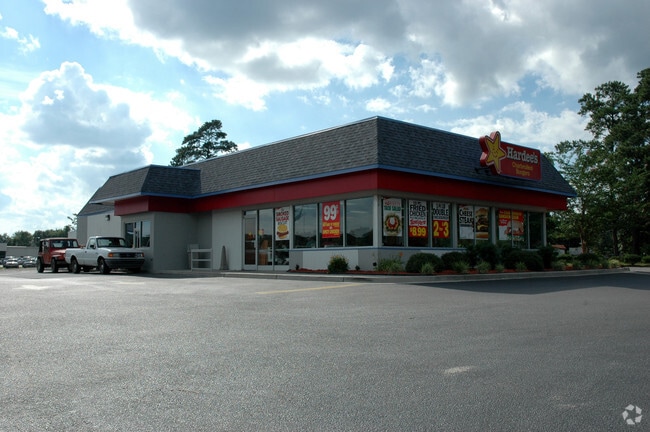
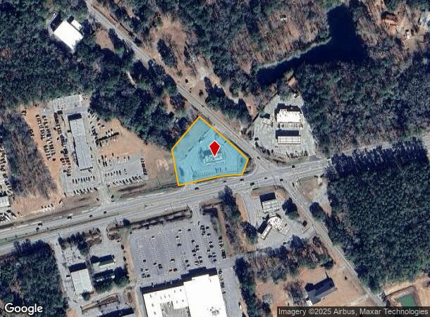
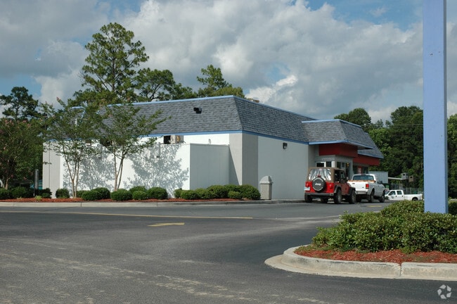
6320 Savannah Hwy
186-00-00-103
Tract B
Restaurantbuilding
DESCRIPTION -TRACT B
X
Charleston
45019C0465K
South Carolina
2025
1.52 AC
2024
W Charleston County
002504
Charleston/N Charleston
3,070 SF
Charleston-North Charleston, SC
DEMOGRAPHICS near 6320 Savannah Hwy
1 Mile
3 Mile
5 Mile
2024 Total Population
871
3,031
7,384
2029 Population
917
3,217
7,894
Pop Growth 2024-2029
+ 5.28%
+ 6.14%
+ 6.91%
Average Age
43
43
44
2024 Total Households
328
1,156
2,874
HH Growth 2024-2029
+ 5.18%
+ 5.97%
+ 6.75%
Median Household Inc
$63,495
$61,660
$61,728
Avg Household Size
2.60
2.50
2.50
2024 Avg HH Vehicles
2.00
2.00
2.00
Median Home Value
$248,598
$264,160
$288,675
Median Year Built
1984
1989
1990
Nearby Places
Map Layers
Map Styles
 Street
 Aerial
- Restaurants
- Banks
- Shops
- Fitness
- Groceries
PUBLIC TRANSPORTATION
AIRPORT
Charleston AFB/International
DRIVE
WALK
Distance
Charleston AFB/International
36 min
23.7 mi
Freight Ports
North Charleston Terminal
DRIVE
WALK
Distance
North Charleston Terminal
35 min
23.1 mi
Nearby Properties
Address
Land Use
TOTAL SIZE
Lot Size
Zoning
Address
Land Use
TOTAL SIZE
Lot Size
Zoning
35.77 AC
EE
Address
Land Use
TOTAL SIZE
Lot Size
Zoning
362.58 AC
Address
Land Use
TOTAL SIZE
Lot Size
Zoning
10.08 AC
EE
Address
Land Use
TOTAL SIZE
Lot Size
Zoning
58.85 AC
Address
Land Use
TOTAL SIZE
Lot Size
Zoning
Address
Land Use
TOTAL SIZE
Lot Size
Zoning
33,428 SF
6.87 AC
Address
Land Use
TOTAL SIZE
Lot Size
Zoning
5,972 SF
1.90 AC
Address
Land Use
TOTAL SIZE
Lot Size
Zoning
8.30 AC
Address
Land Use
TOTAL SIZE
Lot Size
Zoning
7,099 SF
9.89 AC
Address
Land Use
TOTAL SIZE
Lot Size
Zoning
23.02 AC
Address
Land Use
TOTAL SIZE
Lot Size
Zoning
5,400 SF
4.30 AC
Address
Land Use
TOTAL SIZE
Lot Size
Zoning
Address
Land Use
TOTAL SIZE
Lot Size
Zoning
2,482 SF
2.13 AC
Address
Land Use
TOTAL SIZE
Lot Size
Zoning
1,008 SF
4.95 AC
Address
Land Use
TOTAL SIZE
Lot Size
Zoning
2,553 SF
2.44 AC
Address
Land Use
TOTAL SIZE
Lot Size
Zoning
101 AC
Address
Land Use
TOTAL SIZE
Lot Size
Zoning
4.73 AC
Address
Land Use
TOTAL SIZE
Lot Size
Zoning
8,424 SF
0.99 AC
Address
Land Use
TOTAL SIZE
Lot Size
Zoning
8,897 SF
1.39 AC
Address
Land Use
TOTAL SIZE
Lot Size
Zoning
1,571 SF
2.55 AC
Address
Land Use
TOTAL SIZE
Lot Size
Zoning
Address
Land Use
TOTAL SIZE
Lot Size
Zoning
10.80 AC
Address
Land Use
TOTAL SIZE
Lot Size
Zoning
12.50 AC
Address
Land Use
TOTAL SIZE
Lot Size
Zoning
3,673 SF
3.50 AC
Address
Land Use
TOTAL SIZE
Lot Size
Zoning
9,012 SF
1.03 AC
Address
Land Use
TOTAL SIZE
Lot Size
Zoning
576 SF
2 AC
Address
Land Use
TOTAL SIZE
Lot Size
Zoning
6,700 SF
1 AC
Address
Land Use
TOTAL SIZE
Lot Size
Zoning
1,200 SF
1.03 AC
Address
Land Use
TOTAL SIZE
Lot Size
Zoning
Address
Land Use
TOTAL SIZE
Lot Size
Zoning
2,478 SF
5.66 AC
The World's #1 Commercial Real Estate Marketplace
Connect with us
© 2026 CoStar Group
The information above has been obtained from sources believed reliable. While we do not doubt its accuracy we have not verified it and make no guarantee, warranty or representation about it. It is your responsibility to independently confirm its accuracy and completeness. Any projections, opinions, assumptions, or estimates used are for example only and do not represent the current or future performance of the property. The value of this transaction to you depends on tax and other factors which should be evaluated by your tax, financial, and legal advisors. You and your advisors should conduct a careful, independent investigation of the property to determine to your satisfaction the suitability of the property for your needs.