Property Record
6321 E Farm Road 104, Strafford, MO 65757


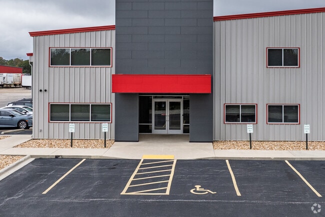
Property Detail
6321 E Farm Road 104
Springfield, MO
14.7A M/L E 221 FT W1/2 LOT 5 NE1/4 & W 420 FT M/L E1/2 LOT 5 NE1/4 6/29/20(EX HWY & RDS) & (EX N 140 FT M/L)
11-06-100-046
GREENE
Commercialnec
Missouri
M-1
5
B and X Area of moderate flood hazard, usually the area between the limits of the 100-year and 500-year floods.
14.70 AC
2025
Outlying Greene County
2025
Springfield
004601
NEARBY LISTINGS FOR SALE OR LEASE
DEMOGRAPHICS near 6321 E Farm Road 104
1 mile
3 mile
5 mile
2025 Total Population
173
5,215
13,861
2030 Population
179
5,421
14,393
Pop Growth 2025-2030
+ 3.47%
+ 3.95%
+ 3.84%
Average Age
40
40
42
2025 Total Households
71
2,022
5,693
HH Growth 2025-2030
+ 4.23%
+ 4.10%
+ 4.02%
Median Household Inc
$64,687
$78,928
$85,207
Avg Household Size
2.40
2.50
2.40
2025 Avg HH Vehicles
2.00
2.00
2.00
Median Home Value
$204,545
$266,190
$322,858
Median Year Built
1988
1991
1994
Nearby Places
Map Layers
Map Styles
 Street
 Aerial
Layers
 Traffic
 Biking
Places
Listings with unknown addresses are not visible on the map
- Restaurants
- Banks
- Shops
- Fitness
- Groceries
PUBLIC TRANSPORTATION
AIRPORT
Springfield-Branson Ntl
Drive
Walk
Distance
Springfield-Branson Ntl
31 min
17.3 mi
Freight Ports
Tulsa Port of Inola
Drive
Walk
Distance
Tulsa Port of Inola
204 min
179.7 mi
Nearby Properties
Address
Land Use
TOTAL SIZE
Lot Size
Zoning
Address
Land Use
TOTAL SIZE
Lot Size
Zoning
68.92 AC
INC
Address
Land Use
TOTAL SIZE
Lot Size
Zoning
617,990 SF
49.88 AC
INC
Address
Land Use
TOTAL SIZE
Lot Size
Zoning
20.01 AC
Address
Land Use
TOTAL SIZE
Lot Size
Zoning
37.01 AC
INC
Address
Land Use
TOTAL SIZE
Lot Size
Zoning
9.17 AC
INC.
Address
Land Use
TOTAL SIZE
Lot Size
Zoning
110,347 SF
14.58 AC
INC
Address
Land Use
TOTAL SIZE
Lot Size
Zoning
8.66 AC
INC
Address
Land Use
TOTAL SIZE
Lot Size
Zoning
31.56 AC
INC
Address
Land Use
TOTAL SIZE
Lot Size
Zoning
16.03 AC
INC
Address
Land Use
TOTAL SIZE
Lot Size
Zoning
11.68 AC
INC
Address
Land Use
TOTAL SIZE
Lot Size
Zoning
491,910 SF
49.03 AC
INC
Address
Land Use
TOTAL SIZE
Lot Size
Zoning
10.11 AC
INC
Address
Land Use
TOTAL SIZE
Lot Size
Zoning
54,952 SF
9.29 AC
INC
Address
Land Use
TOTAL SIZE
Lot Size
Zoning
4.75 AC
INC
Address
Land Use
TOTAL SIZE
Lot Size
Zoning
129,666 SF
13.73 AC
INC
Address
Land Use
TOTAL SIZE
Lot Size
Zoning
67,502 SF
7.70 AC
INC
Address
Land Use
TOTAL SIZE
Lot Size
Zoning
102,824 SF
7.46 AC
M-1
Address
Land Use
TOTAL SIZE
Lot Size
Zoning
84,784 SF
9.02 AC
INC
Address
Land Use
TOTAL SIZE
Lot Size
Zoning
10.07 AC
INC.
Address
Land Use
TOTAL SIZE
Lot Size
Zoning
75,471 SF
22.31 AC
INC
Address
Land Use
TOTAL SIZE
Lot Size
Zoning
92,899 SF
33.70 AC
M-1
Address
Land Use
TOTAL SIZE
Lot Size
Zoning
17.48 AC
INC
Address
Land Use
TOTAL SIZE
Lot Size
Zoning
Address
Land Use
TOTAL SIZE
Lot Size
Zoning
43,584 SF
15.37 AC
INC
Address
Land Use
TOTAL SIZE
Lot Size
Zoning
10 AC
INC.
Address
Land Use
TOTAL SIZE
Lot Size
Zoning
5.22 AC
INC
Address
Land Use
TOTAL SIZE
Lot Size
Zoning
61,640 SF
34.65 AC
INC
Address
Land Use
TOTAL SIZE
Lot Size
Zoning
Address
Land Use
TOTAL SIZE
Lot Size
Zoning
5.22 AC
INC
The World's #1 Commercial Real Estate Marketplace
Connect with us
© 2026 CoStar Group
The information above has been obtained from sources believed reliable. While we do not doubt its accuracy we have not verified it and make no guarantee, warranty or representation about it. It is your responsibility to independently confirm its accuracy and completeness. Any projections, opinions, assumptions, or estimates used are for example only and do not represent the current or future performance of the property. The value of this transaction to you depends on tax and other factors which should be evaluated by your tax, financial, and legal advisors. You and your advisors should conduct a careful, independent investigation of the property to determine to your satisfaction the suitability of the property for your needs.