Property Record
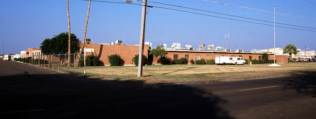
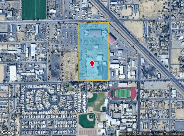
6322 W Myrtle Ave, Glendale, AZ 85301
NEARBY LISTINGS FOR SALE OR LEASE
Property Detail
6322 W Myrtle Ave
Phoenix-Mesa-Chandler, AZ
Hadsells Addition
143-35-001B
HADSELLS ADDITION MCR 2-10
Municipalproperty
Maricopa
X
Arizona
04013C1715L
19
0
18.96 AC
2025
Grand Avenue
092600
Phoenix
262,609 SF
DEMOGRAPHICS near 6322 W Myrtle Ave
1 mile
3 mile
5 mile
2024 Total Population
18,723
180,276
494,297
2029 Population
20,255
194,522
532,505
Pop Growth 2024-2029
+ 8.18%
+ 7.90%
+ 7.73%
Average Age
33
35
35
2024 Total Households
6,057
58,724
153,782
HH Growth 2024-2029
+ 8.29%
+ 7.99%
+ 7.95%
Median Household Inc
$45,133
$53,333
$57,233
Avg Household Size
3.00
2.90
3.00
2024 Avg HH Vehicles
2.00
2.00
2.00
Median Home Value
$224,436
$261,301
$261,559
Median Year Built
1977
1979
1978
Nearby Places
Map Layers
Map Styles
 Street
 Aerial
Transit
 Traffic
 Biking
Places
Listings with unknown addresses are not visible on the map
- Restaurants
- Banks
- Shops
- Fitness
- Groceries
PUBLIC TRANSPORTATION
AIRPORT
Phoenix Sky Harbor International
Drive
Walk
Distance
Phoenix Sky Harbor International
27 min
15.8 mi
Freight Ports
Port of San Diego
Drive
Walk
Distance
Port of San Diego
396 min
353.1 mi
Nearby Properties
Address
Land Use
TOTAL SIZE
Lot Size
Zoning
Address
Land Use
TOTAL SIZE
Lot Size
Zoning
15.17 AC
Address
Land Use
TOTAL SIZE
Lot Size
Zoning
Address
Land Use
TOTAL SIZE
Lot Size
Zoning
611,971 SF
36.16 AC
A1
Address
Land Use
TOTAL SIZE
Lot Size
Zoning
285,815 SF
37.17 AC
R-6
Address
Land Use
TOTAL SIZE
Lot Size
Zoning
926 SF
37.32 AC
I-1
Address
Land Use
TOTAL SIZE
Lot Size
Zoning
629,928 SF
41.37 AC
Address
Land Use
TOTAL SIZE
Lot Size
Zoning
307,822 SF
26.49 AC
PAD
Address
Land Use
TOTAL SIZE
Lot Size
Zoning
276,102 SF
39.72 AC
AG
Address
Land Use
TOTAL SIZE
Lot Size
Zoning
310,295 SF
9.32 AC
Address
Land Use
TOTAL SIZE
Lot Size
Zoning
325,529 SF
10.85 AC
PAD
Address
Land Use
TOTAL SIZE
Lot Size
Zoning
200,998 SF
0.06 AC
C-C
Address
Land Use
TOTAL SIZE
Lot Size
Zoning
187,309 SF
19.99 AC
R-6
Address
Land Use
TOTAL SIZE
Lot Size
Zoning
88,059 SF
78.03 AC
AG
Address
Land Use
TOTAL SIZE
Lot Size
Zoning
217,214 SF
27.12 AC
R-6
Address
Land Use
TOTAL SIZE
Lot Size
Zoning
131,380 SF
25.55 AC
R-6
Address
Land Use
TOTAL SIZE
Lot Size
Zoning
97,509 SF
10.74 AC
AG
Address
Land Use
TOTAL SIZE
Lot Size
Zoning
90,148 SF
6.13 AC
R-6
Address
Land Use
TOTAL SIZE
Lot Size
Zoning
206,709 SF
11.76 AC
Address
Land Use
TOTAL SIZE
Lot Size
Zoning
95,025 SF
13.59 AC
R1-6
Address
Land Use
TOTAL SIZE
Lot Size
Zoning
2.23 AC
Address
Land Use
TOTAL SIZE
Lot Size
Zoning
163,814 SF
15.31 AC
PAD
Address
Land Use
TOTAL SIZE
Lot Size
Zoning
287,199 SF
15.11 AC
M-H
Address
Land Use
TOTAL SIZE
Lot Size
Zoning
134,215 SF
17.75 AC
R-6
Address
Land Use
TOTAL SIZE
Lot Size
Zoning
Address
Land Use
TOTAL SIZE
Lot Size
Zoning
320,093 SF
14.56 AC
M-H
Address
Land Use
TOTAL SIZE
Lot Size
Zoning
94,663 SF
19.32 AC
R-6
Address
Land Use
TOTAL SIZE
Lot Size
Zoning
153,190 SF
24.67 AC
AG
Address
Land Use
TOTAL SIZE
Lot Size
Zoning
212,109 SF
20.14 AC
C-C
Address
Land Use
TOTAL SIZE
Lot Size
Zoning
150,096 SF
12.20 AC
The World's #1 Commercial Real Estate Marketplace
Connect with us
© 2026 CoStar Group
The information above has been obtained from sources believed reliable. While we do not doubt its accuracy we have not verified it and make no guarantee, warranty or representation about it. It is your responsibility to independently confirm its accuracy and completeness. Any projections, opinions, assumptions, or estimates used are for example only and do not represent the current or future performance of the property. The value of this transaction to you depends on tax and other factors which should be evaluated by your tax, financial, and legal advisors. You and your advisors should conduct a careful, independent investigation of the property to determine to your satisfaction the suitability of the property for your needs.