Property Record
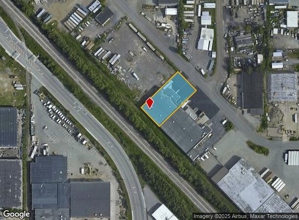
6324 Nielson Way, Anchorage, AK 99518

NEARBY LISTINGS FOR SALE OR LEASE
Property Detail
6324 Nielson Way
Anchorage, AK
Westgate Park
01201211000
WESTGATE PARK BLK 7 LT 17
Warehouse
Anchorage
X
Alaska
0200050742D
17
2024
0.46 AC
2025
W Tudor/Dimond-15
002501
Anchorage
12,040 SF
DEMOGRAPHICS near 6324 Nielson Way
1 Mile
3 Mile
5 Mile
2024 Total Population
7,569
101,710
180,947
2029 Population
7,419
100,118
178,254
Pop Growth 2024-2029
(1.98%)
(1.57%)
(1.49%)
Average Age
38
38
38
2024 Total Households
3,202
40,566
70,787
HH Growth 2024-2029
(2.00%)
(1.61%)
(1.52%)
Median Household Inc
$80,571
$84,441
$87,094
Avg Household Size
2.30
2.40
2.40
2024 Avg HH Vehicles
2.00
2.00
2.00
Median Home Value
$264,193
$318,190
$341,097
Median Year Built
1981
1981
1980
Nearby Places
Map Layers
Map Styles
 Street
 Aerial
- Restaurants
- Banks
- Shops
- Fitness
- Groceries
PUBLIC TRANSPORTATION
AIRPORT
Ted Stevens Anchorage International
DRIVE
WALK
Distance
Ted Stevens Anchorage International
9 min
4.5 mi
Merrill Field
DRIVE
WALK
Distance
Merrill Field
12 min
5.7 mi
Freight Ports
Port of Anchorage
DRIVE
WALK
Distance
Port of Anchorage
13 min
5.8 mi
Nearby Properties
Address
Land Use
TOTAL SIZE
Lot Size
Zoning
Address
Land Use
TOTAL SIZE
Lot Size
Zoning
658,690 SF
70.86 AC
PLI
Address
Land Use
TOTAL SIZE
Lot Size
Zoning
22,362 SF
71.05 AC
PLI
Address
Land Use
TOTAL SIZE
Lot Size
Zoning
171,692 SF
23.09 AC
I1
Address
Land Use
TOTAL SIZE
Lot Size
Zoning
117,702 SF
9.85 AC
B3SL
Address
Land Use
TOTAL SIZE
Lot Size
Zoning
134,626 SF
16.91 AC
PLI
Address
Land Use
TOTAL SIZE
Lot Size
Zoning
381,477 SF
33.30 AC
B3
Address
Land Use
TOTAL SIZE
Lot Size
Zoning
195,079 SF
44.79 AC
PLI
Address
Land Use
TOTAL SIZE
Lot Size
Zoning
267,442 SF
61.04 AC
PLI
Address
Land Use
TOTAL SIZE
Lot Size
Zoning
61,127 SF
3.04 AC
B3
Address
Land Use
TOTAL SIZE
Lot Size
Zoning
121,359 SF
4.35 AC
B3SL
Address
Land Use
TOTAL SIZE
Lot Size
Zoning
120,000 SF
9.09 AC
PLI
Address
Land Use
TOTAL SIZE
Lot Size
Zoning
124,058 SF
18.15 AC
B3
Address
Land Use
TOTAL SIZE
Lot Size
Zoning
56,747 SF
6.89 AC
B3SL
Address
Land Use
TOTAL SIZE
Lot Size
Zoning
66,354 SF
44.23 AC
I2
Address
Land Use
TOTAL SIZE
Lot Size
Zoning
242,189 SF
21.83 AC
I2
Address
Land Use
TOTAL SIZE
Lot Size
Zoning
168,640 SF
3.38 AC
I2
Address
Land Use
TOTAL SIZE
Lot Size
Zoning
84,157 SF
3.41 AC
B3
Address
Land Use
TOTAL SIZE
Lot Size
Zoning
69 AC
PR
Address
Land Use
TOTAL SIZE
Lot Size
Zoning
112,874 SF
6.61 AC
ROSL
Address
Land Use
TOTAL SIZE
Lot Size
Zoning
217,754 SF
14.42 AC
I1
Address
Land Use
TOTAL SIZE
Lot Size
Zoning
171,800 SF
1.67 AC
B3
Address
Land Use
TOTAL SIZE
Lot Size
Zoning
19,638 SF
0.97 AC
B3
Address
Land Use
TOTAL SIZE
Lot Size
Zoning
79,766 SF
4.15 AC
B3
Address
Land Use
TOTAL SIZE
Lot Size
Zoning
17,045 SF
14.66 AC
PLI
Address
Land Use
TOTAL SIZE
Lot Size
Zoning
145,475 SF
18.05 AC
B3
Address
Land Use
TOTAL SIZE
Lot Size
Zoning
103,442 SF
3.50 AC
B3
Address
Land Use
TOTAL SIZE
Lot Size
Zoning
68,191 SF
5.39 AC
B3
Address
Land Use
TOTAL SIZE
Lot Size
Zoning
164,774 SF
29.26 AC
PLI
Address
Land Use
TOTAL SIZE
Lot Size
Zoning
56,520 SF
3.81 AC
B3
Address
Land Use
TOTAL SIZE
Lot Size
Zoning
31,780 SF
16.44 AC
R3
The World's #1 Commercial Real Estate Marketplace
Connect with us
© 2025 CoStar Group
The information above has been obtained from sources believed reliable. While we do not doubt its accuracy we have not verified it and make no guarantee, warranty or representation about it. It is your responsibility to independently confirm its accuracy and completeness. Any projections, opinions, assumptions, or estimates used are for example only and do not represent the current or future performance of the property. The value of this transaction to you depends on tax and other factors which should be evaluated by your tax, financial, and legal advisors. You and your advisors should conduct a careful, independent investigation of the property to determine to your satisfaction the suitability of the property for your needs.