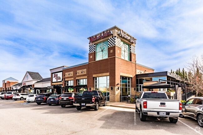
Property Record
6325 Lewis Dr, Kansas City, MO 64152


NEARBY LISTINGS FOR SALE OR LEASE
Property Detail
6325 Lewis Dr
Kansas City, MO-KS
Parkville Commons 6Th
20-70-26-100-002-044-000
PARKVILLE COMMONS 6TH REPLAT OF LOTS 5 & 6 LOT 5A
Regionalshoppingcenterormallwithanchorstore
Platte
X
Missouri
29095C0108G
5a
2024
1.77 AC
2025
I-29 Corridor
030309
Kansas City
32,283 SF
DEMOGRAPHICS near 6325 Lewis Dr
1 Mile
3 Mile
5 Mile
2024 Total Population
5,075
43,752
99,339
2029 Population
5,608
47,851
107,572
Pop Growth 2024-2029
+ 10.50%
+ 9.37%
+ 8.29%
Average Age
40
40
39
2024 Total Households
1,975
17,497
39,633
HH Growth 2024-2029
+ 10.84%
+ 9.56%
+ 8.47%
Median Household Inc
$90,113
$84,981
$79,226
Avg Household Size
2.40
2.40
2.40
2024 Avg HH Vehicles
2.00
2.00
2.00
Median Home Value
$356,435
$291,344
$276,475
Median Year Built
1985
1986
1987
Nearby Places
Map Layers
Map Styles
 Street
 Aerial
- Restaurants
- Banks
- Shops
- Fitness
- Groceries
PUBLIC TRANSPORTATION
AIRPORT
Kansas City International
DRIVE
WALK
Distance
Kansas City International
18 min
11.0 mi
SALE & LEASE HISTORY
LISTING DATE
SALE/LEASE

Sep 25, 2016
For Lease
Apr 05, 2019
For Lease
Nearby Properties
Address
Land Use
TOTAL SIZE
Lot Size
Zoning
Address
Land Use
TOTAL SIZE
Lot Size
Zoning
1,837,323 SF
62.61 AC
Address
Land Use
TOTAL SIZE
Lot Size
Zoning
404,594 SF
40.87 AC
Address
Land Use
TOTAL SIZE
Lot Size
Zoning
370,998 SF
34.29 AC
Address
Land Use
TOTAL SIZE
Lot Size
Zoning
315,970 SF
30.23 AC
Address
Land Use
TOTAL SIZE
Lot Size
Zoning
195,876 SF
14.62 AC
Address
Land Use
TOTAL SIZE
Lot Size
Zoning
437,830 SF
17.60 AC
Address
Land Use
TOTAL SIZE
Lot Size
Zoning
245,190 SF
25.40 AC
Address
Land Use
TOTAL SIZE
Lot Size
Zoning
448,340 SF
6.42 AC
Address
Land Use
TOTAL SIZE
Lot Size
Zoning
207,491 SF
616.94 AC
KR1
Address
Land Use
TOTAL SIZE
Lot Size
Zoning
251,983 SF
15.77 AC
Address
Land Use
TOTAL SIZE
Lot Size
Zoning
165,610 SF
18.07 AC
Address
Land Use
TOTAL SIZE
Lot Size
Zoning
329,938 SF
12.02 AC
Address
Land Use
TOTAL SIZE
Lot Size
Zoning
211,754 SF
16.89 AC
Address
Land Use
TOTAL SIZE
Lot Size
Zoning
Address
Land Use
TOTAL SIZE
Lot Size
Zoning
111,775 SF
5.97 AC
Address
Land Use
TOTAL SIZE
Lot Size
Zoning
95,542 SF
3 AC
Address
Land Use
TOTAL SIZE
Lot Size
Zoning
153,055 SF
10.76 AC
Address
Land Use
TOTAL SIZE
Lot Size
Zoning
4,993 SF
11.02 AC
R2
Address
Land Use
TOTAL SIZE
Lot Size
Zoning
132,804 SF
8.17 AC
R4
Address
Land Use
TOTAL SIZE
Lot Size
Zoning
185,927 SF
5.91 AC
Address
Land Use
TOTAL SIZE
Lot Size
Zoning
48,952 SF
2.44 AC
Address
Land Use
TOTAL SIZE
Lot Size
Zoning
Address
Land Use
TOTAL SIZE
Lot Size
Zoning
88,200 SF
2.03 AC
Address
Land Use
TOTAL SIZE
Lot Size
Zoning
848,976 SF
5.68 AC
Address
Land Use
TOTAL SIZE
Lot Size
Zoning
62,503 SF
7.10 AC
Address
Land Use
TOTAL SIZE
Lot Size
Zoning
277,006 SF
54.64 AC
Address
Land Use
TOTAL SIZE
Lot Size
Zoning
57,962 SF
2.20 AC
B4P
Address
Land Use
TOTAL SIZE
Lot Size
Zoning
71,741 SF
7.15 AC
B4P
Address
Land Use
TOTAL SIZE
Lot Size
Zoning
100,840 SF
6.26 AC
Address
Land Use
TOTAL SIZE
Lot Size
Zoning
99,000 SF
0.73 AC
The World's #1 Commercial Real Estate Marketplace
Connect with us
© 2026 CoStar Group
The information above has been obtained from sources believed reliable. While we do not doubt its accuracy we have not verified it and make no guarantee, warranty or representation about it. It is your responsibility to independently confirm its accuracy and completeness. Any projections, opinions, assumptions, or estimates used are for example only and do not represent the current or future performance of the property. The value of this transaction to you depends on tax and other factors which should be evaluated by your tax, financial, and legal advisors. You and your advisors should conduct a careful, independent investigation of the property to determine to your satisfaction the suitability of the property for your needs.