Property Record
6325 N I 55 N, Jackson, MS 39213
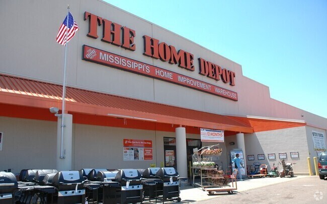

Property Detail
6325 N I 55 N
0710-0001-005
BEG 20 FT W NE COR BEVERLEY HGTS PT 1 WLY 1.78 FT NWLY 999.84 FT NLY 304.62 FT ELY 471.78 FT SLY 133.42 FT ELY 9 FT SLY 37.96 FT ELY 262 FT NLY 204.96 FT NELY 15.71 FT ELY 270.41 FT SELY 48.61 FT WLY 173.48 FT SLY 1032.94 FT TO POB IN W 1/2 NE 1/4 SE
Storebuilding
Hinds
AE The base floodplain where base flood elevations are provided. AE Zones are now used on new format FIRMs instead of A1-A30 Zones.
Mississippi
2024
544,499.54 AC
2025
North Jackson
010201
Jackson
103,700 SF
Jackson, MS
NEARBY LISTINGS FOR SALE OR LEASE
DEMOGRAPHICS near 6325 N I 55 N
1 mile
3 mile
5 mile
2025 Total Population
3,696
51,462
88,450
2030 Population
3,523
50,425
87,402
Pop Growth 2025-2030
(4.68%)
(2.02%)
(1.18%)
Average Age
35
39
40
2025 Total Households
1,576
22,329
38,298
HH Growth 2025-2030
(4.95%)
(2.05%)
(1.25%)
Median Household Inc
$48,214
$58,549
$59,303
Avg Household Size
2.30
2.20
2.20
2025 Avg HH Vehicles
2.00
2.00
2.00
Median Home Value
$138,024
$194,559
$230,466
Median Year Built
1976
1978
1978
Nearby Places
Map Layers
Map Styles
 Street
 Aerial
Layers
 Traffic
 Biking
Places
Listings with unknown addresses are not visible on the map
- Restaurants
- Banks
- Shops
- Fitness
- Groceries
PUBLIC TRANSPORTATION
COMMUTER RAIL
Drive
Walk
Distance
14 min
8.3 mi
AIRPORT
Jackson-Medgar Wiley Evers International
Drive
Walk
Distance
Jackson-Medgar Wiley Evers International
26 min
14.9 mi
Nearby Properties
Address
Land Use
TOTAL SIZE
Lot Size
Zoning
Address
Land Use
TOTAL SIZE
Lot Size
Zoning
8,901 SF
37.80 AC
Address
Land Use
TOTAL SIZE
Lot Size
Zoning
416,776 SF
18.77 AC
Address
Land Use
TOTAL SIZE
Lot Size
Zoning
297,150 SF
5.70 AC
Address
Land Use
TOTAL SIZE
Lot Size
Zoning
10,904 SF
8.50 AC
Address
Land Use
TOTAL SIZE
Lot Size
Zoning
2,261 SF
15 AC
Address
Land Use
TOTAL SIZE
Lot Size
Zoning
168,084 SF
29.59 AC
Address
Land Use
TOTAL SIZE
Lot Size
Zoning
105,600 SF
13 AC
Address
Land Use
TOTAL SIZE
Lot Size
Zoning
2,986 SF
20.40 AC
Address
Land Use
TOTAL SIZE
Lot Size
Zoning
186,992 SF
27.27 AC
Address
Land Use
TOTAL SIZE
Lot Size
Zoning
54,291 SF
6.99 AC
Address
Land Use
TOTAL SIZE
Lot Size
Zoning
49,949 SF
10 AC
Address
Land Use
TOTAL SIZE
Lot Size
Zoning
57,234 SF
Address
Land Use
TOTAL SIZE
Lot Size
Zoning
102,249 SF
14.38 AC
Address
Land Use
TOTAL SIZE
Lot Size
Zoning
10,866 SF
14.20 AC
Address
Land Use
TOTAL SIZE
Lot Size
Zoning
3,975 SF
6.38 AC
Address
Land Use
TOTAL SIZE
Lot Size
Zoning
10,620 SF
2.81 AC
Address
Land Use
TOTAL SIZE
Lot Size
Zoning
230,401 SF
643,381.54 AC
Address
Land Use
TOTAL SIZE
Lot Size
Zoning
156,184 SF
16.82 AC
Address
Land Use
TOTAL SIZE
Lot Size
Zoning
108,198 SF
15.40 AC
Address
Land Use
TOTAL SIZE
Lot Size
Zoning
310,650 SF
17 AC
Address
Land Use
TOTAL SIZE
Lot Size
Zoning
21,892 SF
9.52 AC
Address
Land Use
TOTAL SIZE
Lot Size
Zoning
6,536 SF
9.95 AC
Address
Land Use
TOTAL SIZE
Lot Size
Zoning
48,847 SF
20.70 AC
Address
Land Use
TOTAL SIZE
Lot Size
Zoning
3,369 SF
9 AC
Address
Land Use
TOTAL SIZE
Lot Size
Zoning
6,130 SF
16.93 AC
Address
Land Use
TOTAL SIZE
Lot Size
Zoning
10,310 SF
15 AC
Address
Land Use
TOTAL SIZE
Lot Size
Zoning
9,003 SF
1 AC
Address
Land Use
TOTAL SIZE
Lot Size
Zoning
3,139 SF
13.20 AC
Address
Land Use
TOTAL SIZE
Lot Size
Zoning
15,865 SF
11.83 AC
Address
Land Use
TOTAL SIZE
Lot Size
Zoning
81,911 SF
15.53 AC
The World's #1 Commercial Real Estate Marketplace
Connect with us
© 2026 CoStar Group
The information above has been obtained from sources believed reliable. While we do not doubt its accuracy we have not verified it and make no guarantee, warranty or representation about it. It is your responsibility to independently confirm its accuracy and completeness. Any projections, opinions, assumptions, or estimates used are for example only and do not represent the current or future performance of the property. The value of this transaction to you depends on tax and other factors which should be evaluated by your tax, financial, and legal advisors. You and your advisors should conduct a careful, independent investigation of the property to determine to your satisfaction the suitability of the property for your needs.