Property Record
6326 Maywick Dr, Madison, WI 53718
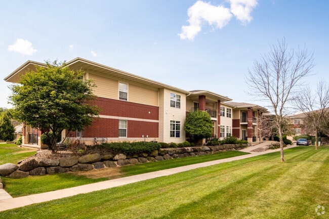

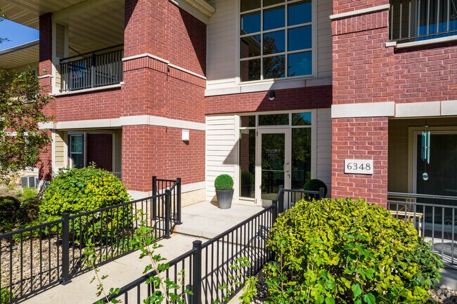

Property Detail
6326 Maywick Dr
0710-114-1804-5
MAYWICK ESTATES, LOT 4.
Commercialnec
DANE
SR-V2
Wisconsin
B and X Area of moderate flood hazard, usually the area between the limits of the 100-year and 500-year floods.
4
2025
2.19 AC
2025
East Madison
011407
Milwaukee/Madison
50,990 SF
Madison, WI
NEARBY LISTINGS FOR SALE OR LEASE
DEMOGRAPHICS near 6326 Maywick Dr
1 mile
3 mile
5 mile
2025 Total Population
8,213
38,986
99,531
2030 Population
8,589
40,307
103,366
Pop Growth 2025-2030
+ 4.58%
+ 3.39%
+ 3.85%
Average Age
41
41
40
2025 Total Households
3,744
16,900
44,808
HH Growth 2025-2030
+ 4.78%
+ 3.74%
+ 4.19%
Median Household Inc
$94,737
$88,139
$84,998
Avg Household Size
2.10
2.20
2.20
2025 Avg HH Vehicles
2.00
2.00
2.00
Median Home Value
$351,827
$335,309
$347,585
Median Year Built
2003
1983
1977
Nearby Places
Map Layers
Map Styles
 Street
 Aerial
Layers
 Traffic
 Biking
Places
Listings with unknown addresses are not visible on the map
- Restaurants
- Banks
- Shops
- Fitness
- Groceries
PUBLIC TRANSPORTATION
AIRPORT
Dane County Regional/Truax Field
Drive
Walk
Distance
Dane County Regional/Truax Field
14 min
8.3 mi
Freight Ports
Port Milwaukee
Drive
Walk
Distance
Port Milwaukee
89 min
74.2 mi
Nearby Properties
Address
Land Use
TOTAL SIZE
Lot Size
Zoning
Address
Land Use
TOTAL SIZE
Lot Size
Zoning
289,884 SF
19.36 AC
SR-V2
Address
Land Use
TOTAL SIZE
Lot Size
Zoning
168,685 SF
14.05 AC
IL
Address
Land Use
TOTAL SIZE
Lot Size
Zoning
266,955 SF
12.77 AC
PD
Address
Land Use
TOTAL SIZE
Lot Size
Zoning
286,104 SF
19.47 AC
SR-V2
Address
Land Use
TOTAL SIZE
Lot Size
Zoning
20,965 SF
10.98 AC
IL
Address
Land Use
TOTAL SIZE
Lot Size
Zoning
166,108 SF
2 AC
WP-25
Address
Land Use
TOTAL SIZE
Lot Size
Zoning
156,054 SF
9.40 AC
SE
Address
Land Use
TOTAL SIZE
Lot Size
Zoning
272,519 SF
16.40 AC
IL
Address
Land Use
TOTAL SIZE
Lot Size
Zoning
131,000 SF
4.51 AC
WP-25
Address
Land Use
TOTAL SIZE
Lot Size
Zoning
149,897 SF
17.72 AC
IL
Address
Land Use
TOTAL SIZE
Lot Size
Zoning
6,868 SF
18.35 AC
IL
Address
Land Use
TOTAL SIZE
Lot Size
Zoning
131,307 SF
1.21 AC
PD
Address
Land Use
TOTAL SIZE
Lot Size
Zoning
87,541 SF
1.85 AC
TR-U2
Address
Land Use
TOTAL SIZE
Lot Size
Zoning
163,540 SF
6.47 AC
PD
Address
Land Use
TOTAL SIZE
Lot Size
Zoning
140,832 SF
3.51 AC
WP-25
Address
Land Use
TOTAL SIZE
Lot Size
Zoning
115,724 SF
5.63 AC
SR-V2
Address
Land Use
TOTAL SIZE
Lot Size
Zoning
116,406 SF
4.01 AC
PD
Address
Land Use
TOTAL SIZE
Lot Size
Zoning
202,323 SF
10.45 AC
IL
Address
Land Use
TOTAL SIZE
Lot Size
Zoning
95,909 SF
1 AC
TE
Address
Land Use
TOTAL SIZE
Lot Size
Zoning
100,176 SF
5.15 AC
PD
Address
Land Use
TOTAL SIZE
Lot Size
Zoning
115,949 SF
2.91 AC
PD
Address
Land Use
TOTAL SIZE
Lot Size
Zoning
204,296 SF
14.35 AC
CC
Address
Land Use
TOTAL SIZE
Lot Size
Zoning
281,400 SF
15.01 AC
IL
Address
Land Use
TOTAL SIZE
Lot Size
Zoning
82,062 SF
2.38 AC
WP-25
Address
Land Use
TOTAL SIZE
Lot Size
Zoning
86,015 SF
3.03 AC
CC-T
Address
Land Use
TOTAL SIZE
Lot Size
Zoning
1.99 AC
Address
Land Use
TOTAL SIZE
Lot Size
Zoning
110,792 SF
5.25 AC
SR-V2
Address
Land Use
TOTAL SIZE
Lot Size
Zoning
106,792 SF
3.79 AC
SR-V2
Address
Land Use
TOTAL SIZE
Lot Size
Zoning
131,127 SF
6.11 AC
SR-V2
Address
Land Use
TOTAL SIZE
Lot Size
Zoning
115,215 SF
16.33 AC
CC-T
The World's #1 Commercial Real Estate Marketplace
Connect with us
© 2026 CoStar Group
The information above has been obtained from sources believed reliable. While we do not doubt its accuracy we have not verified it and make no guarantee, warranty or representation about it. It is your responsibility to independently confirm its accuracy and completeness. Any projections, opinions, assumptions, or estimates used are for example only and do not represent the current or future performance of the property. The value of this transaction to you depends on tax and other factors which should be evaluated by your tax, financial, and legal advisors. You and your advisors should conduct a careful, independent investigation of the property to determine to your satisfaction the suitability of the property for your needs.