Property Record
6329 Pheasant Ln, Middleton, WI 53562

NEARBY LISTINGS FOR SALE OR LEASE
Property Detail
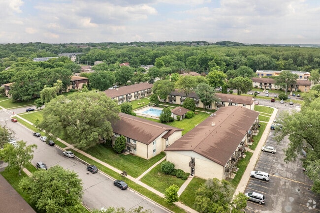
6329 Pheasant Ln
Madison, WI
Pheasant Hills/2Nd Add
0708-121-8790-3
SEC 12-7-8 PRT NW1/4NE1/4 COM SEC N1/4 COR TH S1DEG52'14W 152.09 FT TH N89DEG32 '4E 351.1 FT ALG CENTURY AVE S LN TO POB TH CONT N89DEG32'4E 411.21 FT TH S0DE G16'27W 200.01 FT TH S89DEG32'4W 417.27 FT TH N2DEG34E 200.17 FT TO POB (82, 845 SQ FT) SUB
Commercialnec
Dane
X
Wisconsin
55025C0401G
48
2024
7.49 AC
2024
Amherst
011101
Milwaukee/Madison
DEMOGRAPHICS near 6329 Pheasant Ln
1 mile
3 mile
5 mile
2024 Total Population
9,429
54,810
130,802
2029 Population
9,766
57,075
135,496
Pop Growth 2024-2029
+ 3.57%
+ 4.13%
+ 3.59%
Average Age
42
42
38
2024 Total Households
4,320
25,534
55,965
HH Growth 2024-2029
+ 3.63%
+ 4.21%
+ 3.87%
Median Household Inc
$76,859
$81,530
$82,056
Avg Household Size
2.10
2.10
2.10
2024 Avg HH Vehicles
2.00
2.00
2.00
Median Home Value
$445,647
$422,272
$414,074
Median Year Built
1979
1981
1981
Nearby Places
Map Layers
Map Styles
 Street
 Aerial
Transit
 Traffic
 Biking
Places
Listings with unknown addresses are not visible on the map
- Restaurants
- Banks
- Shops
- Fitness
- Groceries
PUBLIC TRANSPORTATION
AIRPORT
Dane County Regional/Truax Field
Drive
Walk
Distance
Dane County Regional/Truax Field
20 min
11.0 mi
Freight Ports
Port Milwaukee
Drive
Walk
Distance
Port Milwaukee
110 min
88.0 mi
Nearby Properties
Address
Land Use
TOTAL SIZE
Lot Size
Zoning
Address
Land Use
TOTAL SIZE
Lot Size
Zoning
69,336 SF
26.90 AC
SE
Address
Land Use
TOTAL SIZE
Lot Size
Zoning
226,593 SF
28.49 AC
PD
Address
Land Use
TOTAL SIZE
Lot Size
Zoning
291,526 SF
2.89 AC
PD
Address
Land Use
TOTAL SIZE
Lot Size
Zoning
15.61 AC
Address
Land Use
TOTAL SIZE
Lot Size
Zoning
700,496 SF
23.94 AC
SR-V2
Address
Land Use
TOTAL SIZE
Lot Size
Zoning
37,909 SF
10.27 AC
SEC
Address
Land Use
TOTAL SIZE
Lot Size
Zoning
203,672 SF
7.34 AC
PD
Address
Land Use
TOTAL SIZE
Lot Size
Zoning
349,680 SF
6.28 AC
TR-U2
Address
Land Use
TOTAL SIZE
Lot Size
Zoning
420,780 SF
10.14 AC
PD
Address
Land Use
TOTAL SIZE
Lot Size
Zoning
8.48 AC
Address
Land Use
TOTAL SIZE
Lot Size
Zoning
1.44 AC
TE
Address
Land Use
TOTAL SIZE
Lot Size
Zoning
169,563 SF
19.82 AC
SEC
Address
Land Use
TOTAL SIZE
Lot Size
Zoning
467,400 SF
6.17 AC
TR-U2
Address
Land Use
TOTAL SIZE
Lot Size
Zoning
10.12 AC
Address
Land Use
TOTAL SIZE
Lot Size
Zoning
5.95 AC
Address
Land Use
TOTAL SIZE
Lot Size
Zoning
11.09 AC
Address
Land Use
TOTAL SIZE
Lot Size
Zoning
2.91 AC
SE
Address
Land Use
TOTAL SIZE
Lot Size
Zoning
159,686 SF
7.39 AC
SEC
Address
Land Use
TOTAL SIZE
Lot Size
Zoning
Address
Land Use
TOTAL SIZE
Lot Size
Zoning
4.37 AC
Address
Land Use
TOTAL SIZE
Lot Size
Zoning
Address
Land Use
TOTAL SIZE
Lot Size
Zoning
37,909 SF
10.27 AC
SEC
Address
Land Use
TOTAL SIZE
Lot Size
Zoning
Address
Land Use
TOTAL SIZE
Lot Size
Zoning
10.01 AC
Address
Land Use
TOTAL SIZE
Lot Size
Zoning
11,752 SF
0.58 AC
PD
Address
Land Use
TOTAL SIZE
Lot Size
Zoning
264,603 SF
10.32 AC
PD
Address
Land Use
TOTAL SIZE
Lot Size
Zoning
222,406 SF
0.01 AC
PD
Address
Land Use
TOTAL SIZE
Lot Size
Zoning
168,870 SF
2.89 AC
PD
Address
Land Use
TOTAL SIZE
Lot Size
Zoning
142,082 SF
228.01 AC
PD
Address
Land Use
TOTAL SIZE
Lot Size
Zoning
40.70 AC
The World's #1 Commercial Real Estate Marketplace
Connect with us
© 2026 CoStar Group
The information above has been obtained from sources believed reliable. While we do not doubt its accuracy we have not verified it and make no guarantee, warranty or representation about it. It is your responsibility to independently confirm its accuracy and completeness. Any projections, opinions, assumptions, or estimates used are for example only and do not represent the current or future performance of the property. The value of this transaction to you depends on tax and other factors which should be evaluated by your tax, financial, and legal advisors. You and your advisors should conduct a careful, independent investigation of the property to determine to your satisfaction the suitability of the property for your needs.