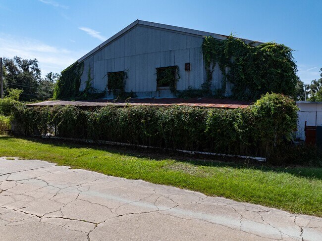
Property Record
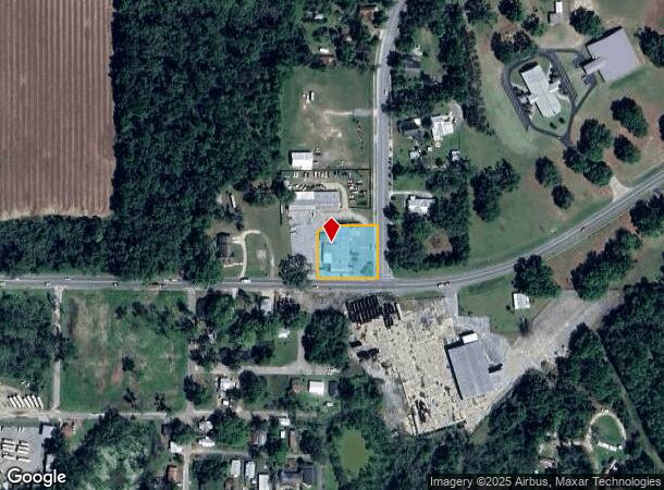
633 Ne Colin Kelly Hwy, Madison, FL 32340
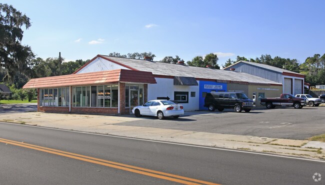
This Property Is For Sale
NEARBY LISTINGS FOR SALE OR LEASE
Property Detail
633 Ne Colin Kelly Hwy
Vehiclerentalsvehiclesales
BEG AT INTERSECTION OF THE W ROW OF CR 591, WITH THE N ROW OF SR 145 IN THE SW4 OF THE NE4 BEING POB RUN W188' N144' E35' E154' S160' TO POB OR 281/78 OR 848/275 OR 1457/97
X
Madison
12079C0285D
Florida
2024
0.68 AC
2024
Florida Panhandle Area
110301
Other Market Areas
9,444 SF
22-1N-09-3988-001-001
DEMOGRAPHICS near 633 Ne Colin Kelly Hwy
1 Mile
3 Mile
5 Mile
2024 Total Population
2,339
7,487
8,797
2029 Population
2,390
7,613
8,932
Pop Growth 2024-2029
+ 2.18%
+ 1.68%
+ 1.53%
Average Age
43
42
43
2024 Total Households
980
2,668
3,158
HH Growth 2024-2029
+ 2.04%
+ 2.10%
+ 1.90%
Median Household Inc
$31,071
$31,443
$32,243
Avg Household Size
2.30
2.30
2.30
2024 Avg HH Vehicles
2.00
2.00
2.00
Median Home Value
$92,082
$94,232
$99,036
Median Year Built
1972
1978
1980
Nearby Places
- Restaurants
- Banks
- Shops
- Fitness
- Groceries
PUBLIC TRANSPORTATION
AIRPORT
Valdosta Regional
DRIVE
WALK
Distance
Valdosta Regional
35 min
24.6 mi
Nearby Properties
Address
Land Use
TOTAL SIZE
Lot Size
Zoning
Address
Land Use
TOTAL SIZE
Lot Size
Zoning
212,291 SF
59.16 AC
Address
Land Use
TOTAL SIZE
Lot Size
Zoning
228,223 SF
94.53 AC
INC
Address
Land Use
TOTAL SIZE
Lot Size
Zoning
78,953 SF
4.05 AC
INC
Address
Land Use
TOTAL SIZE
Lot Size
Zoning
136,374 SF
45.30 AC
PUB
Address
Land Use
TOTAL SIZE
Lot Size
Zoning
106,976 SF
8.92 AC
INC
Address
Land Use
TOTAL SIZE
Lot Size
Zoning
46,885 SF
4.84 AC
Address
Land Use
TOTAL SIZE
Lot Size
Zoning
40,872 SF
9.60 AC
Address
Land Use
TOTAL SIZE
Lot Size
Zoning
32,536 SF
2.03 AC
Address
Land Use
TOTAL SIZE
Lot Size
Zoning
27,283 SF
24.74 AC
Address
Land Use
TOTAL SIZE
Lot Size
Zoning
23,066 SF
5 AC
Address
Land Use
TOTAL SIZE
Lot Size
Zoning
57,806 SF
6.83 AC
INC
Address
Land Use
TOTAL SIZE
Lot Size
Zoning
13,486 SF
1.01 AC
INC
Address
Land Use
TOTAL SIZE
Lot Size
Zoning
238.82 AC
Address
Land Use
TOTAL SIZE
Lot Size
Zoning
11,432 SF
3.56 AC
Address
Land Use
TOTAL SIZE
Lot Size
Zoning
50,894 SF
5.74 AC
C5
Address
Land Use
TOTAL SIZE
Lot Size
Zoning
66,445 SF
7.05 AC
Address
Land Use
TOTAL SIZE
Lot Size
Zoning
73,847 SF
4.60 AC
Address
Land Use
TOTAL SIZE
Lot Size
Zoning
106,153 SF
10.22 AC
INC
Address
Land Use
TOTAL SIZE
Lot Size
Zoning
29,088 SF
0.68 AC
Address
Land Use
TOTAL SIZE
Lot Size
Zoning
10,918 SF
0.46 AC
Address
Land Use
TOTAL SIZE
Lot Size
Zoning
15,319 SF
6.50 AC
Address
Land Use
TOTAL SIZE
Lot Size
Zoning
30,868 SF
7.77 AC
INC
Address
Land Use
TOTAL SIZE
Lot Size
Zoning
22,384 SF
0.92 AC
Address
Land Use
TOTAL SIZE
Lot Size
Zoning
20,750 SF
7.38 AC
Address
Land Use
TOTAL SIZE
Lot Size
Zoning
27,467 SF
4.17 AC
C1
Address
Land Use
TOTAL SIZE
Lot Size
Zoning
11,055 SF
1.90 AC
INC
Address
Land Use
TOTAL SIZE
Lot Size
Zoning
10,484 SF
55.55 AC
INC
Address
Land Use
TOTAL SIZE
Lot Size
Zoning
24,061 SF
8.36 AC
Address
Land Use
TOTAL SIZE
Lot Size
Zoning
7,822 SF
20 AC
Address
Land Use
TOTAL SIZE
Lot Size
Zoning
10,390 SF
1.87 AC
The World's #1 Commercial Real Estate Marketplace
Connect with us
© 2025 CoStar Group
The information above has been obtained from sources believed reliable. While we do not doubt its accuracy we have not verified it and make no guarantee, warranty or representation about it. It is your responsibility to independently confirm its accuracy and completeness. Any projections, opinions, assumptions, or estimates used are for example only and do not represent the current or future performance of the property. The value of this transaction to you depends on tax and other factors which should be evaluated by your tax, financial, and legal advisors. You and your advisors should conduct a careful, independent investigation of the property to determine to your satisfaction the suitability of the property for your needs.