Property Record
6331 Roosevelt Blvd, Jacksonville, FL 32244


Save to a Folder
{{folder.Name}}
{{folder.ListingIds.length}} Properties
{{folder.ListingIds.length}} Property
Create a New Folder
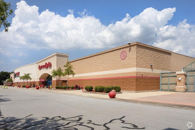
Property Detail
6331 Roosevelt Blvd
100552-0070
56-93 15-3S-26E 20.16 SOUTH ORTEGA MARKETPLACE PARCEL 5
Departmentstore
Duval
PUD
Florida
B and X Area of moderate flood hazard, usually the area between the limits of the 100-year and 500-year floods.
5
2025
20.16 AC
2026
Riverside
013100
Jacksonville (Florida)
187,612 SF
Jacksonville, FL
NEARBY LISTINGS FOR SALE OR LEASE
DEMOGRAPHICS near 6331 Roosevelt Blvd
1 mile
3 mile
5 mile
2025 Total Population
1,759
30,847
148,113
2030 Population
1,873
32,851
157,138
Pop Growth 2025-2030
+ 6.48%
+ 6.50%
+ 6.09%
Average Age
42
39
39
2025 Total Households
767
12,173
60,345
HH Growth 2025-2030
+ 6.91%
+ 6.88%
+ 6.41%
Median Household Inc
$87,045
$66,151
$65,792
Avg Household Size
2.20
2.40
2.40
2025 Avg HH Vehicles
2.00
2.00
2.00
Median Home Value
$317,460
$311,874
$292,792
Median Year Built
1965
1979
1976
Nearby Places
Map Layers
Map Styles
 Street
 Aerial
Layers
 Traffic
 Biking
Places
Listings with unknown addresses are not visible on the map
- Restaurants
- Banks
- Shops
- Fitness
- Groceries
PUBLIC TRANSPORTATION
AIRPORT
Jacksonville International
Drive
Walk
Distance
Jacksonville International
37 min
23.3 mi
Freight Ports
Jacksonville Port
Drive
Walk
Distance
Jacksonville Port
24 min
13.7 mi
Nearby Properties
Address
Land Use
TOTAL SIZE
Lot Size
Zoning
Address
Land Use
TOTAL SIZE
Lot Size
Zoning
810,000 SF
3,511.12 AC
PBF-1
Address
Land Use
TOTAL SIZE
Lot Size
Zoning
402,240 SF
20.66 AC
PUD
Address
Land Use
TOTAL SIZE
Lot Size
Zoning
188,666 SF
17.76 AC
PUD
Address
Land Use
TOTAL SIZE
Lot Size
Zoning
416,674 SF
18.38 AC
RMD-D
Address
Land Use
TOTAL SIZE
Lot Size
Zoning
203,724 SF
14.71 AC
RMD-D
Address
Land Use
TOTAL SIZE
Lot Size
Zoning
224,893 SF
13.51 AC
RMD-D
Address
Land Use
TOTAL SIZE
Lot Size
Zoning
309,137 SF
20.09 AC
RMD-D
Address
Land Use
TOTAL SIZE
Lot Size
Zoning
228,290 SF
12.65 AC
RMD-D
Address
Land Use
TOTAL SIZE
Lot Size
Zoning
96,314 SF
21.05 AC
CCG-1
Address
Land Use
TOTAL SIZE
Lot Size
Zoning
276,281 SF
11.72 AC
RMD-D
Address
Land Use
TOTAL SIZE
Lot Size
Zoning
152,768 SF
9.66 AC
RMD-D
Address
Land Use
TOTAL SIZE
Lot Size
Zoning
67,581 SF
24.24 AC
PUD
Address
Land Use
TOTAL SIZE
Lot Size
Zoning
159,337 SF
11.09 AC
RMD-D
Address
Land Use
TOTAL SIZE
Lot Size
Zoning
85,238 SF
3.90 AC
CCG-2
Address
Land Use
TOTAL SIZE
Lot Size
Zoning
59,810 SF
11.90 AC
CCG-2
Address
Land Use
TOTAL SIZE
Lot Size
Zoning
130,709 SF
10.65 AC
RMD-C
Address
Land Use
TOTAL SIZE
Lot Size
Zoning
107,045 SF
9 AC
RMD-D
Address
Land Use
TOTAL SIZE
Lot Size
Zoning
52,696 SF
10.11 AC
PUD
Address
Land Use
TOTAL SIZE
Lot Size
Zoning
75,850 SF
15 AC
PUD
Address
Land Use
TOTAL SIZE
Lot Size
Zoning
65,750 SF
11.52 AC
IL
Address
Land Use
TOTAL SIZE
Lot Size
Zoning
119,755 SF
14.77 AC
PUD
Address
Land Use
TOTAL SIZE
Lot Size
Zoning
95,720 SF
5.22 AC
PUD
Address
Land Use
TOTAL SIZE
Lot Size
Zoning
100,238 SF
9.68 AC
RMD-D
Address
Land Use
TOTAL SIZE
Lot Size
Zoning
104,400 SF
3.90 AC
CCG-2
Address
Land Use
TOTAL SIZE
Lot Size
Zoning
79,718 SF
286.79 AC
RLD-100A
Address
Land Use
TOTAL SIZE
Lot Size
Zoning
12.05 AC
RLD-90
Address
Land Use
TOTAL SIZE
Lot Size
Zoning
56,110 SF
9.51 AC
PUD
Address
Land Use
TOTAL SIZE
Lot Size
Zoning
167,047 SF
30.77 AC
PBF-1
Address
Land Use
TOTAL SIZE
Lot Size
Zoning
65,150 SF
2.94 AC
CCG-1
The World's #1 Commercial Real Estate Marketplace
Connect with us
© 2026 CoStar Group
The information above has been obtained from sources believed reliable. While we do not doubt its accuracy we have not verified it and make no guarantee, warranty or representation about it. It is your responsibility to independently confirm its accuracy and completeness. Any projections, opinions, assumptions, or estimates used are for example only and do not represent the current or future performance of the property. The value of this transaction to you depends on tax and other factors which should be evaluated by your tax, financial, and legal advisors. You and your advisors should conduct a careful, independent investigation of the property to determine to your satisfaction the suitability of the property for your needs.