Property Record
6334 Nesbitt Rd, Madison, WI 53719

Save to a Folder
{{folder.Name}}
{{folder.ListingIds.length}} Properties
{{folder.ListingIds.length}} Property
Create a New Folder
This Property Is For Sale
Property Detail
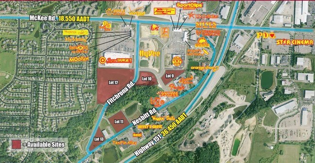
6334 Nesbitt Rd
Madison, WI
ORCHARD POINTE LOT 13 EXC TO CITY OF FITCHBURG FOR RD R/W IN DOC #5490136
0609-072-2013-2
DANE
Commercialnec
Wisconsin
B and X Area of moderate flood hazard, usually the area between the limits of the 100-year and 500-year floods.
13
2025
2 AC
2025
Southwest Madison
000409
Milwaukee/Madison
NEARBY LISTINGS FOR SALE OR LEASE
DEMOGRAPHICS near 6334 Nesbitt Rd
1 mile
3 mile
5 mile
2025 Total Population
8,786
62,262
138,447
2030 Population
9,138
64,528
144,164
Pop Growth 2025-2030
+ 4.01%
+ 3.64%
+ 4.13%
Average Age
38
39
39
2025 Total Households
3,704
26,072
61,333
HH Growth 2025-2030
+ 4.29%
+ 4.05%
+ 4.51%
Median Household Inc
$116,285
$97,064
$93,889
Avg Household Size
2.30
2.30
2.20
2025 Avg HH Vehicles
2.00
2.00
2.00
Median Home Value
$351,552
$380,088
$418,171
Median Year Built
1996
1990
1989
Nearby Places
Map Layers
Map Styles
 Street
 Aerial
Layers
 Traffic
 Biking
Places
Listings with unknown addresses are not visible on the map
- Restaurants
- Banks
- Shops
- Fitness
- Groceries
PUBLIC TRANSPORTATION
AIRPORT
Dane County Regional/Truax Field
Drive
Walk
Distance
Dane County Regional/Truax Field
27 min
12.5 mi
Freight Ports
Port Milwaukee
Drive
Walk
Distance
Port Milwaukee
108 min
89.2 mi
Nearby Properties
Address
Land Use
TOTAL SIZE
Lot Size
Zoning
Address
Land Use
TOTAL SIZE
Lot Size
Zoning
13.06 AC
Address
Land Use
TOTAL SIZE
Lot Size
Zoning
156,908 SF
23.87 AC
SE
Address
Land Use
TOTAL SIZE
Lot Size
Zoning
89.21 AC
Address
Land Use
TOTAL SIZE
Lot Size
Zoning
16.45 AC
Address
Land Use
TOTAL SIZE
Lot Size
Zoning
233,136 SF
4.84 AC
TR-U1
Address
Land Use
TOTAL SIZE
Lot Size
Zoning
11.20 AC
SE
Address
Land Use
TOTAL SIZE
Lot Size
Zoning
237,562 SF
4.59 AC
PD
Address
Land Use
TOTAL SIZE
Lot Size
Zoning
17.80 AC
Address
Land Use
TOTAL SIZE
Lot Size
Zoning
248,319 SF
8.47 AC
PD
Address
Land Use
TOTAL SIZE
Lot Size
Zoning
13.98 AC
Address
Land Use
TOTAL SIZE
Lot Size
Zoning
13.87 AC
Address
Land Use
TOTAL SIZE
Lot Size
Zoning
Address
Land Use
TOTAL SIZE
Lot Size
Zoning
187,535 SF
7.96 AC
SR-V2
Address
Land Use
TOTAL SIZE
Lot Size
Zoning
8.10 AC
Address
Land Use
TOTAL SIZE
Lot Size
Zoning
164,268 SF
14.37 AC
PD
Address
Land Use
TOTAL SIZE
Lot Size
Zoning
15.20 AC
Address
Land Use
TOTAL SIZE
Lot Size
Zoning
22.54 AC
Address
Land Use
TOTAL SIZE
Lot Size
Zoning
101,700 SF
6.76 AC
CC
Address
Land Use
TOTAL SIZE
Lot Size
Zoning
110,368 SF
3.45 AC
SR-V2
Address
Land Use
TOTAL SIZE
Lot Size
Zoning
182,932 SF
5.63 AC
PD
Address
Land Use
TOTAL SIZE
Lot Size
Zoning
4.64 AC
Address
Land Use
TOTAL SIZE
Lot Size
Zoning
317,584 SF
17.22 AC
CC
Address
Land Use
TOTAL SIZE
Lot Size
Zoning
92,627 SF
2.43 AC
SR-V2
Address
Land Use
TOTAL SIZE
Lot Size
Zoning
92,897 SF
1.21 AC
WP-12
Address
Land Use
TOTAL SIZE
Lot Size
Zoning
8.12 AC
Address
Land Use
TOTAL SIZE
Lot Size
Zoning
17.81 AC
Address
Land Use
TOTAL SIZE
Lot Size
Zoning
119,664 SF
9.21 AC
WP-12
Address
Land Use
TOTAL SIZE
Lot Size
Zoning
3.71 AC
Address
Land Use
TOTAL SIZE
Lot Size
Zoning
132,272 SF
7.88 AC
SR-V2
Address
Land Use
TOTAL SIZE
Lot Size
Zoning
111,743 SF
3.54 AC
PD
The World's #1 Commercial Real Estate Marketplace
Connect with us
© 2026 CoStar Group
The information above has been obtained from sources believed reliable. While we do not doubt its accuracy we have not verified it and make no guarantee, warranty or representation about it. It is your responsibility to independently confirm its accuracy and completeness. Any projections, opinions, assumptions, or estimates used are for example only and do not represent the current or future performance of the property. The value of this transaction to you depends on tax and other factors which should be evaluated by your tax, financial, and legal advisors. You and your advisors should conduct a careful, independent investigation of the property to determine to your satisfaction the suitability of the property for your needs.