Property Record
6335 Brevard Rd, Etowah, NC 28729
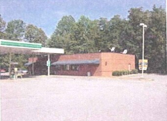

Property Detail
6335 Brevard Rd
0802931
SR1324 ON OLD MORGAN RD
Supermarket
HENDERSON
802931~CC
North Carolina
B and X Area of moderate flood hazard, usually the area between the limits of the 100-year and 500-year floods.
8219
2025
1.81 AC
2025
Henderson County
930703
Asheville
3,192 SF
Asheville, NC
NEARBY LISTINGS FOR SALE OR LEASE
-
-
View all Etowah listings for sale on LoopNet.com
DEMOGRAPHICS near 6335 Brevard Rd
1 mile
3 mile
5 mile
2025 Total Population
2,079
10,633
23,937
2030 Population
2,109
10,924
24,638
Pop Growth 2025-2030
+ 1.44%
+ 2.74%
+ 2.93%
Average Age
48
48
49
2025 Total Households
924
4,578
10,255
HH Growth 2025-2030
+ 1.62%
+ 2.88%
+ 3.08%
Median Household Inc
$66,000
$67,944
$73,639
Avg Household Size
2.20
2.30
2.30
2025 Avg HH Vehicles
2.00
2.00
2.00
Median Home Value
$343,203
$383,252
$429,006
Median Year Built
1994
1993
1990
Nearby Places
Map Layers
Map Styles
 Street
 Aerial
Layers
 Traffic
 Biking
Places
Listings with unknown addresses are not visible on the map
- Restaurants
- Banks
- Shops
- Fitness
- Groceries
PUBLIC TRANSPORTATION
AIRPORT
Asheville Regional
Drive
Walk
Distance
Asheville Regional
22 min
14.3 mi
Greenville Spartanburg International
Drive
Walk
Distance
Greenville Spartanburg International
77 min
48.4 mi
Nearby Properties
Address
Land Use
TOTAL SIZE
Lot Size
Zoning
Address
Land Use
TOTAL SIZE
Lot Size
Zoning
35.90 AC
10005135~R
Address
Land Use
TOTAL SIZE
Lot Size
Zoning
43,839 SF
10.87 AC
9933934~R1
Address
Land Use
TOTAL SIZE
Lot Size
Zoning
6,955 SF
173.84 AC
9963128~R1
Address
Land Use
TOTAL SIZE
Lot Size
Zoning
13,600 SF
4.43 AC
10012116~C
Address
Land Use
TOTAL SIZE
Lot Size
Zoning
40,940 SF
7.39 AC
9928960~CC
Address
Land Use
TOTAL SIZE
Lot Size
Zoning
4,250 SF
3.67 AC
10007980~C
Address
Land Use
TOTAL SIZE
Lot Size
Zoning
23,112 SF
9.55 AC
9902435~I
Address
Land Use
TOTAL SIZE
Lot Size
Zoning
44,884 SF
4.55 AC
1018998~CC
Address
Land Use
TOTAL SIZE
Lot Size
Zoning
4,281 SF
88.88 AC
1008348~R2
Address
Land Use
TOTAL SIZE
Lot Size
Zoning
16,620 SF
2.76 AC
9933590~R1
Address
Land Use
TOTAL SIZE
Lot Size
Zoning
22,068 SF
3.05 AC
1012993~CC
Address
Land Use
TOTAL SIZE
Lot Size
Zoning
8,048 SF
2.30 AC
1003374~CC
Address
Land Use
TOTAL SIZE
Lot Size
Zoning
15,008 SF
1.72 AC
9926305~R2
Address
Land Use
TOTAL SIZE
Lot Size
Zoning
56,440 SF
5.16 AC
401929~R2R
Address
Land Use
TOTAL SIZE
Lot Size
Zoning
10,126 SF
3.07 AC
9974230~CC
Address
Land Use
TOTAL SIZE
Lot Size
Zoning
18,212 SF
0.87 AC
9933816~LC
Address
Land Use
TOTAL SIZE
Lot Size
Zoning
2,334 SF
5.11 AC
9933856~R1
Address
Land Use
TOTAL SIZE
Lot Size
Zoning
1,200 SF
10.36 AC
9933823~I
Address
Land Use
TOTAL SIZE
Lot Size
Zoning
3,936 SF
2.46 AC
1008415~CC
Address
Land Use
TOTAL SIZE
Lot Size
Zoning
4,876 SF
1.88 AC
10008195~R
Address
Land Use
TOTAL SIZE
Lot Size
Zoning
19,880 SF
1.21 AC
10007979~C
Address
Land Use
TOTAL SIZE
Lot Size
Zoning
3,900 SF
5.93 AC
9905114~MR
Address
Land Use
TOTAL SIZE
Lot Size
Zoning
7,304 SF
1.90 AC
10007087~C
Address
Land Use
TOTAL SIZE
Lot Size
Zoning
52.30 AC
10013369~R
Address
Land Use
TOTAL SIZE
Lot Size
Zoning
4,536 SF
1.28 AC
802874~R1
Address
Land Use
TOTAL SIZE
Lot Size
Zoning
5,398 SF
8.46 AC
9974100~R2
Address
Land Use
TOTAL SIZE
Lot Size
Zoning
4,636 SF
1.53 AC
9961034~CC
Address
Land Use
TOTAL SIZE
Lot Size
Zoning
3,200 SF
4.03 AC
9902450~CC
Address
Land Use
TOTAL SIZE
Lot Size
Zoning
5,400 SF
0.95 AC
1008414~CC
The World's #1 Commercial Real Estate Marketplace
Connect with us
© 2026 CoStar Group
The information above has been obtained from sources believed reliable. While we do not doubt its accuracy we have not verified it and make no guarantee, warranty or representation about it. It is your responsibility to independently confirm its accuracy and completeness. Any projections, opinions, assumptions, or estimates used are for example only and do not represent the current or future performance of the property. The value of this transaction to you depends on tax and other factors which should be evaluated by your tax, financial, and legal advisors. You and your advisors should conduct a careful, independent investigation of the property to determine to your satisfaction the suitability of the property for your needs.