Property Record
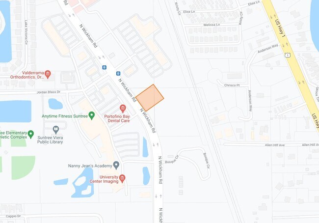
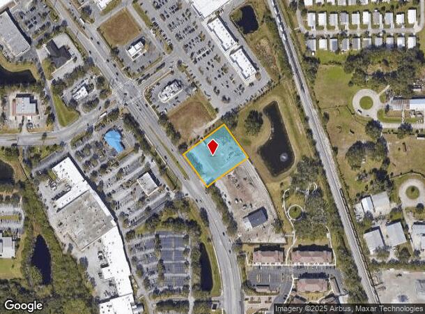
6335 N Wickham Rd, Melbourne, FL 32940
NEARBY LISTINGS FOR SALE OR LEASE
Property Detail
6335 N Wickham Rd
Palm Bay-Melbourne-Titusville, FL
Oakwood Landing Commercial
26-37-19-XN-0000A.0-0003.00
OAKWOOD LANDING COMMERCIAL LOT 3 BLK A
Carwash
Brevard
X
Florida
2024
3
2025
1.15 AC
064127
Brevard County
4,969 SF
Orlando
DEMOGRAPHICS near 6335 N Wickham Rd
1 Mile
3 Mile
5 Mile
2024 Total Population
4,066
32,764
92,658
2029 Population
4,567
35,660
101,741
Pop Growth 2024-2029
+ 12.32%
+ 8.84%
+ 9.80%
Average Age
54
47
46
2024 Total Households
1,914
13,761
39,515
HH Growth 2024-2029
+ 12.59%
+ 8.76%
+ 9.43%
Median Household Inc
$63,085
$95,675
$85,786
Avg Household Size
2.10
2.30
2.30
2024 Avg HH Vehicles
2.00
2.00
2.00
Median Home Value
$286,490
$351,795
$354,711
Median Year Built
1995
1995
1994
Nearby Places
Map Layers
Map Styles
 Street
 Aerial
- Restaurants
- Banks
- Shops
- Fitness
- Groceries
PUBLIC TRANSPORTATION
AIRPORT
Melbourne Orlando International
DRIVE
WALK
Distance
Melbourne Orlando International
23 min
11.0 mi
Freight Ports
Port Canaveral
DRIVE
WALK
Distance
Port Canaveral
35 min
22.8 mi
Nearby Properties
Address
Land Use
TOTAL SIZE
Lot Size
Zoning
Address
Land Use
TOTAL SIZE
Lot Size
Zoning
354,864 SF
26.76 AC
PIP
Address
Land Use
TOTAL SIZE
Lot Size
Zoning
406,986 SF
30.50 AC
PUD
Address
Land Use
TOTAL SIZE
Lot Size
Zoning
360,921 SF
85.76 AC
R2
Address
Land Use
TOTAL SIZE
Lot Size
Zoning
269,541 SF
17.80 AC
PUD
Address
Land Use
TOTAL SIZE
Lot Size
Zoning
134,562 SF
18.25 AC
BU1
Address
Land Use
TOTAL SIZE
Lot Size
Zoning
227,172 SF
26.78 AC
BU1
Address
Land Use
TOTAL SIZE
Lot Size
Zoning
113,498 SF
37.57 AC
PUD
Address
Land Use
TOTAL SIZE
Lot Size
Zoning
96,110 SF
49.65 AC
INH
Address
Land Use
TOTAL SIZE
Lot Size
Zoning
133,137 SF
10.59 AC
PUD
Address
Land Use
TOTAL SIZE
Lot Size
Zoning
102,972 SF
18 AC
R2(6)
Address
Land Use
TOTAL SIZE
Lot Size
Zoning
97,430 SF
51.89 AC
BU1
Address
Land Use
TOTAL SIZE
Lot Size
Zoning
170,721 SF
28.52 AC
PIP
Address
Land Use
TOTAL SIZE
Lot Size
Zoning
83,420 SF
5.94 AC
PUD
Address
Land Use
TOTAL SIZE
Lot Size
Zoning
91,470 SF
3.01 AC
BU1
Address
Land Use
TOTAL SIZE
Lot Size
Zoning
54,114 SF
11.48 AC
Address
Land Use
TOTAL SIZE
Lot Size
Zoning
120,600 SF
2.76 AC
Address
Land Use
TOTAL SIZE
Lot Size
Zoning
222,414 SF
13.13 AC
BU1
Address
Land Use
TOTAL SIZE
Lot Size
Zoning
82,494 SF
11.49 AC
BU1
Address
Land Use
TOTAL SIZE
Lot Size
Zoning
51,042 SF
1.70 AC
TU-2
Address
Land Use
TOTAL SIZE
Lot Size
Zoning
67,313 SF
335.11 AC
PUD
Address
Land Use
TOTAL SIZE
Lot Size
Zoning
79,972 SF
7.20 AC
TU-2
Address
Land Use
TOTAL SIZE
Lot Size
Zoning
168,229 SF
20.36 AC
BU1/BU2
Address
Land Use
TOTAL SIZE
Lot Size
Zoning
2.61 AC
PUD
Address
Land Use
TOTAL SIZE
Lot Size
Zoning
73,100 SF
5.67 AC
C2
Address
Land Use
TOTAL SIZE
Lot Size
Zoning
128,415 SF
9.98 AC
BU2
Address
Land Use
TOTAL SIZE
Lot Size
Zoning
1.10 AC
BU-1
Address
Land Use
TOTAL SIZE
Lot Size
Zoning
62,431 SF
16.51 AC
BU-1
Address
Land Use
TOTAL SIZE
Lot Size
Zoning
94,217 SF
9.74 AC
PUD
Address
Land Use
TOTAL SIZE
Lot Size
Zoning
40,907 SF
5.52 AC
BU-1
Address
Land Use
TOTAL SIZE
Lot Size
Zoning
20,050 SF
9.19 AC
SEU
The World's #1 Commercial Real Estate Marketplace
Connect with us
© 2025 CoStar Group
The information above has been obtained from sources believed reliable. While we do not doubt its accuracy we have not verified it and make no guarantee, warranty or representation about it. It is your responsibility to independently confirm its accuracy and completeness. Any projections, opinions, assumptions, or estimates used are for example only and do not represent the current or future performance of the property. The value of this transaction to you depends on tax and other factors which should be evaluated by your tax, financial, and legal advisors. You and your advisors should conduct a careful, independent investigation of the property to determine to your satisfaction the suitability of the property for your needs.