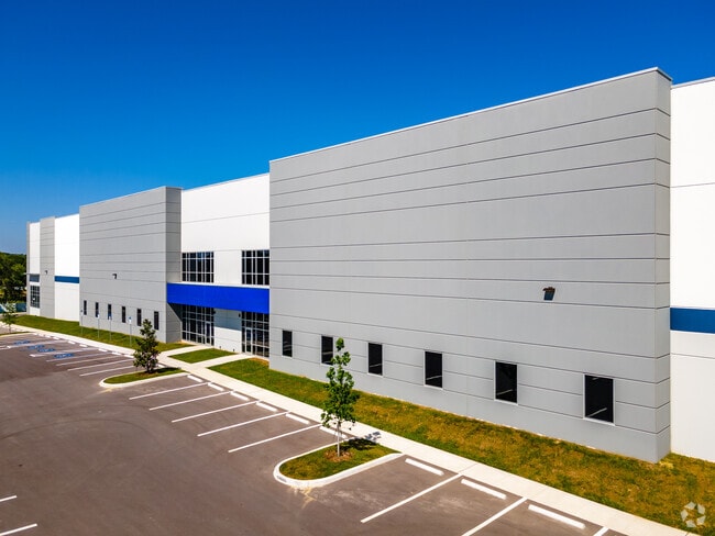
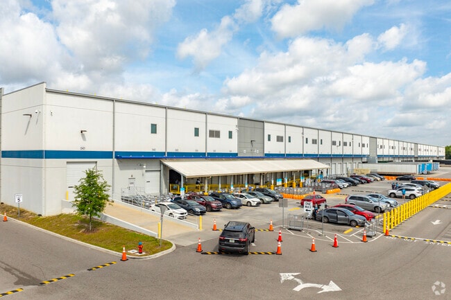
Property Record
6337 579 Hwy, Seffner, FL 33584


Current Lease Availabilities
Property Detail
6337 579 Hwy
U-27-28-20-ZZZ-000002-19850.0
COMM AT NW COR OF NW 1/4 OF SW 1/4 OF SEC 27 THN RUN N 89 DEG 57 MIN 20 SEC E 30 FT FOR A POB ST PT BEING ON ELY R/W LINE OF MANGO RD (CR 579) THN CONT N 89 DEG 57 MIN 20 SEC E 696.11 FT THN S 00 DEG 03 MIN 27 SEC E 661.16 FT THN S 89 DEG 58 MIN 17 S
Warehouse
HILLSBOROUGH
PD
Florida
B and X Area of moderate flood hazard, usually the area between the limits of the 100-year and 500-year floods.
19850
2024
19.37 AC
2025
E Hillsborough/Plant
012107
Tampa/St Petersburg
159,876 SF
Tampa-St. Petersburg-Clearwater, FL
NEARBY LISTINGS FOR SALE OR LEASE
DEMOGRAPHICS near 6337 579 Hwy
1 mile
3 mile
5 mile
2024 Total Population
1,370
39,740
119,033
2029 Population
1,490
43,070
127,970
Pop Growth 2024-2029
+ 8.76%
+ 8.38%
+ 7.51%
Average Age
41
39
39
2024 Total Households
466
14,373
43,171
HH Growth 2024-2029
+ 8.80%
+ 8.56%
+ 7.79%
Median Household Inc
$65,571
$65,507
$70,721
Avg Household Size
2.80
2.70
2.60
2024 Avg HH Vehicles
2.00
2.00
2.00
Median Home Value
$405,952
$334,287
$338,070
Median Year Built
1995
1990
1988
Nearby Places
Map Layers
Map Styles
 Street
 Aerial
Transit
 Traffic
 Biking
Places
Listings with unknown addresses are not visible on the map
- Restaurants
- Banks
- Shops
- Fitness
- Groceries
PUBLIC TRANSPORTATION
AIRPORT
Tampa International
Drive
Walk
Distance
Tampa International
29 min
19.5 mi
St Pete-Clearwater International
Drive
Walk
Distance
St Pete-Clearwater International
46 min
28.7 mi
Freight Ports
Port of Tampa Bay
Drive
Walk
Distance
Port of Tampa Bay
21 min
13.0 mi
Nearby Properties
Address
Land Use
TOTAL SIZE
Lot Size
Zoning
Address
Land Use
TOTAL SIZE
Lot Size
Zoning
472,855 SF
34.23 AC
PD
Address
Land Use
TOTAL SIZE
Lot Size
Zoning
466,038 SF
26.75 AC
PD
Address
Land Use
TOTAL SIZE
Lot Size
Zoning
491,498 SF
35.60 AC
PD
Address
Land Use
TOTAL SIZE
Lot Size
Zoning
333,142 SF
51.21 AC
AR
Address
Land Use
TOTAL SIZE
Lot Size
Zoning
425,350 SF
38.72 AC
PD
Address
Land Use
TOTAL SIZE
Lot Size
Zoning
635,413 SF
43.44 AC
PD
Address
Land Use
TOTAL SIZE
Lot Size
Zoning
174,144 SF
79.80 AC
PD
Address
Land Use
TOTAL SIZE
Lot Size
Zoning
165,277 SF
27.50 AC
AR
Address
Land Use
TOTAL SIZE
Lot Size
Zoning
236,297 SF
15.58 AC
PD
Address
Land Use
TOTAL SIZE
Lot Size
Zoning
292,586 SF
478.91 AC
SPI-AP-V
Address
Land Use
TOTAL SIZE
Lot Size
Zoning
129,696 SF
8.93 AC
PD
Address
Land Use
TOTAL SIZE
Lot Size
Zoning
213,686 SF
12.33 AC
PD
Address
Land Use
TOTAL SIZE
Lot Size
Zoning
128,267 SF
38.76 AC
PD
Address
Land Use
TOTAL SIZE
Lot Size
Zoning
94,653 SF
17.31 AC
PD
Address
Land Use
TOTAL SIZE
Lot Size
Zoning
87,856 SF
3.53 AC
PD
Address
Land Use
TOTAL SIZE
Lot Size
Zoning
92,715 SF
20.10 AC
PD
Address
Land Use
TOTAL SIZE
Lot Size
Zoning
95,520 SF
41.88 AC
PD
Address
Land Use
TOTAL SIZE
Lot Size
Zoning
81,002 SF
80.72 AC
PD
Address
Land Use
TOTAL SIZE
Lot Size
Zoning
277,763 SF
15.46 AC
PD
Address
Land Use
TOTAL SIZE
Lot Size
Zoning
97,416 SF
5.32 AC
PD
Address
Land Use
TOTAL SIZE
Lot Size
Zoning
55,594 SF
25.19 AC
AR
Address
Land Use
TOTAL SIZE
Lot Size
Zoning
113,729 SF
6.70 AC
PD
Address
Land Use
TOTAL SIZE
Lot Size
Zoning
101,071 SF
24.44 AC
PD
Address
Land Use
TOTAL SIZE
Lot Size
Zoning
90,979 SF
13.44 AC
RSC-6
Address
Land Use
TOTAL SIZE
Lot Size
Zoning
69,265 SF
6.44 AC
CG
Address
Land Use
TOTAL SIZE
Lot Size
Zoning
158,042 SF
16.44 AC
PD
Address
Land Use
TOTAL SIZE
Lot Size
Zoning
60,270 SF
25.43 AC
AR
Address
Land Use
TOTAL SIZE
Lot Size
Zoning
81,899 SF
12.11 AC
CG
Address
Land Use
TOTAL SIZE
Lot Size
Zoning
52,800 SF
5.05 AC
PD
The World's #1 Commercial Real Estate Marketplace
Connect with us
© 2026 CoStar Group
The information above has been obtained from sources believed reliable. While we do not doubt its accuracy we have not verified it and make no guarantee, warranty or representation about it. It is your responsibility to independently confirm its accuracy and completeness. Any projections, opinions, assumptions, or estimates used are for example only and do not represent the current or future performance of the property. The value of this transaction to you depends on tax and other factors which should be evaluated by your tax, financial, and legal advisors. You and your advisors should conduct a careful, independent investigation of the property to determine to your satisfaction the suitability of the property for your needs.