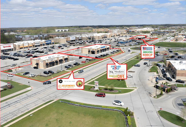
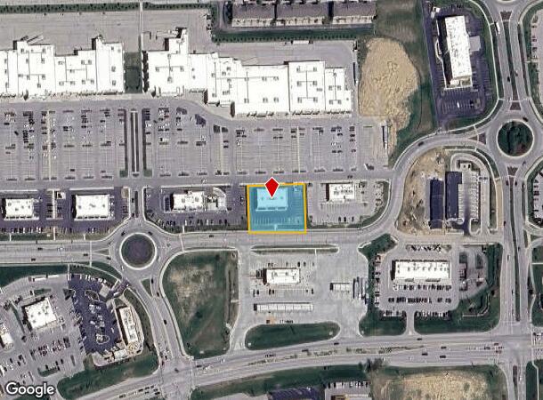
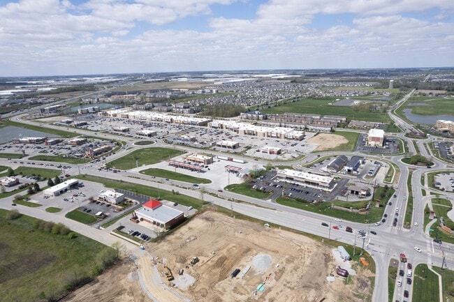
Property Record
6338 Mills Dr, Whitestown, IN 46075
Current Lease Availabilities
NEARBY LISTINGS FOR SALE OR LEASE
-
-
View all Whitestown listings for lease on LoopNet.com
Property Detail
6338 Mills Dr
06-04-06-000-032.004-021
RE-PLAT OF LOTS 5 & 6 IN BLOCK E-1 - ANSON DEVELOPMENT - PHASE 1 SOUTH LOT 6 0.70A
Storebuilding
Boone
X
Indiana
18011C0328E
5-6,6
2024
0.70 AC
2025
Boone County
810607
Indianapolis
6,000 SF
Indianapolis-Carmel-Anderson, IN
DEMOGRAPHICS near 6338 Mills Dr
1 Mile
3 Mile
5 Mile
2024 Total Population
6,456
20,987
43,387
2029 Population
7,230
23,748
48,493
Pop Growth 2024-2029
+ 11.99%
+ 13.16%
+ 11.77%
Average Age
34
35
38
2024 Total Households
2,336
7,381
15,538
HH Growth 2024-2029
+ 12.41%
+ 13.43%
+ 11.96%
Median Household Inc
$113,287
$118,061
$122,179
Avg Household Size
2.80
2.80
2.80
2024 Avg HH Vehicles
2.00
2.00
2.00
Median Home Value
$368,814
$348,928
$398,512
Median Year Built
2009
2010
2002
Nearby Places
- Restaurants
- Banks
- Shops
- Fitness
- Groceries
PUBLIC TRANSPORTATION
AIRPORT
Indianapolis International
DRIVE
WALK
Distance
Indianapolis International
40 min
23.7 mi
Nearby Properties
Address
Land Use
TOTAL SIZE
Lot Size
Zoning
Address
Land Use
TOTAL SIZE
Lot Size
Zoning
676 SF
69.72 AC
ZO01
Address
Land Use
TOTAL SIZE
Lot Size
Zoning
9,413 SF
27.40 AC
ZO01
Address
Land Use
TOTAL SIZE
Lot Size
Zoning
336 SF
52.76 AC
ZO01
Address
Land Use
TOTAL SIZE
Lot Size
Zoning
518 SF
95.61 AC
ZO01
Address
Land Use
TOTAL SIZE
Lot Size
Zoning
632,788 SF
59.27 AC
ZO01
Address
Land Use
TOTAL SIZE
Lot Size
Zoning
61.91 AC
ZO01
Address
Land Use
TOTAL SIZE
Lot Size
Zoning
44.11 AC
ZO01
Address
Land Use
TOTAL SIZE
Lot Size
Zoning
672,180 SF
32.90 AC
ZO01
Address
Land Use
TOTAL SIZE
Lot Size
Zoning
736,560 SF
54.22 AC
ZO01
Address
Land Use
TOTAL SIZE
Lot Size
Zoning
169,272 SF
23.93 AC
ZO01
Address
Land Use
TOTAL SIZE
Lot Size
Zoning
705,024 SF
39.27 AC
ZO01
Address
Land Use
TOTAL SIZE
Lot Size
Zoning
27,177 SF
12.23 AC
ZO01
Address
Land Use
TOTAL SIZE
Lot Size
Zoning
5,668 SF
19 AC
ZO01
Address
Land Use
TOTAL SIZE
Lot Size
Zoning
400,145 SF
31.94 AC
ZO01
Address
Land Use
TOTAL SIZE
Lot Size
Zoning
628,206 SF
31.89 AC
ZO01
Address
Land Use
TOTAL SIZE
Lot Size
Zoning
529,200 SF
19.46 AC
ZO01
Address
Land Use
TOTAL SIZE
Lot Size
Zoning
5,063 SF
12.50 AC
ZO01
Address
Land Use
TOTAL SIZE
Lot Size
Zoning
600,672 SF
33.21 AC
ZO01
Address
Land Use
TOTAL SIZE
Lot Size
Zoning
3,913 SF
13.09 AC
ZO01
Address
Land Use
TOTAL SIZE
Lot Size
Zoning
565,560 SF
35.19 AC
ZO01
Address
Land Use
TOTAL SIZE
Lot Size
Zoning
604,200 SF
42.93 AC
ZO01
Address
Land Use
TOTAL SIZE
Lot Size
Zoning
4,876 SF
10.60 AC
ZO01
Address
Land Use
TOTAL SIZE
Lot Size
Zoning
400,576 SF
42.69 AC
ZO01
Address
Land Use
TOTAL SIZE
Lot Size
Zoning
532,380 SF
28.26 AC
ZO01
Address
Land Use
TOTAL SIZE
Lot Size
Zoning
460,177 SF
27.85 AC
ZO01
Address
Land Use
TOTAL SIZE
Lot Size
Zoning
505,728 SF
33.61 AC
ZO01
Address
Land Use
TOTAL SIZE
Lot Size
Zoning
501,120 SF
27.32 AC
ZO01
Address
Land Use
TOTAL SIZE
Lot Size
Zoning
230,567 SF
63.34 AC
ZO01
Address
Land Use
TOTAL SIZE
Lot Size
Zoning
498,750 SF
23.97 AC
ZO01
Address
Land Use
TOTAL SIZE
Lot Size
Zoning
280,000 SF
16.88 AC
ZO01
The World's #1 Commercial Real Estate Marketplace
Connect with us
© 2025 CoStar Group
The information above has been obtained from sources believed reliable. While we do not doubt its accuracy we have not verified it and make no guarantee, warranty or representation about it. It is your responsibility to independently confirm its accuracy and completeness. Any projections, opinions, assumptions, or estimates used are for example only and do not represent the current or future performance of the property. The value of this transaction to you depends on tax and other factors which should be evaluated by your tax, financial, and legal advisors. You and your advisors should conduct a careful, independent investigation of the property to determine to your satisfaction the suitability of the property for your needs.