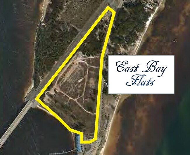
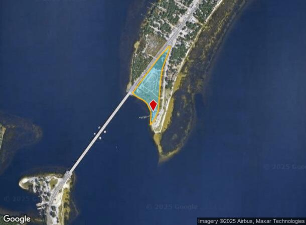
Property Record
6345 E Highway 98 Dr, Panama City, FL 32404
NEARBY LISTINGS FOR SALE OR LEASE
Property Detail
6345 E Highway 98 Dr
26217-000-000
EAST BAY APARTMENTS LOT 3
Vacantlandnec
Bay
AE
Florida
12005C0426J
3
2023
0.83 AC
2025
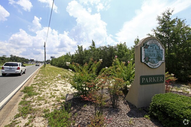
Panama City
000900
Other Market Areas
305,058 SF
Panama City-Panama City Beach, FL
DEMOGRAPHICS near 6345 E Highway 98 Dr
1 Mile
3 Mile
5 Mile
2024 Total Population
848
14,726
38,358
2029 Population
968
16,058
41,605
Pop Growth 2024-2029
+ 14.15%
+ 9.05%
+ 8.46%
Average Age
43
39
39
2024 Total Households
406
5,635
14,505
HH Growth 2024-2029
+ 14.53%
+ 9.30%
+ 8.86%
Median Household Inc
$52,592
$57,017
$52,227
Avg Household Size
2.10
2.60
2.50
2024 Avg HH Vehicles
2.00
2.00
2.00
Median Home Value
$131,720
$164,558
$168,357
Median Year Built
1991
1983
1982
Nearby Places
Map Layers
Map Styles
 Street
 Aerial
- Restaurants
- Banks
- Shops
- Fitness
- Groceries
PUBLIC TRANSPORTATION
AIRPORT
Northwest Florida Beaches International
DRIVE
WALK
Distance
Northwest Florida Beaches International
48 min
30.4 mi
Freight Ports
Port of Panama City
DRIVE
WALK
Distance
Port of Panama City
25 min
13.6 mi
SALE & LEASE HISTORY
LISTING DATE
SALE/LEASE

Oct 28, 2016
For Sale
Nearby Properties
Address
Land Use
TOTAL SIZE
Lot Size
Zoning
Address
Land Use
TOTAL SIZE
Lot Size
Zoning
12.14 AC
BC14
Address
Land Use
TOTAL SIZE
Lot Size
Zoning
6.38 AC
BC14
Address
Land Use
TOTAL SIZE
Lot Size
Zoning
600 AC
BC14
Address
Land Use
TOTAL SIZE
Lot Size
Zoning
650 AC
BC14
Address
Land Use
TOTAL SIZE
Lot Size
Zoning
20,942 SF
15.90 AC
Address
Land Use
TOTAL SIZE
Lot Size
Zoning
263,872 SF
41.33 AC
PC12
Address
Land Use
TOTAL SIZE
Lot Size
Zoning
415,651 SF
266 AC
BC13
Address
Land Use
TOTAL SIZE
Lot Size
Zoning
55,300 SF
10.91 AC
PC12
Address
Land Use
TOTAL SIZE
Lot Size
Zoning
143,208 SF
5.26 AC
Address
Land Use
TOTAL SIZE
Lot Size
Zoning
107,778 SF
10 AC
Address
Land Use
TOTAL SIZE
Lot Size
Zoning
48,576 SF
5.20 AC
CLWY23
Address
Land Use
TOTAL SIZE
Lot Size
Zoning
46,368 SF
2.30 AC
CLWY23
Address
Land Use
TOTAL SIZE
Lot Size
Zoning
38,784 SF
4.50 AC
CLWY23
Address
Land Use
TOTAL SIZE
Lot Size
Zoning
118,902 SF
33.66 AC
BC13
Address
Land Use
TOTAL SIZE
Lot Size
Zoning
70,028 SF
6.64 AC
CLWY04
Address
Land Use
TOTAL SIZE
Lot Size
Zoning
Address
Land Use
TOTAL SIZE
Lot Size
Zoning
52,727 SF
6.80 AC
Address
Land Use
TOTAL SIZE
Lot Size
Zoning
8.68 AC
Address
Land Use
TOTAL SIZE
Lot Size
Zoning
22,660 SF
2.90 AC
Address
Land Use
TOTAL SIZE
Lot Size
Zoning
4,869 SF
11.01 AC
CLWY12
Address
Land Use
TOTAL SIZE
Lot Size
Zoning
64,068 SF
5.59 AC
Address
Land Use
TOTAL SIZE
Lot Size
Zoning
Address
Land Use
TOTAL SIZE
Lot Size
Zoning
28.50 AC
PC12
Address
Land Use
TOTAL SIZE
Lot Size
Zoning
15,000 SF
0.69 AC
CLWY23
Address
Land Use
TOTAL SIZE
Lot Size
Zoning
26,164 SF
15.70 AC
CLWY08
Address
Land Use
TOTAL SIZE
Lot Size
Zoning
48,270 SF
6.75 AC
Address
Land Use
TOTAL SIZE
Lot Size
Zoning
46,916 SF
6.05 AC
PC12
Address
Land Use
TOTAL SIZE
Lot Size
Zoning
41,412 SF
19.58 AC
CLWY05
Address
Land Use
TOTAL SIZE
Lot Size
Zoning
860 SF
6.10 AC
Address
Land Use
TOTAL SIZE
Lot Size
Zoning
2,100 SF
5.60 AC
The World's #1 Commercial Real Estate Marketplace
Connect with us
© 2026 CoStar Group
The information above has been obtained from sources believed reliable. While we do not doubt its accuracy we have not verified it and make no guarantee, warranty or representation about it. It is your responsibility to independently confirm its accuracy and completeness. Any projections, opinions, assumptions, or estimates used are for example only and do not represent the current or future performance of the property. The value of this transaction to you depends on tax and other factors which should be evaluated by your tax, financial, and legal advisors. You and your advisors should conduct a careful, independent investigation of the property to determine to your satisfaction the suitability of the property for your needs.