Property Record
635 Chandler St, Worcester, MA 01602
NEARBY LISTINGS FOR SALE OR LEASE
-
-
View all Worcester listings for sale on LoopNet.com
Property Detail
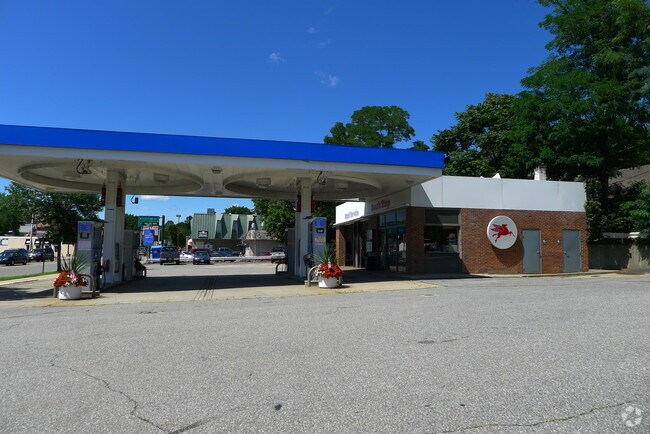
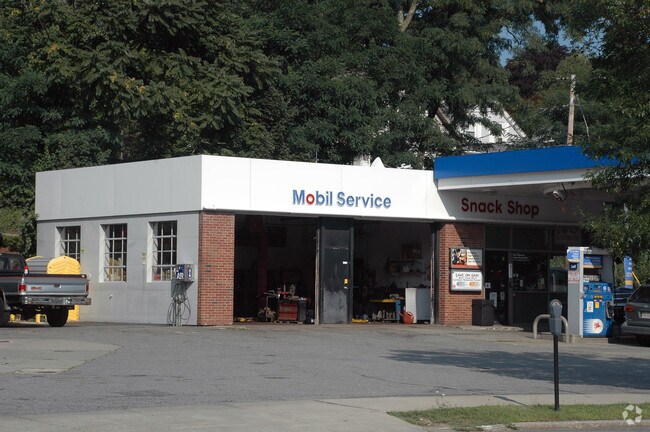
635 Chandler St
Worcester, MA-CT
Worcester
WORC-000030-000001-000031
Massachusetts
Servicestation
0.37 AC
X
Worcester Metro
25027C0613E
Boston
1,440 SF
DEMOGRAPHICS near 635 Chandler St
1 Mile
3 Mile
5 Mile
2024 Total Population
10,018
95,611
215,143
2029 Population
9,871
94,289
212,042
Pop Growth 2024-2029
(1.47%)
(1.38%)
(1.44%)
Average Age
42
38
38
2024 Total Households
3,751
36,306
82,187
HH Growth 2024-2029
(1.49%)
(1.35%)
(1.46%)
Median Household Inc
$94,409
$56,105
$63,071
Avg Household Size
2.40
2.30
2.40
2024 Avg HH Vehicles
2.00
1.00
1.00
Median Home Value
$323,289
$325,595
$322,113
Median Year Built
1951
1949
1950
Nearby Places
Map Layers
Map Styles
 Street
 Aerial
- Restaurants
- Banks
- Shops
- Fitness
- Groceries
PUBLIC TRANSPORTATION
COMMUTER RAIL
DRIVE
WALK
Distance
6 min
3.6 mi
Worcester (Framingham/Worcester Line - Massachusetts Bay Transportation Authority Commuter Rail (Purple Line))
DRIVE
WALK
Distance
Worcester (Framingham/Worcester Line - Massachusetts Bay Transportation Authority Commuter Rail (Purple Line))
7 min
3.8 mi
AIRPORT
Worcester Regional
DRIVE
WALK
Distance
Worcester Regional
6 min
2.3 mi
Freight Ports
Port of Boston
DRIVE
WALK
Distance
Port of Boston
67 min
48.4 mi
SALE & LEASE HISTORY
LISTING DATE
SALE/LEASE

Sep 23, 2016
For Sale
Nearby Properties
Address
Land Use
TOTAL SIZE
Lot Size
Zoning
Address
Land Use
TOTAL SIZE
Lot Size
Zoning
669,637 SF
17.46 AC
BG-6
Address
Land Use
TOTAL SIZE
Lot Size
Zoning
49.51 AC
IN-S
Address
Land Use
TOTAL SIZE
Lot Size
Zoning
381,440 SF
2.74 AC
BG-6
Address
Land Use
TOTAL SIZE
Lot Size
Zoning
244,486 SF
42.64 AC
RL-7
Address
Land Use
TOTAL SIZE
Lot Size
Zoning
3.85 AC
RG-5
Address
Land Use
TOTAL SIZE
Lot Size
Zoning
117,645 SF
3.11 AC
BO-1
Address
Land Use
TOTAL SIZE
Lot Size
Zoning
16,404 SF
10.80 AC
RS-10
Address
Land Use
TOTAL SIZE
Lot Size
Zoning
1,760 SF
105.54 AC
ML10
Address
Land Use
TOTAL SIZE
Lot Size
Zoning
157,385 SF
3.45 AC
BG-6
Address
Land Use
TOTAL SIZE
Lot Size
Zoning
291,410 SF
21.73 AC
RL-7
Address
Land Use
TOTAL SIZE
Lot Size
Zoning
44,584 SF
90.22 AC
Address
Land Use
TOTAL SIZE
Lot Size
Zoning
15.42 AC
RG-5
Address
Land Use
TOTAL SIZE
Lot Size
Zoning
177.12 AC
RL-7
Address
Land Use
TOTAL SIZE
Lot Size
Zoning
3.55 AC
RG-5
Address
Land Use
TOTAL SIZE
Lot Size
Zoning
3.43 AC
ML10
Address
Land Use
TOTAL SIZE
Lot Size
Zoning
3.97 AC
BG-6
Address
Land Use
TOTAL SIZE
Lot Size
Zoning
181,408 SF
1.50 AC
BG-6
Address
Land Use
TOTAL SIZE
Lot Size
Zoning
643,250 SF
35.17 AC
RL-7
Address
Land Use
TOTAL SIZE
Lot Size
Zoning
175,200 SF
2.26 AC
BL-1
Address
Land Use
TOTAL SIZE
Lot Size
Zoning
120,732 SF
28.92 AC
RS-10
Address
Land Use
TOTAL SIZE
Lot Size
Zoning
121,780 SF
1.39 AC
BG-6
Address
Land Use
TOTAL SIZE
Lot Size
Zoning
2.78 AC
MG-2
Address
Land Use
TOTAL SIZE
Lot Size
Zoning
188,980 SF
20 AC
RL-7
Address
Land Use
TOTAL SIZE
Lot Size
Zoning
64,709 SF
1.80 AC
RS-10
Address
Land Use
TOTAL SIZE
Lot Size
Zoning
115,117 SF
1.53 AC
BG10
Address
Land Use
TOTAL SIZE
Lot Size
Zoning
275,319 SF
0.41 AC
BG-6
Address
Land Use
TOTAL SIZE
Lot Size
Zoning
200 SF
50.14 AC
MG-2
Address
Land Use
TOTAL SIZE
Lot Size
Zoning
10.70 AC
RS-7
Address
Land Use
TOTAL SIZE
Lot Size
Zoning
14.66 AC
BG-2
Address
Land Use
TOTAL SIZE
Lot Size
Zoning
251,549 SF
0.27 AC
BG-3
The World's #1 Commercial Real Estate Marketplace
Connect with us
© 2025 CoStar Group
The information above has been obtained from sources believed reliable. While we do not doubt its accuracy we have not verified it and make no guarantee, warranty or representation about it. It is your responsibility to independently confirm its accuracy and completeness. Any projections, opinions, assumptions, or estimates used are for example only and do not represent the current or future performance of the property. The value of this transaction to you depends on tax and other factors which should be evaluated by your tax, financial, and legal advisors. You and your advisors should conduct a careful, independent investigation of the property to determine to your satisfaction the suitability of the property for your needs.