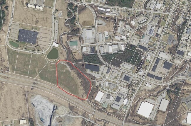
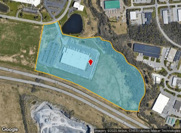
Property Record
635 Community Dr, South Burlington, VT 05403
NEARBY LISTINGS FOR SALE OR LEASE
Property Detail
635 Community Dr
(188) 0436-00055.09B
43.80A
Commercialnec
Chittenden
X
Vermont
50007C0258D
43.80 AC
2024
Vermont North Area
2024
Other Market Areas
004002
Burlington-South Burlington, VT
DEMOGRAPHICS near 635 Community Dr
1 Mile
3 Mile
5 Mile
2024 Total Population
475
22,804
95,491
2029 Population
480
23,128
96,919
Pop Growth 2024-2029
+ 1.05%
+ 1.42%
+ 1.50%
Average Age
40
42
38
2024 Total Households
191
10,033
39,506
HH Growth 2024-2029
+ 1.05%
+ 1.55%
+ 1.62%
Median Household Inc
$122,916
$92,760
$77,635
Avg Household Size
2.40
2.20
2.10
2024 Avg HH Vehicles
2.00
2.00
2.00
Median Home Value
$359,302
$373,378
$383,173
Median Year Built
1986
1989
1978
Nearby Places
- Restaurants
- Banks
- Shops
- Fitness
- Groceries
PUBLIC TRANSPORTATION
COMMUTER RAIL
Essex Junction-Burlington Amtrak Station (Vermonter - Amtrak)
DRIVE
WALK
Distance
Essex Junction-Burlington Amtrak Station (Vermonter - Amtrak)
12 min
4.4 mi
Btn (Ethan Allen Express - Amtrak)
DRIVE
WALK
Distance
Btn (Ethan Allen Express - Amtrak)
14 min
5.2 mi
AIRPORT
Patrick Leahy Burlington International
DRIVE
WALK
Distance
Patrick Leahy Burlington International
18 min
5.4 mi
Plattsburgh International
DRIVE
WALK
Distance
Plattsburgh International
73 min
36.8 mi
Freight Ports
Montreal
DRIVE
WALK
Distance
Montreal
132 min
100.1 mi
Nearby Properties
Address
Land Use
TOTAL SIZE
Lot Size
Zoning
Address
Land Use
TOTAL SIZE
Lot Size
Zoning
Address
Land Use
TOTAL SIZE
Lot Size
Zoning
Address
Land Use
TOTAL SIZE
Lot Size
Zoning
Address
Land Use
TOTAL SIZE
Lot Size
Zoning
Address
Land Use
TOTAL SIZE
Lot Size
Zoning
Address
Land Use
TOTAL SIZE
Lot Size
Zoning
Address
Land Use
TOTAL SIZE
Lot Size
Zoning
Address
Land Use
TOTAL SIZE
Lot Size
Zoning
78,064 SF
2.71 AC
Address
Land Use
TOTAL SIZE
Lot Size
Zoning
Address
Land Use
TOTAL SIZE
Lot Size
Zoning
736.20 AC
Address
Land Use
TOTAL SIZE
Lot Size
Zoning
Address
Land Use
TOTAL SIZE
Lot Size
Zoning
52,824 SF
14.43 AC
Address
Land Use
TOTAL SIZE
Lot Size
Zoning
Address
Land Use
TOTAL SIZE
Lot Size
Zoning
235,994 SF
Address
Land Use
TOTAL SIZE
Lot Size
Zoning
54,000 SF
3.98 AC
Address
Land Use
TOTAL SIZE
Lot Size
Zoning
Address
Land Use
TOTAL SIZE
Lot Size
Zoning
3.20 AC
Address
Land Use
TOTAL SIZE
Lot Size
Zoning
Address
Land Use
TOTAL SIZE
Lot Size
Zoning
54,000 SF
5 AC
Address
Land Use
TOTAL SIZE
Lot Size
Zoning
Address
Land Use
TOTAL SIZE
Lot Size
Zoning
Address
Land Use
TOTAL SIZE
Lot Size
Zoning
Address
Land Use
TOTAL SIZE
Lot Size
Zoning
40.12 AC
I
Address
Land Use
TOTAL SIZE
Lot Size
Zoning
Address
Land Use
TOTAL SIZE
Lot Size
Zoning
64,000 SF
68 AC
Address
Land Use
TOTAL SIZE
Lot Size
Zoning
69,120 SF
11.20 AC
Address
Land Use
TOTAL SIZE
Lot Size
Zoning
35,064 SF
3.71 AC
Address
Land Use
TOTAL SIZE
Lot Size
Zoning
Address
Land Use
TOTAL SIZE
Lot Size
Zoning
The World's #1 Commercial Real Estate Marketplace
Connect with us
© 2025 CoStar Group
The information above has been obtained from sources believed reliable. While we do not doubt its accuracy we have not verified it and make no guarantee, warranty or representation about it. It is your responsibility to independently confirm its accuracy and completeness. Any projections, opinions, assumptions, or estimates used are for example only and do not represent the current or future performance of the property. The value of this transaction to you depends on tax and other factors which should be evaluated by your tax, financial, and legal advisors. You and your advisors should conduct a careful, independent investigation of the property to determine to your satisfaction the suitability of the property for your needs.