Property Record
635 Main St, Green Bay, WI 54301


NEARBY LISTINGS FOR SALE OR LEASE
Property Detail
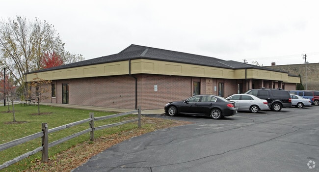
635 Main St
Green Bay, WI
Navarino Plat
11-104
69,660 SQ FT NAVARINO PLAT LOTS 325-326- 327-328 EX PRT DESC IN 303 D 383 & EX J5606-10 FOR ST & LOTS 320, 321 & 322 EX RR & PRT VAC ST IN 2104789 & PRT VAC ALLEY IN 2104790
Commercialnec
Brown
AE
Wisconsin
55009C0169G
325,3
2024
1.60 AC
2024
Green Bay
001000
Green Bay
9,000 SF
DEMOGRAPHICS near 635 Main St
1 mile
3 mile
5 mile
2024 Total Population
12,483
76,579
146,014
2029 Population
12,774
78,034
148,803
Pop Growth 2024-2029
+ 2.33%
+ 1.90%
+ 1.91%
Average Age
35
38
39
2024 Total Households
5,311
32,422
61,506
HH Growth 2024-2029
+ 2.39%
+ 1.95%
+ 2.00%
Median Household Inc
$42,514
$50,321
$55,743
Avg Household Size
2.20
2.20
2.30
2024 Avg HH Vehicles
1.00
2.00
2.00
Median Home Value
$148,002
$149,239
$179,787
Median Year Built
1949
1961
1972
Nearby Places
Map Layers
Map Styles
 Street
 Aerial
Transit
 Traffic
 Biking
Places
Listings with unknown addresses are not visible on the map
- Restaurants
- Banks
- Shops
- Fitness
- Groceries
PUBLIC TRANSPORTATION
AIRPORT
Green Bay/Austin Straubel International
Drive
Walk
Distance
Green Bay/Austin Straubel International
16 min
9.0 mi
Appleton International
Drive
Walk
Distance
Appleton International
51 min
39.5 mi
Nearby Properties
Address
Land Use
TOTAL SIZE
Lot Size
Zoning
Address
Land Use
TOTAL SIZE
Lot Size
Zoning
197.25 AC
Address
Land Use
TOTAL SIZE
Lot Size
Zoning
36.49 AC
Address
Land Use
TOTAL SIZE
Lot Size
Zoning
22.35 AC
Address
Land Use
TOTAL SIZE
Lot Size
Zoning
6.32 AC
R1
Address
Land Use
TOTAL SIZE
Lot Size
Zoning
Address
Land Use
TOTAL SIZE
Lot Size
Zoning
96.49 AC
Address
Land Use
TOTAL SIZE
Lot Size
Zoning
17,227 SF
3.13 AC
GI
Address
Land Use
TOTAL SIZE
Lot Size
Zoning
184,367 SF
10.34 AC
GI
Address
Land Use
TOTAL SIZE
Lot Size
Zoning
Address
Land Use
TOTAL SIZE
Lot Size
Zoning
14.75 AC
Address
Land Use
TOTAL SIZE
Lot Size
Zoning
19.73 AC
Address
Land Use
TOTAL SIZE
Lot Size
Zoning
16.74 AC
Address
Land Use
TOTAL SIZE
Lot Size
Zoning
23.44 AC
Address
Land Use
TOTAL SIZE
Lot Size
Zoning
Address
Land Use
TOTAL SIZE
Lot Size
Zoning
0.74 AC
Address
Land Use
TOTAL SIZE
Lot Size
Zoning
15.43 AC
Address
Land Use
TOTAL SIZE
Lot Size
Zoning
44.27 AC
Address
Land Use
TOTAL SIZE
Lot Size
Zoning
0.63 AC
Address
Land Use
TOTAL SIZE
Lot Size
Zoning
1.25 AC
Address
Land Use
TOTAL SIZE
Lot Size
Zoning
28.20 AC
Address
Land Use
TOTAL SIZE
Lot Size
Zoning
25.53 AC
Address
Land Use
TOTAL SIZE
Lot Size
Zoning
0.48 AC
Address
Land Use
TOTAL SIZE
Lot Size
Zoning
Address
Land Use
TOTAL SIZE
Lot Size
Zoning
81,981 SF
0.80 AC
D2
Address
Land Use
TOTAL SIZE
Lot Size
Zoning
9.51 AC
Address
Land Use
TOTAL SIZE
Lot Size
Zoning
567,424 SF
53.92 AC
C1, GI
Address
Land Use
TOTAL SIZE
Lot Size
Zoning
48.24 AC
Address
Land Use
TOTAL SIZE
Lot Size
Zoning
Address
Land Use
TOTAL SIZE
Lot Size
Zoning
6.56 AC
Address
Land Use
TOTAL SIZE
Lot Size
Zoning
320,146 SF
48.50 AC
GI, R1
The World's #1 Commercial Real Estate Marketplace
Connect with us
© 2026 CoStar Group
The information above has been obtained from sources believed reliable. While we do not doubt its accuracy we have not verified it and make no guarantee, warranty or representation about it. It is your responsibility to independently confirm its accuracy and completeness. Any projections, opinions, assumptions, or estimates used are for example only and do not represent the current or future performance of the property. The value of this transaction to you depends on tax and other factors which should be evaluated by your tax, financial, and legal advisors. You and your advisors should conduct a careful, independent investigation of the property to determine to your satisfaction the suitability of the property for your needs.