Property Record
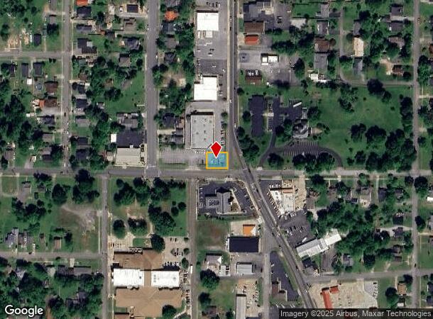
635 S 6Th St, Mayfield, KY 42066


NEARBY LISTINGS FOR SALE OR LEASE
Property Detail
635 S 6Th St
206.00.05.022.00
---COMBINED BILL---
Commercialnec
Graves
X
Kentucky
21083C0232C
0.17 AC
2025
Kentucky West Area
2025
Other Market Areas
020302
Mayfield, KY
14,469 SF
DEMOGRAPHICS near 635 S 6Th St
1 Mile
3 Mile
5 Mile
2024 Total Population
6,872
13,276
17,135
2029 Population
6,797
13,071
16,841
Pop Growth 2024-2029
(1.09%)
(1.54%)
(1.72%)
Average Age
38
39
40
2024 Total Households
2,695
5,295
6,885
HH Growth 2024-2029
(1.11%)
(1.55%)
(1.73%)
Median Household Inc
$32,308
$40,376
$42,449
Avg Household Size
2.40
2.40
2.40
2024 Avg HH Vehicles
2.00
2.00
2.00
Median Home Value
$107,158
$132,782
$137,613
Median Year Built
1967
1972
1973
Nearby Places
Map Layers
Map Styles
 Street
 Aerial
- Restaurants
- Banks
- Shops
- Fitness
- Groceries
Nearby Properties
Address
Land Use
TOTAL SIZE
Lot Size
Zoning
Address
Land Use
TOTAL SIZE
Lot Size
Zoning
0.47 AC
R
Address
Land Use
TOTAL SIZE
Lot Size
Zoning
4.58 AC
R
Address
Land Use
TOTAL SIZE
Lot Size
Zoning
121,900 SF
14.70 AC
R
Address
Land Use
TOTAL SIZE
Lot Size
Zoning
17.12 AC
R
Address
Land Use
TOTAL SIZE
Lot Size
Zoning
Address
Land Use
TOTAL SIZE
Lot Size
Zoning
0.49 AC
R
Address
Land Use
TOTAL SIZE
Lot Size
Zoning
34.20 AC
R
Address
Land Use
TOTAL SIZE
Lot Size
Zoning
10,080 SF
8.44 AC
R
Address
Land Use
TOTAL SIZE
Lot Size
Zoning
7.55 AC
R
Address
Land Use
TOTAL SIZE
Lot Size
Zoning
11.35 AC
R
Address
Land Use
TOTAL SIZE
Lot Size
Zoning
19,482 SF
0.76 AC
RESIDENTIA
Address
Land Use
TOTAL SIZE
Lot Size
Zoning
19.40 AC
Address
Land Use
TOTAL SIZE
Lot Size
Zoning
32,526 SF
7.50 AC
R
Address
Land Use
TOTAL SIZE
Lot Size
Zoning
40 AC
R
Address
Land Use
TOTAL SIZE
Lot Size
Zoning
27,758 SF
12.50 AC
R
Address
Land Use
TOTAL SIZE
Lot Size
Zoning
Address
Land Use
TOTAL SIZE
Lot Size
Zoning
8,284 SF
5.65 AC
R
Address
Land Use
TOTAL SIZE
Lot Size
Zoning
6.04 AC
Address
Land Use
TOTAL SIZE
Lot Size
Zoning
105 AC
R
Address
Land Use
TOTAL SIZE
Lot Size
Zoning
4.62 AC
RESIDENTIA
Address
Land Use
TOTAL SIZE
Lot Size
Zoning
15.17 AC
R
Address
Land Use
TOTAL SIZE
Lot Size
Zoning
38,760 SF
4.10 AC
R
Address
Land Use
TOTAL SIZE
Lot Size
Zoning
13,760 SF
0.30 AC
R
Address
Land Use
TOTAL SIZE
Lot Size
Zoning
1.65 AC
R
Address
Land Use
TOTAL SIZE
Lot Size
Zoning
20,712 SF
0.15 AC
R
Address
Land Use
TOTAL SIZE
Lot Size
Zoning
1.66 AC
R
Address
Land Use
TOTAL SIZE
Lot Size
Zoning
3,472 SF
0.28 AC
R
Address
Land Use
TOTAL SIZE
Lot Size
Zoning
3,596 SF
1.51 AC
Address
Land Use
TOTAL SIZE
Lot Size
Zoning
7,200 SF
30.95 AC
RESIDENTIA
The World's #1 Commercial Real Estate Marketplace
Connect with us
© 2025 CoStar Group
The information above has been obtained from sources believed reliable. While we do not doubt its accuracy we have not verified it and make no guarantee, warranty or representation about it. It is your responsibility to independently confirm its accuracy and completeness. Any projections, opinions, assumptions, or estimates used are for example only and do not represent the current or future performance of the property. The value of this transaction to you depends on tax and other factors which should be evaluated by your tax, financial, and legal advisors. You and your advisors should conduct a careful, independent investigation of the property to determine to your satisfaction the suitability of the property for your needs.