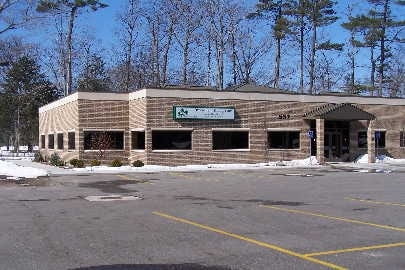
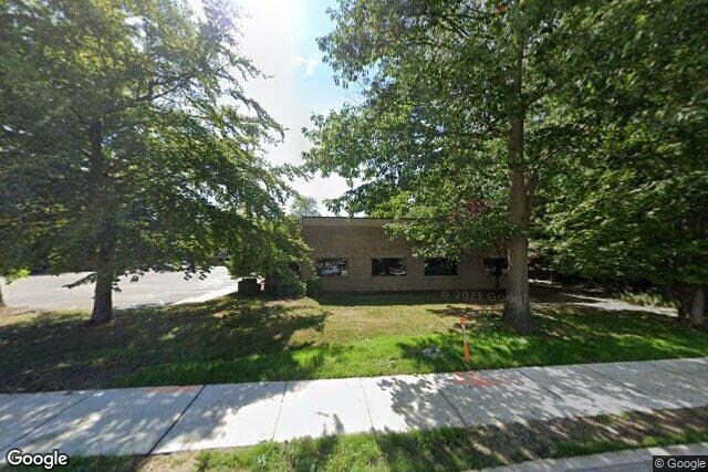
Property Record
635 Seminole Rd, Norton Shores, MI 49441

NEARBY LISTINGS FOR SALE OR LEASE
Property Detail
635 Seminole Rd
27-107-100-0026-00
CITY OF NORTON SHORES THAT PART OF GOVT LOT 3 SEC 7 BEG AT A PT ON N LN OF GOVT LOT 3 WHICH IS N 88D 33M 35S W 477.10 FT FR
Commercialnec
Muskegon
X
Michigan
26121C0267E
5.47 AC
0
Muskegon Heights
2025
West Michigan
002400
Muskegon, MI
37,550 SF
DEMOGRAPHICS near 635 Seminole Rd
1 Mile
3 Mile
5 Mile
2024 Total Population
7,464
55,620
93,277
2029 Population
7,548
55,996
94,006
Pop Growth 2024-2029
+ 1.13%
+ 0.68%
+ 0.78%
Average Age
41
40
41
2024 Total Households
3,228
21,494
37,002
HH Growth 2024-2029
+ 0.96%
+ 0.57%
+ 0.78%
Median Household Inc
$52,289
$49,568
$49,479
Avg Household Size
2.20
2.40
2.30
2024 Avg HH Vehicles
2.00
2.00
2.00
Median Home Value
$131,880
$137,375
$144,516
Median Year Built
1960
1956
1960
Nearby Places
Map Layers
Map Styles
 Street
 Aerial
- Restaurants
- Banks
- Shops
- Fitness
- Groceries
SALE & LEASE HISTORY
LISTING DATE
SALE/LEASE

Jun 05, 2025
For Sale
Jul 16, 2024
For Lease
Nearby Properties
Address
Land Use
TOTAL SIZE
Lot Size
Zoning
Address
Land Use
TOTAL SIZE
Lot Size
Zoning
82,643 SF
5.20 AC
MC
Address
Land Use
TOTAL SIZE
Lot Size
Zoning
6,900 SF
165.61 AC
GI
Address
Land Use
TOTAL SIZE
Lot Size
Zoning
84,452 SF
6.82 AC
PUD
Address
Land Use
TOTAL SIZE
Lot Size
Zoning
249,032 SF
19.18 AC
MFR
Address
Land Use
TOTAL SIZE
Lot Size
Zoning
41,382 SF
6.20 AC
PUD
Address
Land Use
TOTAL SIZE
Lot Size
Zoning
187,210 SF
23.22 AC
GI
Address
Land Use
TOTAL SIZE
Lot Size
Zoning
219,341 SF
18.55 AC
C-SE
Address
Land Use
TOTAL SIZE
Lot Size
Zoning
194,708 SF
15.59 AC
C-2
Address
Land Use
TOTAL SIZE
Lot Size
Zoning
19,171 SF
6.55 AC
MC
Address
Land Use
TOTAL SIZE
Lot Size
Zoning
350,378 SF
21.50 AC
GI
Address
Land Use
TOTAL SIZE
Lot Size
Zoning
184,786 SF
24.10 AC
SUD
Address
Land Use
TOTAL SIZE
Lot Size
Zoning
68,782 SF
10.52 AC
C-2
Address
Land Use
TOTAL SIZE
Lot Size
Zoning
122.75 AC
R-2
Address
Land Use
TOTAL SIZE
Lot Size
Zoning
124,416 SF
7.41 AC
MFR
Address
Land Use
TOTAL SIZE
Lot Size
Zoning
17,461 SF
2.72 AC
MC
Address
Land Use
TOTAL SIZE
Lot Size
Zoning
125,478 SF
7.90 AC
WM
Address
Land Use
TOTAL SIZE
Lot Size
Zoning
110,460 SF
12.26 AC
AR-8
Address
Land Use
TOTAL SIZE
Lot Size
Zoning
399,872 SF
16.99 AC
I-2
Address
Land Use
TOTAL SIZE
Lot Size
Zoning
32,811 SF
5.87 AC
B-4
Address
Land Use
TOTAL SIZE
Lot Size
Zoning
121,766 SF
10.29 AC
C-NE
Address
Land Use
TOTAL SIZE
Lot Size
Zoning
123,081 SF
8.50 AC
B-4
Address
Land Use
TOTAL SIZE
Lot Size
Zoning
224,070 SF
15.85 AC
GI
Address
Land Use
TOTAL SIZE
Lot Size
Zoning
79,792 SF
4.94 AC
PUD
Address
Land Use
TOTAL SIZE
Lot Size
Zoning
67,896 SF
8.56 AC
B-4
Address
Land Use
TOTAL SIZE
Lot Size
Zoning
1,020 SF
90.15 AC
PUD
Address
Land Use
TOTAL SIZE
Lot Size
Zoning
51,021 SF
5.52 AC
PUD
Address
Land Use
TOTAL SIZE
Lot Size
Zoning
15,303 SF
1.84 AC
MC
Address
Land Use
TOTAL SIZE
Lot Size
Zoning
15,409 SF
2.51 AC
MC
Address
Land Use
TOTAL SIZE
Lot Size
Zoning
85,440 SF
4.51 AC
SUD
Address
Land Use
TOTAL SIZE
Lot Size
Zoning
15,028 SF
1.21 AC
B-4
The World's #1 Commercial Real Estate Marketplace
Connect with us
© 2025 CoStar Group
The information above has been obtained from sources believed reliable. While we do not doubt its accuracy we have not verified it and make no guarantee, warranty or representation about it. It is your responsibility to independently confirm its accuracy and completeness. Any projections, opinions, assumptions, or estimates used are for example only and do not represent the current or future performance of the property. The value of this transaction to you depends on tax and other factors which should be evaluated by your tax, financial, and legal advisors. You and your advisors should conduct a careful, independent investigation of the property to determine to your satisfaction the suitability of the property for your needs.