Property Record
6350 Aviation Cir, Loveland, CO 80538
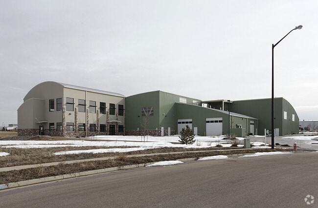

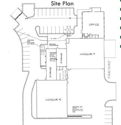
Property Detail
6350 Aviation Cir
86273-28-908
LOT 8, BLOCK 1, LOVELAND-FORT COLLINS INDUSTRIAL AIRPARK NINTH SUBDIVISION, LOV (2002054164), AMD (20030130592)
Stateproperty
Larimer
I
Colorado
B and X Area of moderate flood hazard, usually the area between the limits of the 100-year and 500-year floods.
8
2024
1.55 AC
2025
Fort Collins/Loveland
001715
Denver
14,820 SF
Fort Collins-Loveland, CO
NEARBY LISTINGS FOR SALE OR LEASE
DEMOGRAPHICS near 6350 Aviation Cir
1 mile
3 mile
5 mile
2025 Total Population
1,157
18,238
98,672
2030 Population
1,193
19,325
103,934
Pop Growth 2025-2030
+ 3.11%
+ 5.96%
+ 5.33%
Average Age
44
42
40
2025 Total Households
439
7,186
37,715
HH Growth 2025-2030
+ 3.19%
+ 6.12%
+ 5.26%
Median Household Inc
$173,364
$134,916
$109,200
Avg Household Size
2.70
2.50
2.60
2025 Avg HH Vehicles
2.00
2.00
2.00
Median Home Value
$715,587
$754,388
$643,319
Median Year Built
2007
2010
2004
Nearby Places
Map Layers
Map Styles
 Street
 Aerial
Transit
 Traffic
 Biking
Places
Listings with unknown addresses are not visible on the map
- Restaurants
- Banks
- Shops
- Fitness
- Groceries
SALE & LEASE HISTORY
LISTING DATE
SALE/LEASE

Sep 23, 2016
For Sale
Mar 30, 2017
For Sale
Nearby Properties
Address
Land Use
TOTAL SIZE
Lot Size
Zoning
Address
Land Use
TOTAL SIZE
Lot Size
Zoning
689,698 SF
112.68 AC
P59
Address
Land Use
TOTAL SIZE
Lot Size
Zoning
1 SF
74.68 AC
AP
Address
Land Use
TOTAL SIZE
Lot Size
Zoning
444,114 SF
73.02 AC
Address
Land Use
TOTAL SIZE
Lot Size
Zoning
1,149,762 SF
172.22 AC
I
Address
Land Use
TOTAL SIZE
Lot Size
Zoning
99,085 SF
206.52 AC
P74
Address
Land Use
TOTAL SIZE
Lot Size
Zoning
316,352 SF
42.97 AC
I
Address
Land Use
TOTAL SIZE
Lot Size
Zoning
592,494 SF
31.85 AC
Address
Land Use
TOTAL SIZE
Lot Size
Zoning
307,636 SF
Address
Land Use
TOTAL SIZE
Lot Size
Zoning
120,688 SF
1.24 AC
Address
Land Use
TOTAL SIZE
Lot Size
Zoning
197,850 SF
35.83 AC
B
Address
Land Use
TOTAL SIZE
Lot Size
Zoning
84,548 SF
4.91 AC
P12
Address
Land Use
TOTAL SIZE
Lot Size
Zoning
80,042 SF
13.82 AC
Address
Land Use
TOTAL SIZE
Lot Size
Zoning
162,753 SF
13.39 AC
P59
Address
Land Use
TOTAL SIZE
Lot Size
Zoning
342,525 SF
11.86 AC
Address
Land Use
TOTAL SIZE
Lot Size
Zoning
122,597 SF
7.45 AC
Address
Land Use
TOTAL SIZE
Lot Size
Zoning
69,768 SF
13.41 AC
Address
Land Use
TOTAL SIZE
Lot Size
Zoning
115,778 SF
27.67 AC
I
Address
Land Use
TOTAL SIZE
Lot Size
Zoning
122,597 SF
6.57 AC
Address
Land Use
TOTAL SIZE
Lot Size
Zoning
122,597 SF
7.11 AC
Address
Land Use
TOTAL SIZE
Lot Size
Zoning
81,664 SF
0.95 AC
Address
Land Use
TOTAL SIZE
Lot Size
Zoning
122,597 SF
6.77 AC
Address
Land Use
TOTAL SIZE
Lot Size
Zoning
48,924 SF
4.89 AC
Address
Land Use
TOTAL SIZE
Lot Size
Zoning
169,139 SF
8.72 AC
I
Address
Land Use
TOTAL SIZE
Lot Size
Zoning
43,725 SF
18.39 AC
Address
Land Use
TOTAL SIZE
Lot Size
Zoning
145,851 SF
9.39 AC
P59
Address
Land Use
TOTAL SIZE
Lot Size
Zoning
54,230 SF
2.84 AC
P59
Address
Land Use
TOTAL SIZE
Lot Size
Zoning
136,516 SF
9.64 AC
I
Address
Land Use
TOTAL SIZE
Lot Size
Zoning
51,873 SF
9 AC
P59
Address
Land Use
TOTAL SIZE
Lot Size
Zoning
39,696 SF
13.91 AC
Address
Land Use
TOTAL SIZE
Lot Size
Zoning
27,022 SF
3.53 AC
The World's #1 Commercial Real Estate Marketplace
Connect with us
© 2026 CoStar Group
The information above has been obtained from sources believed reliable. While we do not doubt its accuracy we have not verified it and make no guarantee, warranty or representation about it. It is your responsibility to independently confirm its accuracy and completeness. Any projections, opinions, assumptions, or estimates used are for example only and do not represent the current or future performance of the property. The value of this transaction to you depends on tax and other factors which should be evaluated by your tax, financial, and legal advisors. You and your advisors should conduct a careful, independent investigation of the property to determine to your satisfaction the suitability of the property for your needs.