Property Record
6350 Ladd Ave, Louisville, KY 40216


NEARBY LISTINGS FOR SALE OR LEASE
Property Detail
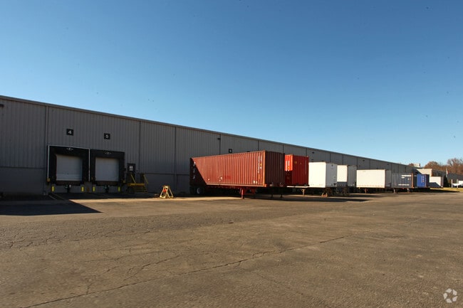
6350 Ladd Ave
101305010000
24.868 AC NES PADUCAH & LOU RAILROAD 1295 FT+- SOUTH OF LADD AVE
Warehouse
Jefferson
AE
Kentucky
21111C0054F
24.87 AC
2025
W Outlying Jefferson Cnty
2025
Louisville
012702
Louisville-Jefferson County, KY-IN
194,084 SF
DEMOGRAPHICS near 6350 Ladd Ave
1 Mile
3 Mile
5 Mile
2024 Total Population
7,264
45,623
147,465
2029 Population
7,241
45,097
146,603
Pop Growth 2024-2029
(0.32%)
(1.15%)
(0.58%)
Average Age
39
40
39
2024 Total Households
3,017
18,833
59,664
HH Growth 2024-2029
(0.43%)
(1.19%)
(0.67%)
Median Household Inc
$39,722
$47,113
$44,123
Avg Household Size
2.40
2.40
2.40
2024 Avg HH Vehicles
2.00
2.00
2.00
Median Home Value
$148,888
$161,097
$143,248
Median Year Built
1965
1965
1959
Nearby Places
Map Layers
Map Styles
 Street
 Aerial
- Restaurants
- Banks
- Shops
- Fitness
- Groceries
PUBLIC TRANSPORTATION
AIRPORT
Louisville Muhammad Ali International
DRIVE
WALK
Distance
Louisville Muhammad Ali International
20 min
8.9 mi
Nearby Properties
Address
Land Use
TOTAL SIZE
Lot Size
Zoning
Address
Land Use
TOTAL SIZE
Lot Size
Zoning
427,128 SF
96.79 AC
Address
Land Use
TOTAL SIZE
Lot Size
Zoning
241,462 SF
25.28 AC
EZ1-ENTERP
Address
Land Use
TOTAL SIZE
Lot Size
Zoning
24.92 AC
EZ1-ENTERP
Address
Land Use
TOTAL SIZE
Lot Size
Zoning
26.79 AC
R4-RESIDEN
Address
Land Use
TOTAL SIZE
Lot Size
Zoning
16.14 AC
Address
Land Use
TOTAL SIZE
Lot Size
Zoning
427,337 SF
50.32 AC
EZ1-ENTERP
Address
Land Use
TOTAL SIZE
Lot Size
Zoning
519,508 SF
25.18 AC
EZ1-ENTERP
Address
Land Use
TOTAL SIZE
Lot Size
Zoning
Address
Land Use
TOTAL SIZE
Lot Size
Zoning
38.34 AC
Address
Land Use
TOTAL SIZE
Lot Size
Zoning
310,552 SF
24 AC
EZ1-ENTERP
Address
Land Use
TOTAL SIZE
Lot Size
Zoning
270 SF
121 AC
M3-INDUSTR
Address
Land Use
TOTAL SIZE
Lot Size
Zoning
164,677 SF
13.54 AC
EZ1-ENTERP
Address
Land Use
TOTAL SIZE
Lot Size
Zoning
325,600 SF
17.15 AC
EZ1-ENTERP
Address
Land Use
TOTAL SIZE
Lot Size
Zoning
29.54 AC
R5-RESIDEN
Address
Land Use
TOTAL SIZE
Lot Size
Zoning
19,032 SF
5.88 AC
C1-COMMERC
Address
Land Use
TOTAL SIZE
Lot Size
Zoning
300,000 SF
18.27 AC
EZ1-ENTERP
Address
Land Use
TOTAL SIZE
Lot Size
Zoning
220,844 SF
29.19 AC
C2-COMMERC
Address
Land Use
TOTAL SIZE
Lot Size
Zoning
9.95 AC
Address
Land Use
TOTAL SIZE
Lot Size
Zoning
21.36 AC
Address
Land Use
TOTAL SIZE
Lot Size
Zoning
259,570 SF
20.38 AC
EZ1-ENTERP
Address
Land Use
TOTAL SIZE
Lot Size
Zoning
2,352 SF
2.42 AC
C2-COMMERC
Address
Land Use
TOTAL SIZE
Lot Size
Zoning
269,280 SF
13.38 AC
EZ1-ENTERP
Address
Land Use
TOTAL SIZE
Lot Size
Zoning
Address
Land Use
TOTAL SIZE
Lot Size
Zoning
326,731 SF
25.44 AC
EZ1-ENTERP
Address
Land Use
TOTAL SIZE
Lot Size
Zoning
19,000 SF
12.86 AC
EZ1-ENTERP
Address
Land Use
TOTAL SIZE
Lot Size
Zoning
5,720 SF
93.67 AC
EZ1-ENTERP
Address
Land Use
TOTAL SIZE
Lot Size
Zoning
19,375 SF
10.11 AC
C1-COMMERC
Address
Land Use
TOTAL SIZE
Lot Size
Zoning
213,150 SF
13.29 AC
EZ1-ENTERP
Address
Land Use
TOTAL SIZE
Lot Size
Zoning
121,509 SF
4.48 AC
The World's #1 Commercial Real Estate Marketplace
Connect with us
© 2025 CoStar Group
The information above has been obtained from sources believed reliable. While we do not doubt its accuracy we have not verified it and make no guarantee, warranty or representation about it. It is your responsibility to independently confirm its accuracy and completeness. Any projections, opinions, assumptions, or estimates used are for example only and do not represent the current or future performance of the property. The value of this transaction to you depends on tax and other factors which should be evaluated by your tax, financial, and legal advisors. You and your advisors should conduct a careful, independent investigation of the property to determine to your satisfaction the suitability of the property for your needs.