Property Record
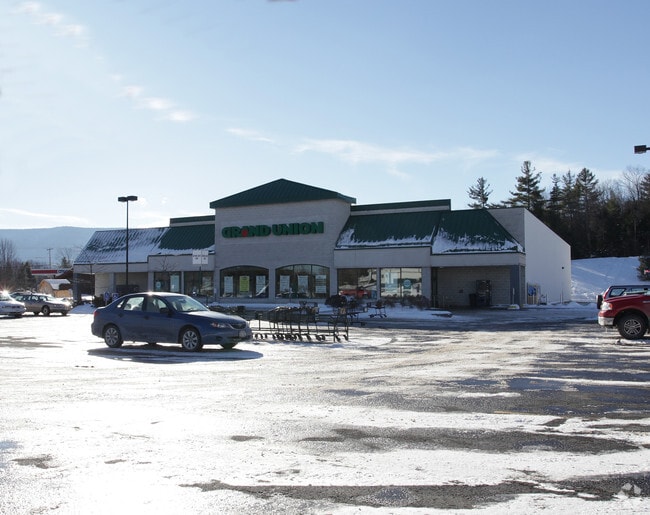
6350 Main St, Tannersville, NY 12485


NEARBY LISTINGS FOR SALE OR LEASE
Property Detail
6350 Main St
Supermarket
Greene
A
New York
36039C0384G
26.000
2025
2.80 AC
2024
Greene County
080403
Albany/Schenectady/Troy
23,600 SF
193603-165-020-0001-026-000-0000
DEMOGRAPHICS near 6350 Main St
1 Mile
3 Mile
5 Mile
2024 Total Population
375
1,176
2,337
2029 Population
358
1,121
2,253
Pop Growth 2024-2029
(4.53%)
(4.68%)
(3.59%)
Average Age
40
41
43
2024 Total Households
121
407
895
HH Growth 2024-2029
(6.61%)
(5.90%)
(4.25%)
Median Household Inc
$65,000
$63,906
$60,170
Avg Household Size
2.20
2.20
2.20
2024 Avg HH Vehicles
2.00
2.00
2.00
Median Home Value
$247,368
$276,270
$283,221
Median Year Built
1973
1975
1979
Nearby Places
Map Layers
Map Styles
 Street
 Aerial
- Restaurants
- Banks
- Shops
- Fitness
- Groceries
Nearby Properties
Address
Land Use
TOTAL SIZE
Lot Size
Zoning
Address
Land Use
TOTAL SIZE
Lot Size
Zoning
0.01 AC
01 - NOT Z
Address
Land Use
TOTAL SIZE
Lot Size
Zoning
4,726 SF
1,036.60 AC
01 - NOT Z
Address
Land Use
TOTAL SIZE
Lot Size
Zoning
61,470 SF
6.60 AC
01 - NOT Z
Address
Land Use
TOTAL SIZE
Lot Size
Zoning
37,208 SF
291 AC
01 - NOT Z
Address
Land Use
TOTAL SIZE
Lot Size
Zoning
2,345 SF
2.10 AC
01 - NOT Z
Address
Land Use
TOTAL SIZE
Lot Size
Zoning
5,664 SF
73.60 AC
01 - NOT Z
Address
Land Use
TOTAL SIZE
Lot Size
Zoning
43,162 SF
3.50 AC
01 - NOT Z
Address
Land Use
TOTAL SIZE
Lot Size
Zoning
25,896 SF
6.20 AC
01 - NOT Z
Address
Land Use
TOTAL SIZE
Lot Size
Zoning
6,860 SF
107.90 AC
01 - NOT Z
Address
Land Use
TOTAL SIZE
Lot Size
Zoning
4,299 SF
1.60 AC
RC
Address
Land Use
TOTAL SIZE
Lot Size
Zoning
710.40 AC
01 - NOT Z
Address
Land Use
TOTAL SIZE
Lot Size
Zoning
312.40 AC
C
Address
Land Use
TOTAL SIZE
Lot Size
Zoning
67.48 AC
RC
Address
Land Use
TOTAL SIZE
Lot Size
Zoning
7,086 SF
8.70 AC
01 - NOT Z
Address
Land Use
TOTAL SIZE
Lot Size
Zoning
26,992 SF
1.70 AC
01 - NOT Z
Address
Land Use
TOTAL SIZE
Lot Size
Zoning
611.70 AC
01 - NOT Z
Address
Land Use
TOTAL SIZE
Lot Size
Zoning
5,946 SF
3.40 AC
01 - NOT Z
Address
Land Use
TOTAL SIZE
Lot Size
Zoning
10,138 SF
1.50 AC
01 - NOT Z
Address
Land Use
TOTAL SIZE
Lot Size
Zoning
4,511 SF
38.90 AC
01 - NOT Z
Address
Land Use
TOTAL SIZE
Lot Size
Zoning
12,850 SF
4.70 AC
01 - NOT Z
Address
Land Use
TOTAL SIZE
Lot Size
Zoning
2,688 SF
1.52 AC
01 - NOT Z
Address
Land Use
TOTAL SIZE
Lot Size
Zoning
6,540 SF
15 AC
01 - NOT Z
Address
Land Use
TOTAL SIZE
Lot Size
Zoning
9,196 SF
1.90 AC
01 - NOT Z
Address
Land Use
TOTAL SIZE
Lot Size
Zoning
12,960 SF
0.79 AC
01 - NOT Z
Address
Land Use
TOTAL SIZE
Lot Size
Zoning
8,356 SF
0.77 AC
01 - NOT Z
Address
Land Use
TOTAL SIZE
Lot Size
Zoning
5,760 SF
4.60 AC
01 - NOT Z
Address
Land Use
TOTAL SIZE
Lot Size
Zoning
6,160 SF
11 AC
01 - NOT Z
Address
Land Use
TOTAL SIZE
Lot Size
Zoning
17,076 SF
8.40 AC
01 - NOT Z
Address
Land Use
TOTAL SIZE
Lot Size
Zoning
5,375 SF
3.80 AC
01 - NOT Z
The World's #1 Commercial Real Estate Marketplace
Connect with us
© 2026 CoStar Group
The information above has been obtained from sources believed reliable. While we do not doubt its accuracy we have not verified it and make no guarantee, warranty or representation about it. It is your responsibility to independently confirm its accuracy and completeness. Any projections, opinions, assumptions, or estimates used are for example only and do not represent the current or future performance of the property. The value of this transaction to you depends on tax and other factors which should be evaluated by your tax, financial, and legal advisors. You and your advisors should conduct a careful, independent investigation of the property to determine to your satisfaction the suitability of the property for your needs.