Property Record
6350 W Ramsey St, Banning, CA 92220


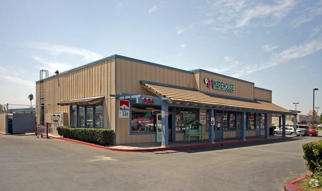

Property Detail
6350 W Ramsey St
419-112-014
1.52 ACRES IN POR LOT 41 AND LOTS 42 & 43 MB 023/019 GRAND VIEW RANCHO
Regionalshoppingcenterormallwithanchorstore
Riverside
C2
California
A Areas with a 1% annual chance of flooding and a 26% chance of flooding over the life of a 30-year mortgage.
43
2024
1.52 AC
2025
Beaumont/Hemet
044103
Inland Empire (California)
19,737 SF
Riverside-San Bernardino-Ontario, CA
NEARBY LISTINGS FOR SALE OR LEASE
DEMOGRAPHICS near 6350 W Ramsey St
1 mile
3 mile
5 mile
2025 Total Population
11,727
57,188
88,749
2030 Population
12,228
59,261
91,769
Pop Growth 2025-2030
+ 4.27%
+ 3.62%
+ 3.40%
Average Age
44
42
41
2025 Total Households
4,276
20,181
30,043
HH Growth 2025-2030
+ 3.58%
+ 3.06%
+ 2.88%
Median Household Inc
$79,285
$81,422
$82,897
Avg Household Size
2.60
2.80
2.80
2025 Avg HH Vehicles
2.00
2.00
2.00
Median Home Value
$459,941
$456,443
$458,034
Median Year Built
2002
1998
1996
Nearby Places
Map Layers
Map Styles
 Street
 Aerial
Layers
 Traffic
 Biking
Places
Listings with unknown addresses are not visible on the map
- Restaurants
- Banks
- Shops
- Fitness
- Groceries
PUBLIC TRANSPORTATION
AIRPORT
Palm Springs International
Drive
Walk
Distance
Palm Springs International
37 min
30.3 mi
SALE & LEASE HISTORY
LISTING DATE
SALE/LEASE

Sep 25, 2016
For Lease
Nearby Properties
Address
Land Use
TOTAL SIZE
Lot Size
Zoning
Address
Land Use
TOTAL SIZE
Lot Size
Zoning
600,000 SF
30.81 AC
RA
Address
Land Use
TOTAL SIZE
Lot Size
Zoning
146,056 SF
15.95 AC
Address
Land Use
TOTAL SIZE
Lot Size
Zoning
444,455 SF
19.89 AC
IND
Address
Land Use
TOTAL SIZE
Lot Size
Zoning
95,590 SF
7.48 AC
Address
Land Use
TOTAL SIZE
Lot Size
Zoning
153,303 SF
11.08 AC
Address
Land Use
TOTAL SIZE
Lot Size
Zoning
211,062 SF
11.02 AC
Address
Land Use
TOTAL SIZE
Lot Size
Zoning
216,071 SF
21.90 AC
Address
Land Use
TOTAL SIZE
Lot Size
Zoning
174,418 SF
46.93 AC
Address
Land Use
TOTAL SIZE
Lot Size
Zoning
116,175 SF
4.86 AC
RA
Address
Land Use
TOTAL SIZE
Lot Size
Zoning
44,506 SF
2.35 AC
Address
Land Use
TOTAL SIZE
Lot Size
Zoning
97,103 SF
8 AC
Address
Land Use
TOTAL SIZE
Lot Size
Zoning
39,866 SF
3.55 AC
Address
Land Use
TOTAL SIZE
Lot Size
Zoning
43,105 SF
4.23 AC
Address
Land Use
TOTAL SIZE
Lot Size
Zoning
42,325 SF
2.31 AC
Address
Land Use
TOTAL SIZE
Lot Size
Zoning
44,506 SF
2.84 AC
Address
Land Use
TOTAL SIZE
Lot Size
Zoning
141,286 SF
10.72 AC
Address
Land Use
TOTAL SIZE
Lot Size
Zoning
103,087 SF
8.52 AC
Address
Land Use
TOTAL SIZE
Lot Size
Zoning
27,359 SF
1.97 AC
C2
Address
Land Use
TOTAL SIZE
Lot Size
Zoning
127,688 SF
6.75 AC
IND
Address
Land Use
TOTAL SIZE
Lot Size
Zoning
90,184 SF
4.81 AC
C1
Address
Land Use
TOTAL SIZE
Lot Size
Zoning
42,602 SF
3.91 AC
RA
Address
Land Use
TOTAL SIZE
Lot Size
Zoning
59,641 SF
2.02 AC
CPS
Address
Land Use
TOTAL SIZE
Lot Size
Zoning
24,542 SF
3.02 AC
Address
Land Use
TOTAL SIZE
Lot Size
Zoning
39,250 SF
1.38 AC
C2
Address
Land Use
TOTAL SIZE
Lot Size
Zoning
62,796 SF
1.48 AC
Address
Land Use
TOTAL SIZE
Lot Size
Zoning
26,882 SF
7.88 AC
W2
Address
Land Use
TOTAL SIZE
Lot Size
Zoning
53,021 SF
5.40 AC
Address
Land Use
TOTAL SIZE
Lot Size
Zoning
20,800 SF
1.10 AC
C2
Address
Land Use
TOTAL SIZE
Lot Size
Zoning
66,528 SF
4.95 AC
RSF
The World's #1 Commercial Real Estate Marketplace
Connect with us
© 2026 CoStar Group
The information above has been obtained from sources believed reliable. While we do not doubt its accuracy we have not verified it and make no guarantee, warranty or representation about it. It is your responsibility to independently confirm its accuracy and completeness. Any projections, opinions, assumptions, or estimates used are for example only and do not represent the current or future performance of the property. The value of this transaction to you depends on tax and other factors which should be evaluated by your tax, financial, and legal advisors. You and your advisors should conduct a careful, independent investigation of the property to determine to your satisfaction the suitability of the property for your needs.