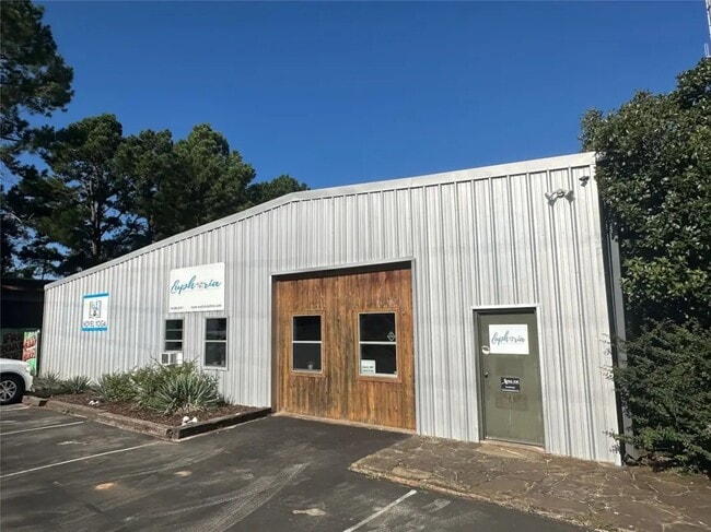
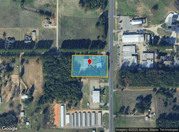
Property Record
6353 State Highway 19 N, Athens, TX 75752
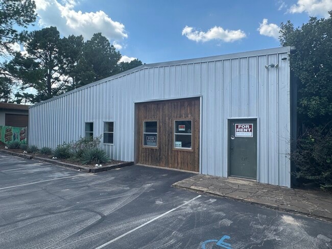
Current Lease Availabilities
NEARBY LISTINGS FOR SALE OR LEASE
Property Detail
6353 State Highway 19 N
Athens, TX
B C Walters Sur
0797-0120-0000-00
AB 797 B C WALTERS SUR, TR 12(REF:LT 2H) (SMITH TRACT)
Commercialnec
Henderson
X
Texas
48213C0330E
2h
2024
2.22 AC
2025
Henderson County
950400
Dallas/Ft Worth
10,510 SF
DEMOGRAPHICS near 6353 State Highway 19 N
1 Mile
3 Mile
5 Mile
2024 Total Population
532
10,346
15,545
2029 Population
562
10,965
16,479
Pop Growth 2024-2029
+ 5.64%
+ 5.98%
+ 6.01%
Average Age
41
39
40
2024 Total Households
194
3,691
5,762
HH Growth 2024-2029
+ 5.67%
+ 5.74%
+ 5.83%
Median Household Inc
$37,222
$43,325
$49,169
Avg Household Size
2.40
2.50
2.50
2024 Avg HH Vehicles
1.00
2.00
2.00
Median Home Value
$150,000
$113,732
$150,000
Median Year Built
1983
1975
1978
Nearby Places
Map Layers
Map Styles
 Street
 Aerial
- Restaurants
- Banks
- Shops
- Fitness
- Groceries
PUBLIC TRANSPORTATION
AIRPORT
Tyler Pounds Regional
DRIVE
WALK
Distance
Tyler Pounds Regional
45 min
33.4 mi
Freight Ports
Port of Shreveport
DRIVE
WALK
Distance
Port of Shreveport
164 min
142.2 mi
Nearby Properties
Address
Land Use
TOTAL SIZE
Lot Size
Zoning
Address
Land Use
TOTAL SIZE
Lot Size
Zoning
40.91 AC
Address
Land Use
TOTAL SIZE
Lot Size
Zoning
8.02 AC
Address
Land Use
TOTAL SIZE
Lot Size
Zoning
43,612 SF
15.43 AC
Address
Land Use
TOTAL SIZE
Lot Size
Zoning
702,506 SF
35 AC
Address
Land Use
TOTAL SIZE
Lot Size
Zoning
2,254.90 AC
Address
Land Use
TOTAL SIZE
Lot Size
Zoning
1.02 AC
Address
Land Use
TOTAL SIZE
Lot Size
Zoning
154,664 SF
64.73 AC
Address
Land Use
TOTAL SIZE
Lot Size
Zoning
29,984 SF
7.79 AC
Address
Land Use
TOTAL SIZE
Lot Size
Zoning
69,056 SF
16.02 AC
Address
Land Use
TOTAL SIZE
Lot Size
Zoning
140,660 SF
36.75 AC
Address
Land Use
TOTAL SIZE
Lot Size
Zoning
32,077 SF
0.25 AC
Address
Land Use
TOTAL SIZE
Lot Size
Zoning
83,122 SF
5.42 AC
Address
Land Use
TOTAL SIZE
Lot Size
Zoning
38,975 SF
4.61 AC
Address
Land Use
TOTAL SIZE
Lot Size
Zoning
60,558 SF
7.37 AC
Address
Land Use
TOTAL SIZE
Lot Size
Zoning
14,765 SF
110.29 AC
Address
Land Use
TOTAL SIZE
Lot Size
Zoning
38,979 SF
2 AC
Address
Land Use
TOTAL SIZE
Lot Size
Zoning
59,394 SF
8.18 AC
Address
Land Use
TOTAL SIZE
Lot Size
Zoning
28,963 SF
10.11 AC
Address
Land Use
TOTAL SIZE
Lot Size
Zoning
20,883 SF
4.40 AC
Address
Land Use
TOTAL SIZE
Lot Size
Zoning
22,958 SF
1.94 AC
Address
Land Use
TOTAL SIZE
Lot Size
Zoning
151,225 SF
Address
Land Use
TOTAL SIZE
Lot Size
Zoning
64,650 SF
11.56 AC
Address
Land Use
TOTAL SIZE
Lot Size
Zoning
17,262 SF
17.41 AC
Address
Land Use
TOTAL SIZE
Lot Size
Zoning
52,792 SF
22.40 AC
Address
Land Use
TOTAL SIZE
Lot Size
Zoning
19,505 SF
24.43 AC
Address
Land Use
TOTAL SIZE
Lot Size
Zoning
20,774 SF
0.57 AC
Address
Land Use
TOTAL SIZE
Lot Size
Zoning
20,076 SF
6 AC
Address
Land Use
TOTAL SIZE
Lot Size
Zoning
9,780 SF
2.61 AC
Address
Land Use
TOTAL SIZE
Lot Size
Zoning
23,715 SF
0.28 AC
Address
Land Use
TOTAL SIZE
Lot Size
Zoning
19,025 SF
2.72 AC
The World's #1 Commercial Real Estate Marketplace
Connect with us
© 2025 CoStar Group
The information above has been obtained from sources believed reliable. While we do not doubt its accuracy we have not verified it and make no guarantee, warranty or representation about it. It is your responsibility to independently confirm its accuracy and completeness. Any projections, opinions, assumptions, or estimates used are for example only and do not represent the current or future performance of the property. The value of this transaction to you depends on tax and other factors which should be evaluated by your tax, financial, and legal advisors. You and your advisors should conduct a careful, independent investigation of the property to determine to your satisfaction the suitability of the property for your needs.