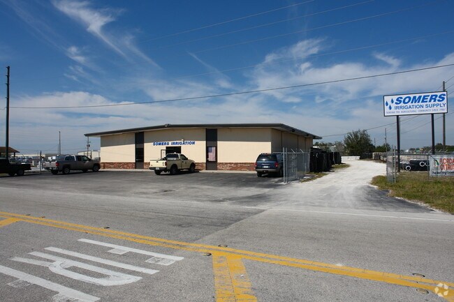
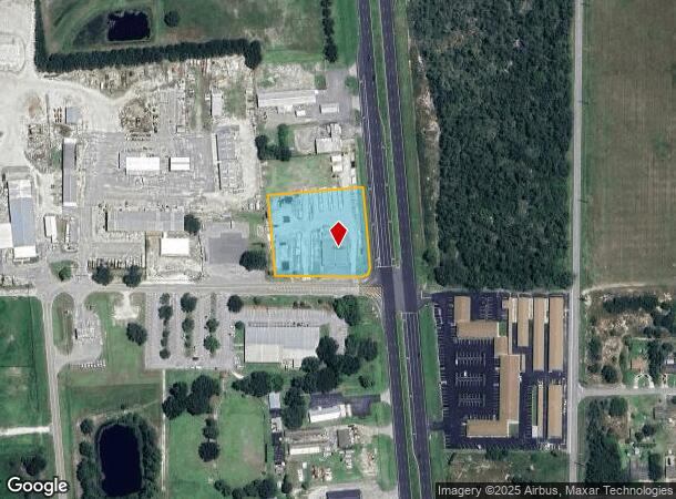
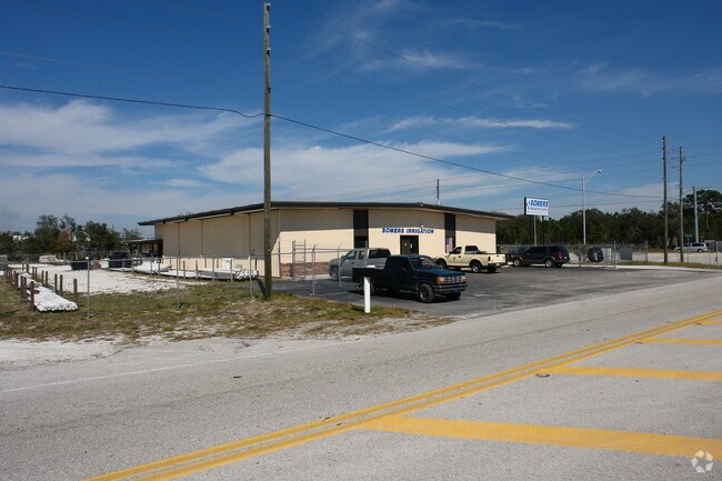
Property Record
6353 Us 27 S, Sebring, FL 33870
NEARBY LISTINGS FOR SALE OR LEASE
Property Detail
6353 Us 27 S
Sebring, FL
Skyview Sub Sec 1
C-09-35-29-050-0000-0110
SKYVIEW SUB SEC 1 PB 9 PG 20 LOTS 11 + 12
Storemultistory
Highlands
X
Florida
12055C0233C
11,12
2024
1.83 AC
2025
Florida Central South Area
960800
Other Market Areas
3,732 SF
DEMOGRAPHICS near 6353 Us 27 S
1 Mile
3 Mile
5 Mile
2024 Total Population
809
11,459
27,205
2029 Population
875
12,643
29,703
Pop Growth 2024-2029
+ 8.16%
+ 10.33%
+ 9.18%
Average Age
49
51
49
2024 Total Households
352
5,285
12,008
HH Growth 2024-2029
+ 8.24%
+ 10.41%
+ 9.37%
Median Household Inc
$44,374
$35,217
$40,529
Avg Household Size
2.30
2.10
2.20
2024 Avg HH Vehicles
3.00
1.00
1.00
Median Home Value
$148,157
$106,477
$144,728
Median Year Built
1980
1983
1983
Nearby Places
Map Layers
Map Styles
 Street
 Aerial
- Restaurants
- Banks
- Shops
- Fitness
- Groceries
PUBLIC TRANSPORTATION
COMMUTER RAIL
Sebring Amtrak Station (Silver Meteor - Amtrak, Silver Star - Amtrak)
DRIVE
WALK
Distance
Sebring Amtrak Station (Silver Meteor - Amtrak, Silver Star - Amtrak)
10 min
5.1 mi
Freight Ports
Port of Tampa Bay
DRIVE
WALK
Distance
Port of Tampa Bay
130 min
93.1 mi
Nearby Properties
Address
Land Use
TOTAL SIZE
Lot Size
Zoning
Address
Land Use
TOTAL SIZE
Lot Size
Zoning
123,239 SF
10.51 AC
C1
Address
Land Use
TOTAL SIZE
Lot Size
Zoning
128,672 SF
6.84 AC
C1
Address
Land Use
TOTAL SIZE
Lot Size
Zoning
40,295 SF
1.65 AC
C1
Address
Land Use
TOTAL SIZE
Lot Size
Zoning
78,313 SF
18.85 AC
PU
Address
Land Use
TOTAL SIZE
Lot Size
Zoning
76,186 SF
6.38 AC
C1
Address
Land Use
TOTAL SIZE
Lot Size
Zoning
70,602 SF
50 AC
PU
Address
Land Use
TOTAL SIZE
Lot Size
Zoning
41,822 SF
4.11 AC
C1
Address
Land Use
TOTAL SIZE
Lot Size
Zoning
82,784 SF
12.22 AC
R3FUD
Address
Land Use
TOTAL SIZE
Lot Size
Zoning
113,523 SF
11.38 AC
R1
Address
Land Use
TOTAL SIZE
Lot Size
Zoning
53,075 SF
12.27 AC
R3FUD
Address
Land Use
TOTAL SIZE
Lot Size
Zoning
49,298 SF
33.38 AC
PU
Address
Land Use
TOTAL SIZE
Lot Size
Zoning
34,234 SF
3.46 AC
C1
Address
Land Use
TOTAL SIZE
Lot Size
Zoning
40,680 SF
5.29 AC
C1
Address
Land Use
TOTAL SIZE
Lot Size
Zoning
4,693 SF
13.79 AC
CG1
Address
Land Use
TOTAL SIZE
Lot Size
Zoning
49,983 SF
7.31 AC
MUQD
Address
Land Use
TOTAL SIZE
Lot Size
Zoning
114,966 SF
13.81 AC
R2
Address
Land Use
TOTAL SIZE
Lot Size
Zoning
43,588 SF
5.43 AC
C1
Address
Land Use
TOTAL SIZE
Lot Size
Zoning
3,015 SF
10.23 AC
CG3
Address
Land Use
TOTAL SIZE
Lot Size
Zoning
50,426 SF
6.83 AC
C1
Address
Land Use
TOTAL SIZE
Lot Size
Zoning
28,766 SF
32.17 AC
CG2
Address
Land Use
TOTAL SIZE
Lot Size
Zoning
28,360 SF
13.47 AC
B3
Address
Land Use
TOTAL SIZE
Lot Size
Zoning
29,619 SF
2.45 AC
C1
Address
Land Use
TOTAL SIZE
Lot Size
Zoning
2,986 SF
10.14 AC
RV
Address
Land Use
TOTAL SIZE
Lot Size
Zoning
23,072 SF
1.02 AC
C1
Address
Land Use
TOTAL SIZE
Lot Size
Zoning
52,657 SF
5.75 AC
R3
Address
Land Use
TOTAL SIZE
Lot Size
Zoning
20,931 SF
183.34 AC
R1A
Address
Land Use
TOTAL SIZE
Lot Size
Zoning
1,024 SF
7.22 AC
CG3
Address
Land Use
TOTAL SIZE
Lot Size
Zoning
5,830 SF
2.55 AC
C1
Address
Land Use
TOTAL SIZE
Lot Size
Zoning
45,833 SF
4.41 AC
C1
Address
Land Use
TOTAL SIZE
Lot Size
Zoning
34,104 SF
2.98 AC
C1
The World's #1 Commercial Real Estate Marketplace
Connect with us
© 2025 CoStar Group
The information above has been obtained from sources believed reliable. While we do not doubt its accuracy we have not verified it and make no guarantee, warranty or representation about it. It is your responsibility to independently confirm its accuracy and completeness. Any projections, opinions, assumptions, or estimates used are for example only and do not represent the current or future performance of the property. The value of this transaction to you depends on tax and other factors which should be evaluated by your tax, financial, and legal advisors. You and your advisors should conduct a careful, independent investigation of the property to determine to your satisfaction the suitability of the property for your needs.