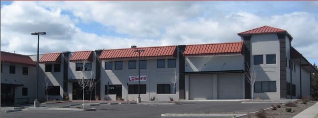
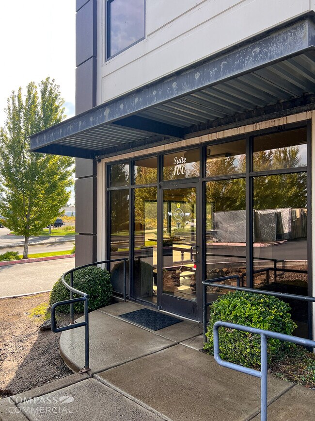
Property Record
63595 Hunnell Rd, Bend, OR 97703


Property Detail
63595 Hunnell Rd
206000
TRIANGLE CENTER LOT 1
Commercialnec
Deschutes
CG
Oregon
B and X Area of moderate flood hazard, usually the area between the limits of the 100-year and 500-year floods.
1
2025
2.15 AC
2025
Deschutes County
001102
Portland
30,000 SF
Bend, OR
NEARBY LISTINGS FOR SALE OR LEASE
DEMOGRAPHICS near 63595 Hunnell Rd
1 mile
3 mile
5 mile
2025 Total Population
3,687
31,508
78,553
2030 Population
3,731
32,172
80,417
Pop Growth 2025-2030
+ 1.19%
+ 2.11%
+ 2.37%
Average Age
40
41
41
2025 Total Households
1,321
12,345
32,533
HH Growth 2025-2030
+ 1.21%
+ 2.04%
+ 2.32%
Median Household Inc
$116,684
$112,080
$103,348
Avg Household Size
2.60
2.50
2.30
2025 Avg HH Vehicles
3.00
2.00
2.00
Median Home Value
$749,636
$766,478
$785,472
Median Year Built
2002
1999
1998
Nearby Places
Map Layers
Map Styles
 Street
 Aerial
Layers
 Traffic
 Biking
Places
Listings with unknown addresses are not visible on the map
- Restaurants
- Banks
- Shops
- Fitness
- Groceries
PUBLIC TRANSPORTATION
AIRPORT
Roberts Field
Drive
Walk
Distance
Roberts Field
20 min
13.4 mi
SALE & LEASE HISTORY
LISTING DATE
SALE/LEASE

Sep 25, 2025
For Lease
Oct 02, 2018
For Lease
Nearby Properties
Address
Land Use
TOTAL SIZE
Lot Size
Zoning
Address
Land Use
TOTAL SIZE
Lot Size
Zoning
12,000 SF
2.77 AC
IL
Address
Land Use
TOTAL SIZE
Lot Size
Zoning
2.77 AC
IL
Address
Land Use
TOTAL SIZE
Lot Size
Zoning
7.99 AC
IL
Address
Land Use
TOTAL SIZE
Lot Size
Zoning
7.99 AC
IL
Address
Land Use
TOTAL SIZE
Lot Size
Zoning
317,867 SF
32.72 AC
CG
Address
Land Use
TOTAL SIZE
Lot Size
Zoning
1,546 SF
6.41 AC
RH
Address
Land Use
TOTAL SIZE
Lot Size
Zoning
229,286 SF
17.96 AC
CG
Address
Land Use
TOTAL SIZE
Lot Size
Zoning
70,294 SF
17.96 AC
CG
Address
Land Use
TOTAL SIZE
Lot Size
Zoning
24.36 AC
Address
Land Use
TOTAL SIZE
Lot Size
Zoning
24.36 AC
IG
Address
Land Use
TOTAL SIZE
Lot Size
Zoning
24.36 AC
IG
Address
Land Use
TOTAL SIZE
Lot Size
Zoning
171,588 SF
4.94 AC
PO
Address
Land Use
TOTAL SIZE
Lot Size
Zoning
12.04 AC
IL
Address
Land Use
TOTAL SIZE
Lot Size
Zoning
120,306 SF
12.04 AC
IL
Address
Land Use
TOTAL SIZE
Lot Size
Zoning
134,322 SF
13.62 AC
CG
Address
Land Use
TOTAL SIZE
Lot Size
Zoning
4.59 AC
RM
Address
Land Use
TOTAL SIZE
Lot Size
Zoning
179,148 SF
17.14 AC
Address
Land Use
TOTAL SIZE
Lot Size
Zoning
96,202 SF
4.28 AC
RM
Address
Land Use
TOTAL SIZE
Lot Size
Zoning
3.67 AC
IL
Address
Land Use
TOTAL SIZE
Lot Size
Zoning
3.67 AC
IL
Address
Land Use
TOTAL SIZE
Lot Size
Zoning
6.92 AC
Address
Land Use
TOTAL SIZE
Lot Size
Zoning
26,752 SF
6.92 AC
IL
Address
Land Use
TOTAL SIZE
Lot Size
Zoning
13,376 SF
6.92 AC
Address
Land Use
TOTAL SIZE
Lot Size
Zoning
70,294 SF
6 AC
CG
Address
Land Use
TOTAL SIZE
Lot Size
Zoning
95,815 SF
8.66 AC
CG
Address
Land Use
TOTAL SIZE
Lot Size
Zoning
17,948 SF
7.52 AC
CL
Address
Land Use
TOTAL SIZE
Lot Size
Zoning
43,915 SF
8.76 AC
IL
Address
Land Use
TOTAL SIZE
Lot Size
Zoning
80,300 SF
8.76 AC
IL
Address
Land Use
TOTAL SIZE
Lot Size
Zoning
94,548 SF
5.22 AC
CL
The World's #1 Commercial Real Estate Marketplace
Connect with us
© 2026 CoStar Group
The information above has been obtained from sources believed reliable. While we do not doubt its accuracy we have not verified it and make no guarantee, warranty or representation about it. It is your responsibility to independently confirm its accuracy and completeness. Any projections, opinions, assumptions, or estimates used are for example only and do not represent the current or future performance of the property. The value of this transaction to you depends on tax and other factors which should be evaluated by your tax, financial, and legal advisors. You and your advisors should conduct a careful, independent investigation of the property to determine to your satisfaction the suitability of the property for your needs.