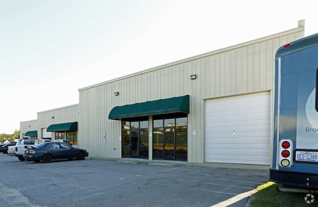
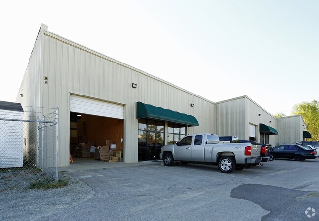
Property Record
636 Old Roberts Rd, Benson, NC 27504

Property Detail
636 Old Roberts Rd
13E04053E
LOT 6 319 FLEX 70/238
Multipleuses
Johnston
IND
North Carolina
B and X Area of moderate flood hazard, usually the area between the limits of the 100-year and 500-year floods.
6
2025
0.90 AC
2025
Johnston County
041504
Raleigh/Durham
12,060 SF
Raleigh-Cary, NC
NEARBY LISTINGS FOR SALE OR LEASE
-
-
View all Benson listings for sale on LoopNet.com
DEMOGRAPHICS near 636 Old Roberts Rd
1 mile
3 mile
5 mile
2025 Total Population
2,406
14,537
44,046
2030 Population
2,705
16,254
49,012
Pop Growth 2025-2030
+ 12.43%
+ 11.81%
+ 11.27%
Average Age
38
38
38
2025 Total Households
851
5,175
15,516
HH Growth 2025-2030
+ 12.46%
+ 11.88%
+ 11.35%
Median Household Inc
$77,947
$96,044
$104,664
Avg Household Size
2.80
2.70
2.80
2025 Avg HH Vehicles
2.00
2.00
2.00
Median Home Value
$290,872
$345,211
$364,298
Median Year Built
2006
2003
2004
Nearby Places
Map Layers
Map Styles
 Street
 Aerial
Transit
 Traffic
 Biking
Places
Listings with unknown addresses are not visible on the map
- Restaurants
- Banks
- Shops
- Fitness
- Groceries
PUBLIC TRANSPORTATION
AIRPORT
Raleigh-Durham International
Drive
Walk
Distance
Raleigh-Durham International
47 min
37.4 mi
SALE & LEASE HISTORY
LISTING DATE
SALE/LEASE

Sep 28, 2016
For Sale
Sep 24, 2016
For Sale
Mar 27, 2019
For Sale
Nearby Properties
Address
Land Use
TOTAL SIZE
Lot Size
Zoning
Address
Land Use
TOTAL SIZE
Lot Size
Zoning
31,796 SF
87.86 AC
RAG
Address
Land Use
TOTAL SIZE
Lot Size
Zoning
16,151 SF
51.85 AC
RAG
Address
Land Use
TOTAL SIZE
Lot Size
Zoning
16,236 SF
38.57 AC
RES
Address
Land Use
TOTAL SIZE
Lot Size
Zoning
93,981 SF
3.23 AC
IND
Address
Land Use
TOTAL SIZE
Lot Size
Zoning
64,632 SF
16.35 AC
COM
Address
Land Use
TOTAL SIZE
Lot Size
Zoning
1,681 SF
4.89 AC
COM
Address
Land Use
TOTAL SIZE
Lot Size
Zoning
8,982 SF
9.42 AC
RAG
Address
Land Use
TOTAL SIZE
Lot Size
Zoning
6,900 SF
2.26 AC
COP
Address
Land Use
TOTAL SIZE
Lot Size
Zoning
15,582 SF
2.87 AC
COM
Address
Land Use
TOTAL SIZE
Lot Size
Zoning
293.36 AC
RAG
Address
Land Use
TOTAL SIZE
Lot Size
Zoning
9,000 SF
3.34 AC
COM
Address
Land Use
TOTAL SIZE
Lot Size
Zoning
39.67 AC
COM
Address
Land Use
TOTAL SIZE
Lot Size
Zoning
2,850 SF
197.63 AC
RAG
Address
Land Use
TOTAL SIZE
Lot Size
Zoning
81.10 AC
RAG
Address
Land Use
TOTAL SIZE
Lot Size
Zoning
6,577 SF
2.64 AC
COM
Address
Land Use
TOTAL SIZE
Lot Size
Zoning
8,464 SF
1.33 AC
COM
Address
Land Use
TOTAL SIZE
Lot Size
Zoning
3,925 SF
1.55 AC
COM
Address
Land Use
TOTAL SIZE
Lot Size
Zoning
69.49 AC
RAG
Address
Land Use
TOTAL SIZE
Lot Size
Zoning
209.23 AC
RAG
Address
Land Use
TOTAL SIZE
Lot Size
Zoning
3,914 SF
2.30 AC
IND
Address
Land Use
TOTAL SIZE
Lot Size
Zoning
3,000 SF
3.33 AC
COM
Address
Land Use
TOTAL SIZE
Lot Size
Zoning
10,446 SF
1.50 AC
COM
Address
Land Use
TOTAL SIZE
Lot Size
Zoning
4,064 SF
1.08 AC
COM
Address
Land Use
TOTAL SIZE
Lot Size
Zoning
3,320 SF
1.59 AC
COM
Address
Land Use
TOTAL SIZE
Lot Size
Zoning
7,192 SF
7.90 AC
RAG
Address
Land Use
TOTAL SIZE
Lot Size
Zoning
5,520 SF
6.83 AC
RAG
Address
Land Use
TOTAL SIZE
Lot Size
Zoning
6,591 SF
4.03 AC
IND
Address
Land Use
TOTAL SIZE
Lot Size
Zoning
5,000 SF
4.61 AC
COP
Address
Land Use
TOTAL SIZE
Lot Size
Zoning
1,864 SF
85.80 AC
COM
The World's #1 Commercial Real Estate Marketplace
Connect with us
© 2026 CoStar Group
The information above has been obtained from sources believed reliable. While we do not doubt its accuracy we have not verified it and make no guarantee, warranty or representation about it. It is your responsibility to independently confirm its accuracy and completeness. Any projections, opinions, assumptions, or estimates used are for example only and do not represent the current or future performance of the property. The value of this transaction to you depends on tax and other factors which should be evaluated by your tax, financial, and legal advisors. You and your advisors should conduct a careful, independent investigation of the property to determine to your satisfaction the suitability of the property for your needs.