Property Record
6363 John J Pershing Dr, Omaha, NE 68110
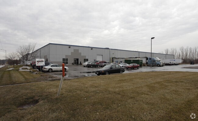

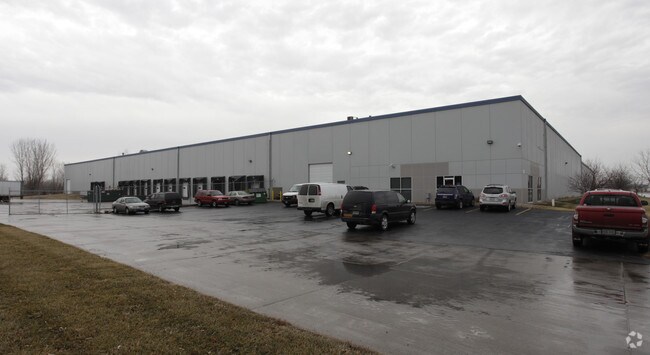
Property Detail
6363 John J Pershing Dr
Omaha, NE-IA
UNION LAND COS 1ST ADD REP 1* LOT 2 BLOCK 0 LT 2
3935-0060-23
Douglas
Warehouse
Nebraska
2024
2
2025
6.88 AC
000400
Northeast Omaha
164,320 SF
Omaha/Council Bluffs
NEARBY LISTINGS FOR SALE OR LEASE
-
-
View all Omaha listings for sale on LoopNet.com
DEMOGRAPHICS near 6363 John J Pershing Dr
1 mile
3 mile
5 mile
2025 Total Population
4,599
48,016
161,586
2030 Population
4,869
49,658
166,506
Pop Growth 2025-2030
+ 5.87%
+ 3.42%
+ 3.04%
Average Age
37
37
37
2025 Total Households
1,690
16,937
65,610
HH Growth 2025-2030
+ 6.15%
+ 3.68%
+ 3.39%
Median Household Inc
$48,134
$47,189
$54,774
Avg Household Size
2.60
2.60
2.30
2025 Avg HH Vehicles
2.00
2.00
2.00
Median Home Value
$115,830
$135,641
$175,026
Median Year Built
1948
1955
1956
Nearby Places
Map Layers
Map Styles
 Street
 Aerial
Layers
 Traffic
 Biking
Places
Listings with unknown addresses are not visible on the map
- Restaurants
- Banks
- Shops
- Fitness
- Groceries
PUBLIC TRANSPORTATION
AIRPORT
Eppley Airfield
Drive
Walk
Distance
Eppley Airfield
9 min
3.5 mi
Nearby Properties
Address
Land Use
TOTAL SIZE
Lot Size
Zoning
Address
Land Use
TOTAL SIZE
Lot Size
Zoning
39.68 AC
Address
Land Use
TOTAL SIZE
Lot Size
Zoning
18.12 AC
Address
Land Use
TOTAL SIZE
Lot Size
Zoning
540,097 SF
20.98 AC
GI
Address
Land Use
TOTAL SIZE
Lot Size
Zoning
184,154 SF
9.93 AC
Address
Land Use
TOTAL SIZE
Lot Size
Zoning
69,554 SF
3.45 AC
Address
Land Use
TOTAL SIZE
Lot Size
Zoning
200,000 SF
11.49 AC
GI
Address
Land Use
TOTAL SIZE
Lot Size
Zoning
142,451 SF
19.14 AC
Address
Land Use
TOTAL SIZE
Lot Size
Zoning
2.23 AC
Address
Land Use
TOTAL SIZE
Lot Size
Zoning
113,216 SF
12.93 AC
GI
Address
Land Use
TOTAL SIZE
Lot Size
Zoning
58,945 SF
3.97 AC
Address
Land Use
TOTAL SIZE
Lot Size
Zoning
119,236 SF
Address
Land Use
TOTAL SIZE
Lot Size
Zoning
Address
Land Use
TOTAL SIZE
Lot Size
Zoning
111,770 SF
2.65 AC
Address
Land Use
TOTAL SIZE
Lot Size
Zoning
149,796 SF
13.08 AC
GI
Address
Land Use
TOTAL SIZE
Lot Size
Zoning
97,422 SF
4.06 AC
Address
Land Use
TOTAL SIZE
Lot Size
Zoning
383,283 SF
11.94 AC
GI
Address
Land Use
TOTAL SIZE
Lot Size
Zoning
198,000 SF
14.90 AC
GI
Address
Land Use
TOTAL SIZE
Lot Size
Zoning
1.78 AC
Address
Land Use
TOTAL SIZE
Lot Size
Zoning
246,595 SF
17.53 AC
HI
Address
Land Use
TOTAL SIZE
Lot Size
Zoning
1.90 AC
Address
Land Use
TOTAL SIZE
Lot Size
Zoning
4.76 AC
Address
Land Use
TOTAL SIZE
Lot Size
Zoning
90,000 SF
7.64 AC
GI
Address
Land Use
TOTAL SIZE
Lot Size
Zoning
1.96 AC
Address
Land Use
TOTAL SIZE
Lot Size
Zoning
88,628 SF
7.80 AC
GI
Address
Land Use
TOTAL SIZE
Lot Size
Zoning
9.25 AC
Address
Land Use
TOTAL SIZE
Lot Size
Zoning
62,500 SF
9.84 AC
Address
Land Use
TOTAL SIZE
Lot Size
Zoning
88,125 SF
18.15 AC
GI
Address
Land Use
TOTAL SIZE
Lot Size
Zoning
86,745 SF
7.17 AC
The World's #1 Commercial Real Estate Marketplace
Connect with us
© 2026 CoStar Group
The information above has been obtained from sources believed reliable. While we do not doubt its accuracy we have not verified it and make no guarantee, warranty or representation about it. It is your responsibility to independently confirm its accuracy and completeness. Any projections, opinions, assumptions, or estimates used are for example only and do not represent the current or future performance of the property. The value of this transaction to you depends on tax and other factors which should be evaluated by your tax, financial, and legal advisors. You and your advisors should conduct a careful, independent investigation of the property to determine to your satisfaction the suitability of the property for your needs.