Property Record
6366 Telegraph Rd, Saint Louis, MO 63129
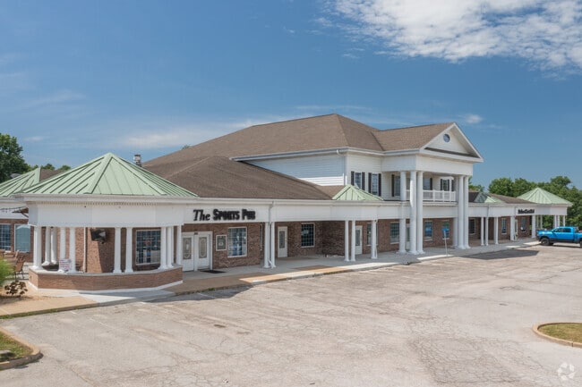


Property Detail
6366 Telegraph Rd
33H-13-0871
VICTROIA CROSSING PLAZA LOT 1
Regionalshoppingcenterormallwithanchorstore
Saint Louis
NU
Missouri
B and X Area of moderate flood hazard, usually the area between the limits of the 100-year and 500-year floods.
1
2024
7.83 AC
2025
Southwest County
220445
St. Louis
34,248 SF
St. Louis, MO-IL
NEARBY LISTINGS FOR SALE OR LEASE
DEMOGRAPHICS near 6366 Telegraph Rd
1 mile
3 mile
5 mile
2025 Total Population
7,323
40,407
101,542
2030 Population
7,153
39,741
100,356
Pop Growth 2025-2030
(2.32%)
(1.65%)
(1.17%)
Average Age
45
44
43
2025 Total Households
2,793
16,096
42,589
HH Growth 2025-2030
(2.36%)
(1.66%)
(1.17%)
Median Household Inc
$109,121
$103,987
$86,617
Avg Household Size
2.60
2.50
2.30
2025 Avg HH Vehicles
2.00
2.00
2.00
Median Home Value
$353,313
$291,391
$270,811
Median Year Built
1983
1978
1977
Nearby Places
Map Layers
Map Styles
 Street
 Aerial
Layers
 Traffic
 Biking
Places
Listings with unknown addresses are not visible on the map
- Restaurants
- Banks
- Shops
- Fitness
- Groceries
PUBLIC TRANSPORTATION
AIRPORT
St Louis Lambert International
Drive
Walk
Distance
St Louis Lambert International
46 min
25.3 mi
Scott AFB/Midamerica St Louis
Drive
Walk
Distance
Scott AFB/Midamerica St Louis
56 min
38.6 mi
SALE & LEASE HISTORY
LISTING DATE
SALE/LEASE

Sep 25, 2016
For Lease
Nearby Properties
Address
Land Use
TOTAL SIZE
Lot Size
Zoning
Address
Land Use
TOTAL SIZE
Lot Size
Zoning
9,211 SF
193.33 AC
RS
Address
Land Use
TOTAL SIZE
Lot Size
Zoning
31.25 AC
R2
Address
Land Use
TOTAL SIZE
Lot Size
Zoning
225,758 SF
16.85 AC
R4
Address
Land Use
TOTAL SIZE
Lot Size
Zoning
342,288 SF
19.97 AC
R7
Address
Land Use
TOTAL SIZE
Lot Size
Zoning
27.92 AC
R2
Address
Land Use
TOTAL SIZE
Lot Size
Zoning
53,714 SF
59.99 AC
FPNU
Address
Land Use
TOTAL SIZE
Lot Size
Zoning
237,114 SF
18.12 AC
M1
Address
Land Use
TOTAL SIZE
Lot Size
Zoning
900 SF
82.33 AC
NU
Address
Land Use
TOTAL SIZE
Lot Size
Zoning
315,332 SF
53.99 AC
CT1
Address
Land Use
TOTAL SIZE
Lot Size
Zoning
143,076 SF
18.99 AC
C-8
Address
Land Use
TOTAL SIZE
Lot Size
Zoning
127,090 SF
11.28 AC
C-8
Address
Land Use
TOTAL SIZE
Lot Size
Zoning
205,040 SF
13.93 AC
M
Address
Land Use
TOTAL SIZE
Lot Size
Zoning
58,287 SF
18.90 AC
NU
Address
Land Use
TOTAL SIZE
Lot Size
Zoning
197.30 AC
PS
Address
Land Use
TOTAL SIZE
Lot Size
Zoning
130,680 SF
9.99 AC
R7
Address
Land Use
TOTAL SIZE
Lot Size
Zoning
170,620 SF
8.62 AC
CT1
Address
Land Use
TOTAL SIZE
Lot Size
Zoning
8.89 AC
R3
Address
Land Use
TOTAL SIZE
Lot Size
Zoning
151,960 SF
10.88 AC
R2
Address
Land Use
TOTAL SIZE
Lot Size
Zoning
13.03 AC
NU
Address
Land Use
TOTAL SIZE
Lot Size
Zoning
11.81 AC
R2
Address
Land Use
TOTAL SIZE
Lot Size
Zoning
138,485 SF
11.50 AC
R2
Address
Land Use
TOTAL SIZE
Lot Size
Zoning
1,244 SF
15.24 AC
R2
Address
Land Use
TOTAL SIZE
Lot Size
Zoning
221,956 SF
14.53 AC
CT1
Address
Land Use
TOTAL SIZE
Lot Size
Zoning
6.95 AC
R2
Address
Land Use
TOTAL SIZE
Lot Size
Zoning
62,170 SF
7.56 AC
FPM1
Address
Land Use
TOTAL SIZE
Lot Size
Zoning
8.29 AC
NU
Address
Land Use
TOTAL SIZE
Lot Size
Zoning
61,500 SF
5.09 AC
Address
Land Use
TOTAL SIZE
Lot Size
Zoning
107,700 SF
7.81 AC
Address
Land Use
TOTAL SIZE
Lot Size
Zoning
4.96 AC
NU
Address
Land Use
TOTAL SIZE
Lot Size
Zoning
139,500 SF
8.60 AC
CT1
The World's #1 Commercial Real Estate Marketplace
Connect with us
© 2026 CoStar Group
The information above has been obtained from sources believed reliable. While we do not doubt its accuracy we have not verified it and make no guarantee, warranty or representation about it. It is your responsibility to independently confirm its accuracy and completeness. Any projections, opinions, assumptions, or estimates used are for example only and do not represent the current or future performance of the property. The value of this transaction to you depends on tax and other factors which should be evaluated by your tax, financial, and legal advisors. You and your advisors should conduct a careful, independent investigation of the property to determine to your satisfaction the suitability of the property for your needs.