Property Record
6369 Us Highway 50 E, Carson City, NV 89701
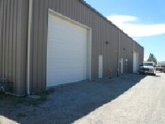


Property Detail
6369 Us Highway 50 E
008-522-11
ADDITIONAL BUILDING ON PROPERTY
Lightindustrial
Carson City
GI
Nevada
B and X Area of moderate flood hazard, usually the area between the limits of the 100-year and 500-year floods.
1.52 AC
2025
Carson City County
2025
Reno/Sparks
001002
Carson City, NV
19,230 SF
NEARBY LISTINGS FOR SALE OR LEASE
DEMOGRAPHICS near 6369 Us Highway 50 E
1 mile
3 mile
5 mile
2025 Total Population
297
16,518
50,556
2030 Population
291
16,410
50,373
Pop Growth 2025-2030
(2.02%)
(0.65%)
(0.36%)
Average Age
42
42
43
2025 Total Households
108
6,413
20,596
HH Growth 2025-2030
(1.85%)
(0.87%)
(0.39%)
Median Household Inc
$76,667
$64,374
$68,485
Avg Household Size
2.70
2.50
2.30
2025 Avg HH Vehicles
2.00
2.00
2.00
Median Home Value
$399,999
$359,482
$424,355
Median Year Built
1979
1981
1980
Nearby Places
Map Layers
Map Styles
 Street
 Aerial
Layers
 Traffic
 Biking
Places
Listings with unknown addresses are not visible on the map
- Restaurants
- Banks
- Shops
- Fitness
- Groceries
PUBLIC TRANSPORTATION
AIRPORT
Reno/Tahoe International
Drive
Walk
Distance
Reno/Tahoe International
55 min
34.0 mi
Freight Ports
Port of Stockton
Drive
Walk
Distance
Port of Stockton
223 min
155.7 mi
SALE & LEASE HISTORY
LISTING DATE
SALE/LEASE

Sep 01, 2021
For Sale
Nearby Properties
Address
Land Use
TOTAL SIZE
Lot Size
Zoning
Address
Land Use
TOTAL SIZE
Lot Size
Zoning
7,419 SF
0.71 AC
PR
Address
Land Use
TOTAL SIZE
Lot Size
Zoning
96,057 SF
10 AC
LI
Address
Land Use
TOTAL SIZE
Lot Size
Zoning
240 AC
PR
Address
Land Use
TOTAL SIZE
Lot Size
Zoning
109,200 SF
9.35 AC
GC
Address
Land Use
TOTAL SIZE
Lot Size
Zoning
89,408 SF
39.22 AC
P
Address
Land Use
TOTAL SIZE
Lot Size
Zoning
29.98 AC
PC
Address
Land Use
TOTAL SIZE
Lot Size
Zoning
375 SF
520 AC
PR
Address
Land Use
TOTAL SIZE
Lot Size
Zoning
178.40 AC
PR
Address
Land Use
TOTAL SIZE
Lot Size
Zoning
156,408 SF
2.08 AC
MFA-GC
Address
Land Use
TOTAL SIZE
Lot Size
Zoning
160,769 SF
15 AC
LI
Address
Land Use
TOTAL SIZE
Lot Size
Zoning
86,783 SF
52 AC
PR
Address
Land Use
TOTAL SIZE
Lot Size
Zoning
256.42 AC
Address
Land Use
TOTAL SIZE
Lot Size
Zoning
70,763 SF
9.54 AC
P
Address
Land Use
TOTAL SIZE
Lot Size
Zoning
85,751 SF
3.41 AC
Address
Land Use
TOTAL SIZE
Lot Size
Zoning
71,719 SF
1.89 AC
MFA
Address
Land Use
TOTAL SIZE
Lot Size
Zoning
30,481 SF
4.94 AC
Address
Land Use
TOTAL SIZE
Lot Size
Zoning
69,316 SF
2.91 AC
Address
Land Use
TOTAL SIZE
Lot Size
Zoning
80,880 SF
4 AC
Address
Land Use
TOTAL SIZE
Lot Size
Zoning
76,770 SF
2.92 AC
MFA
Address
Land Use
TOTAL SIZE
Lot Size
Zoning
30,228 SF
395.78 AC
PR
Address
Land Use
TOTAL SIZE
Lot Size
Zoning
270 AC
PC
Address
Land Use
TOTAL SIZE
Lot Size
Zoning
3,504 SF
39.83 AC
PR
Address
Land Use
TOTAL SIZE
Lot Size
Zoning
30,565 SF
9.99 AC
LI
Address
Land Use
TOTAL SIZE
Lot Size
Zoning
1,197.80 AC
CR
Address
Land Use
TOTAL SIZE
Lot Size
Zoning
99,544 SF
4.08 AC
RC
Address
Land Use
TOTAL SIZE
Lot Size
Zoning
39,411 SF
4.65 AC
LI
Address
Land Use
TOTAL SIZE
Lot Size
Zoning
33,126 SF
4.55 AC
PR
Address
Land Use
TOTAL SIZE
Lot Size
Zoning
14.61 AC
MFA-SF6-PR
Address
Land Use
TOTAL SIZE
Lot Size
Zoning
33,564 SF
1.68 AC
LI
Address
Land Use
TOTAL SIZE
Lot Size
Zoning
46,640 SF
2.50 AC
GI
The World's #1 Commercial Real Estate Marketplace
Connect with us
© 2026 CoStar Group
The information above has been obtained from sources believed reliable. While we do not doubt its accuracy we have not verified it and make no guarantee, warranty or representation about it. It is your responsibility to independently confirm its accuracy and completeness. Any projections, opinions, assumptions, or estimates used are for example only and do not represent the current or future performance of the property. The value of this transaction to you depends on tax and other factors which should be evaluated by your tax, financial, and legal advisors. You and your advisors should conduct a careful, independent investigation of the property to determine to your satisfaction the suitability of the property for your needs.