Property Record
637 2Nd St, Mc Farland, CA 93250
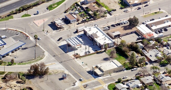

Property Detail
637 2Nd St
Bakersfield-Delano, CA
TRACT 1048 , BLOCK , LOT P 48
200-023-14-00-6
Kern
Servicestationmarket
California
C and X Area of minimal flood hazard, usually depicted on FIRMs as above the 500-year flood level.
p
2024
0.36 AC
2025
NW Outlying Kern County
004704
Bakersfield
1,224 SF
NEARBY LISTINGS FOR SALE OR LEASE
DEMOGRAPHICS near 637 2Nd St
1 mile
3 mile
5 mile
2025 Total Population
11,496
13,960
15,178
2030 Population
11,584
14,042
15,301
Pop Growth 2025-2030
+ 0.77%
+ 0.59%
+ 0.81%
Average Age
32
32
32
2025 Total Households
2,807
3,329
3,652
HH Growth 2025-2030
+ 0.75%
+ 0.69%
+ 0.96%
Median Household Inc
$52,278
$53,590
$53,777
Avg Household Size
4.10
4.10
4.10
2025 Avg HH Vehicles
2.00
2.00
2.00
Median Home Value
$274,257
$278,135
$280,886
Median Year Built
1985
1986
1986
Nearby Places
Map Layers
Map Styles
 Street
 Aerial
Layers
 Traffic
 Biking
Places
Listings with unknown addresses are not visible on the map
- Restaurants
- Banks
- Shops
- Fitness
- Groceries
PUBLIC TRANSPORTATION
AIRPORT
Meadows Field
Drive
Walk
Distance
Meadows Field
31 min
22.1 mi
SALE & LEASE HISTORY
LISTING DATE
SALE/LEASE

May 15, 2024
For Lease
Nearby Properties
Address
Land Use
TOTAL SIZE
Lot Size
Zoning
Address
Land Use
TOTAL SIZE
Lot Size
Zoning
2,726 SF
38.18 AC
A
Address
Land Use
TOTAL SIZE
Lot Size
Zoning
96,202 SF
33.67 AC
Address
Land Use
TOTAL SIZE
Lot Size
Zoning
96,202 SF
19.07 AC
Address
Land Use
TOTAL SIZE
Lot Size
Zoning
626.36 AC
A
Address
Land Use
TOTAL SIZE
Lot Size
Zoning
81,086 SF
12.46 AC
MH
Address
Land Use
TOTAL SIZE
Lot Size
Zoning
39.09 AC
A
Address
Land Use
TOTAL SIZE
Lot Size
Zoning
118.74 AC
A
Address
Land Use
TOTAL SIZE
Lot Size
Zoning
Address
Land Use
TOTAL SIZE
Lot Size
Zoning
33.17 AC
A
Address
Land Use
TOTAL SIZE
Lot Size
Zoning
3,091 SF
5.17 AC
R2
Address
Land Use
TOTAL SIZE
Lot Size
Zoning
15,630 SF
3.32 AC
Address
Land Use
TOTAL SIZE
Lot Size
Zoning
24.65 AC
A
Address
Land Use
TOTAL SIZE
Lot Size
Zoning
632.12 AC
A
Address
Land Use
TOTAL SIZE
Lot Size
Zoning
154.54 AC
A
Address
Land Use
TOTAL SIZE
Lot Size
Zoning
4.70 AC
Address
Land Use
TOTAL SIZE
Lot Size
Zoning
10,600 SF
0.89 AC
C-2
Address
Land Use
TOTAL SIZE
Lot Size
Zoning
13,328 SF
2.64 AC
R-3
Address
Land Use
TOTAL SIZE
Lot Size
Zoning
3,720 SF
62.60 AC
A FPS
Address
Land Use
TOTAL SIZE
Lot Size
Zoning
42,000 SF
15.92 AC
A
Address
Land Use
TOTAL SIZE
Lot Size
Zoning
37,424 SF
5.47 AC
R-4
Address
Land Use
TOTAL SIZE
Lot Size
Zoning
311.87 AC
A
Address
Land Use
TOTAL SIZE
Lot Size
Zoning
136.38 AC
Address
Land Use
TOTAL SIZE
Lot Size
Zoning
55.68 AC
A FPS
Address
Land Use
TOTAL SIZE
Lot Size
Zoning
4,369 SF
30.43 AC
A
Address
Land Use
TOTAL SIZE
Lot Size
Zoning
20.98 AC
A
Address
Land Use
TOTAL SIZE
Lot Size
Zoning
79.33 AC
A
Address
Land Use
TOTAL SIZE
Lot Size
Zoning
34.40 AC
Address
Land Use
TOTAL SIZE
Lot Size
Zoning
2,060 SF
79.09 AC
The World's #1 Commercial Real Estate Marketplace
Connect with us
© 2026 CoStar Group
The information above has been obtained from sources believed reliable. While we do not doubt its accuracy we have not verified it and make no guarantee, warranty or representation about it. It is your responsibility to independently confirm its accuracy and completeness. Any projections, opinions, assumptions, or estimates used are for example only and do not represent the current or future performance of the property. The value of this transaction to you depends on tax and other factors which should be evaluated by your tax, financial, and legal advisors. You and your advisors should conduct a careful, independent investigation of the property to determine to your satisfaction the suitability of the property for your needs.