Property Record
637 W Main St, Tilton, NH 03276

Current Lease Availabilities
Property Detail
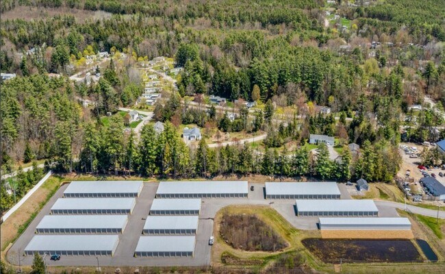
637 W Main St
Laconia, NH
BELKNAP
TILT-000016R-000001-000001
New Hampshire
Commercialnec
1
GENERA
6.75 AC
2025
Concord/New Hampshire North Area
2025
Other Market Areas
965598
NEARBY LISTINGS FOR SALE OR LEASE
-
-
View all Tilton listings for lease on LoopNet.com
DEMOGRAPHICS near 637 W Main St
1 mile
3 mile
5 mile
2025 Total Population
2,284
13,912
18,815
2030 Population
2,314
14,213
19,180
Pop Growth 2025-2030
+ 1.31%
+ 2.16%
+ 1.94%
Average Age
43
43
43
2025 Total Households
920
5,690
7,650
HH Growth 2025-2030
+ 1.30%
+ 2.13%
+ 1.87%
Median Household Inc
$71,112
$73,846
$78,999
Avg Household Size
2.30
2.30
2.40
2025 Avg HH Vehicles
2.00
2.00
2.00
Median Home Value
$288,480
$267,225
$282,852
Median Year Built
1966
1965
1970
Nearby Places
Map Layers
Map Styles
 Street
 Aerial
Layers
 Traffic
 Biking
Places
Listings with unknown addresses are not visible on the map
- Restaurants
- Banks
- Shops
- Fitness
- Groceries
Nearby Properties
Address
Land Use
TOTAL SIZE
Lot Size
Zoning
Address
Land Use
TOTAL SIZE
Lot Size
Zoning
588,961 SF
104.85 AC
REGION
Address
Land Use
TOTAL SIZE
Lot Size
Zoning
149,800 SF
28 AC
MEDIUM
Address
Land Use
TOTAL SIZE
Lot Size
Zoning
1.04 AC
MIXED
Address
Land Use
TOTAL SIZE
Lot Size
Zoning
58,142 SF
7 AC
VILLAG
Address
Land Use
TOTAL SIZE
Lot Size
Zoning
118,611 SF
12.40 AC
VILLAG
Address
Land Use
TOTAL SIZE
Lot Size
Zoning
1,974 SF
5.30 AC
REGION
Address
Land Use
TOTAL SIZE
Lot Size
Zoning
19,172 SF
83 AC
C
Address
Land Use
TOTAL SIZE
Lot Size
Zoning
146,540 SF
18.75 AC
REGION
Address
Land Use
TOTAL SIZE
Lot Size
Zoning
48,809 SF
10.83 AC
REGION
Address
Land Use
TOTAL SIZE
Lot Size
Zoning
143,764 SF
18.64 AC
REGION
Address
Land Use
TOTAL SIZE
Lot Size
Zoning
64,666 SF
8.65 AC
RSW&S
Address
Land Use
TOTAL SIZE
Lot Size
Zoning
68,029 SF
30.94 AC
REGION
Address
Land Use
TOTAL SIZE
Lot Size
Zoning
56,132 SF
9.74 AC
REGION
Address
Land Use
TOTAL SIZE
Lot Size
Zoning
Address
Land Use
TOTAL SIZE
Lot Size
Zoning
80,933 SF
3.79 AC
VILLAG
Address
Land Use
TOTAL SIZE
Lot Size
Zoning
16,833 SF
2.39 AC
B1W&S
Address
Land Use
TOTAL SIZE
Lot Size
Zoning
68,304 SF
11.62 AC
REGION
Address
Land Use
TOTAL SIZE
Lot Size
Zoning
42,523 SF
32.89 AC
R1SFSS
Address
Land Use
TOTAL SIZE
Lot Size
Zoning
93,102 SF
8.21 AC
GENERA
Address
Land Use
TOTAL SIZE
Lot Size
Zoning
20,276 SF
13.02 AC
VILLAG
Address
Land Use
TOTAL SIZE
Lot Size
Zoning
60.27 AC
R2MFSM
Address
Land Use
TOTAL SIZE
Lot Size
Zoning
83,283 SF
16.81 AC
RSW&S
Address
Land Use
TOTAL SIZE
Lot Size
Zoning
17,338 SF
4.07 AC
VILLAG
Address
Land Use
TOTAL SIZE
Lot Size
Zoning
38,159 SF
4 AC
R2MFSM
Address
Land Use
TOTAL SIZE
Lot Size
Zoning
14,126 SF
4.59 AC
REGION
Address
Land Use
TOTAL SIZE
Lot Size
Zoning
94,330 SF
14.70 AC
B1W&S
Address
Land Use
TOTAL SIZE
Lot Size
Zoning
215,790 SF
18 AC
I1
Address
Land Use
TOTAL SIZE
Lot Size
Zoning
54,592 SF
B1W&S
Address
Land Use
TOTAL SIZE
Lot Size
Zoning
2,032 SF
59.56 AC
MEDIUM
The World's #1 Commercial Real Estate Marketplace
Connect with us
© 2026 CoStar Group
The information above has been obtained from sources believed reliable. While we do not doubt its accuracy we have not verified it and make no guarantee, warranty or representation about it. It is your responsibility to independently confirm its accuracy and completeness. Any projections, opinions, assumptions, or estimates used are for example only and do not represent the current or future performance of the property. The value of this transaction to you depends on tax and other factors which should be evaluated by your tax, financial, and legal advisors. You and your advisors should conduct a careful, independent investigation of the property to determine to your satisfaction the suitability of the property for your needs.