Property Record
637 N Highway 17, Palatka, FL 32177
NEARBY LISTINGS FOR SALE OR LEASE
Property Detail
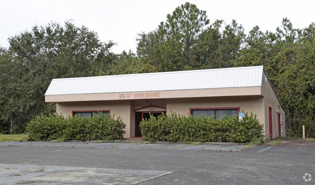
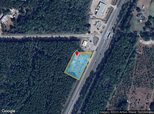
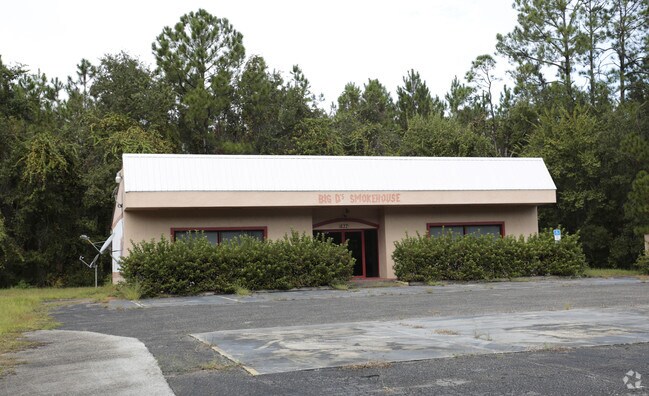
637 N Highway 17
13-09-26-0000-0120-0030
PT OF NW1/4 OF SW1/4 OR416, P1962
Restaurantbuilding
Putnam
X
Florida
12107C0185C
1.50 AC
2025
Florida Central North Area
2025
Other Market Areas
950100
Palatka, FL
2,040 SF
DEMOGRAPHICS near 637 N Highway 17
1 Mile
3 Mile
5 Mile
2024 Total Population
150
1,139
11,325
2029 Population
160
1,187
11,721
Pop Growth 2024-2029
+ 6.67%
+ 4.21%
+ 3.50%
Average Age
44
45
41
2024 Total Households
61
457
4,415
HH Growth 2024-2029
+ 4.92%
+ 4.38%
+ 3.40%
Median Household Inc
$61,875
$54,091
$33,087
Avg Household Size
2.40
2.40
2.50
2024 Avg HH Vehicles
2.00
2.00
2.00
Median Home Value
$163,043
$207,547
$136,915
Median Year Built
1989
1986
1975
Nearby Places
- Restaurants
- Banks
- Shops
- Fitness
- Groceries
PUBLIC TRANSPORTATION
COMMUTER RAIL
Palatka Amtrak (Silver Meteor - Amtrak, Silver Star - Amtrak)
DRIVE
WALK
Distance
Palatka Amtrak (Silver Meteor - Amtrak, Silver Star - Amtrak)
8 min
5.5 mi
Freight Ports
Jacksonville Port
DRIVE
WALK
Distance
Jacksonville Port
79 min
51.9 mi
SALE & LEASE HISTORY
LISTING DATE
SALE/LEASE

Oct 29, 2018
For Sale
May 11, 2017
For Sale
Nearby Properties
Address
Land Use
TOTAL SIZE
Lot Size
Zoning
Address
Land Use
TOTAL SIZE
Lot Size
Zoning
22,360 SF
103.82 AC
Address
Land Use
TOTAL SIZE
Lot Size
Zoning
211,250 SF
586.70 AC
Address
Land Use
TOTAL SIZE
Lot Size
Zoning
21,608 SF
1,990.73 AC
Address
Land Use
TOTAL SIZE
Lot Size
Zoning
54,720 SF
29.19 AC
Address
Land Use
TOTAL SIZE
Lot Size
Zoning
1,107 SF
21.57 AC
Address
Land Use
TOTAL SIZE
Lot Size
Zoning
2,450 SF
26.46 AC
Address
Land Use
TOTAL SIZE
Lot Size
Zoning
684 SF
184.90 AC
Address
Land Use
TOTAL SIZE
Lot Size
Zoning
2,816 SF
15.84 AC
Address
Land Use
TOTAL SIZE
Lot Size
Zoning
176,814 SF
4.64 AC
Address
Land Use
TOTAL SIZE
Lot Size
Zoning
12,960 SF
4.52 AC
Address
Land Use
TOTAL SIZE
Lot Size
Zoning
2,980 SF
38.86 AC
Address
Land Use
TOTAL SIZE
Lot Size
Zoning
10,560 SF
4.65 AC
Address
Land Use
TOTAL SIZE
Lot Size
Zoning
19,610 SF
18.28 AC
Address
Land Use
TOTAL SIZE
Lot Size
Zoning
7,544 SF
24.09 AC
Address
Land Use
TOTAL SIZE
Lot Size
Zoning
3,614 SF
61.87 AC
Address
Land Use
TOTAL SIZE
Lot Size
Zoning
2,108 SF
5.42 AC
Address
Land Use
TOTAL SIZE
Lot Size
Zoning
768 SF
7.16 AC
Address
Land Use
TOTAL SIZE
Lot Size
Zoning
118.46 AC
Address
Land Use
TOTAL SIZE
Lot Size
Zoning
3,924 SF
2.97 AC
Address
Land Use
TOTAL SIZE
Lot Size
Zoning
27,424 SF
4.57 AC
Address
Land Use
TOTAL SIZE
Lot Size
Zoning
2,412 SF
3.34 AC
Address
Land Use
TOTAL SIZE
Lot Size
Zoning
23,584 SF
6.21 AC
Address
Land Use
TOTAL SIZE
Lot Size
Zoning
315.11 AC
Address
Land Use
TOTAL SIZE
Lot Size
Zoning
2,751 SF
7.70 AC
Address
Land Use
TOTAL SIZE
Lot Size
Zoning
900 SF
5.79 AC
Address
Land Use
TOTAL SIZE
Lot Size
Zoning
4,408 SF
3.44 AC
Address
Land Use
TOTAL SIZE
Lot Size
Zoning
6,651 SF
7.26 AC
Address
Land Use
TOTAL SIZE
Lot Size
Zoning
4,070 SF
1.72 AC
Address
Land Use
TOTAL SIZE
Lot Size
Zoning
9,050 SF
3.19 AC
Address
Land Use
TOTAL SIZE
Lot Size
Zoning
4,500 SF
5.43 AC
The World's #1 Commercial Real Estate Marketplace
Connect with us
© 2025 CoStar Group
The information above has been obtained from sources believed reliable. While we do not doubt its accuracy we have not verified it and make no guarantee, warranty or representation about it. It is your responsibility to independently confirm its accuracy and completeness. Any projections, opinions, assumptions, or estimates used are for example only and do not represent the current or future performance of the property. The value of this transaction to you depends on tax and other factors which should be evaluated by your tax, financial, and legal advisors. You and your advisors should conduct a careful, independent investigation of the property to determine to your satisfaction the suitability of the property for your needs.